Quick Links
Chapters
- Management Summary
- Research Design & Time Line
- Environment & Native American Culture
- GIS Design
- Archaeological Database
- Archaeological & Environmental Variables
- Model Development & Evaluation
- Model Results & Interpretation
- Project Applications
- Model Enhancements
- Model Implementation
- Landscape Suitability Models
- Summary & Recommendations
Appendices
- Archaeological Predictive Modeling: An Overview
- GIS Standards & Procedures
- Archaeology Field Survey Standards, Procedures & Rationale
- Archaeology Field Survey Results
- Geomorphology Survey Profiles, Sections, & Lists
- Building a Macrophysical Climate Model for the State of Minnesota
- Correspondence of Support for Mn/Model
- Glossary
- List of Figures
- List of Tables
- Acknowledgments
Chapter 2
Research Design and Project Time Line
By Guy E. Gibbon and Elizabeth Hobbs

Chapter
2 Table of Contents
2.1 Introduction
2.2 The Conceptual Base
2.2.1 Units of Analysis
2.2.2 Dependent Variables:
Archaeological Events
2.2.3 Independent Variables:
Environmental Characteristics of Locations
2.2.4 Types of Models and
Decision Rules
2.2.5 Model Evaluation
2.2.6 The Role of Geographic
Information Systems
2.3 Phase 1: Basic Data Accumulation and Prototype
Model Development
2.3.1 Basic Data
Accumulation
2.3.2 Developing
the Initial GIS Models
2.4 Phase 2: Formal Model Development
2.4.1 Refining and Extending
the Models
2.4.2 Developing the Third
and Fourth Dimensions of the Model
2.5 Phase 3: Model Refinement and Implementation
2.5.1 Modeling Pre-Woodland
Habitats
2.5.2 Testing Geomorphic
Models with Archaeological Data
2.5.3 Enhancing the Statewide
Predictive Model
2.5.4 Model Demonstration
2.5.5 Final Implementation
2.6 Project Time Line
References
The project's approach to modeling probable precontact archaeological resource locations uses Geographic Information Systems (GIS) and statistical analysis to identify relationships between known archaeological sites and their environments. The results are maps indicating areas of low, medium, and high potential for archaeological sites. The field and laboratory procedures adopted in the project were selected because of the requirements of this kind of modeling approach (see Section 2.2). These requirements are: (1) archaeological data acquired through probabilistic methods; (2) quantifiable data and variables formatted into a Geographic Information System (GIS); (3) criteria to evaluate model accuracy; (4) procedures for using, maintaining, and updating the model; and (5) an implementation program. Given these requirements, the Mn/Model project was divided into three developmental phases: (1) basic data accumulation and the creation of prototype models; (2) formal model development; and (3) model refinement and implementation.
While there are many approaches to the development of predictive locational models, all must choose between various kinds of units of analysis, dependent and independent variables, types of models and decision rules, and model evaluation criteria.
In archaeological modeling studies, the unit of analysis is a parcel of land. For the purposes of this discussion, a parcel is considered to be the smallest basic unit, represented by a single cell in the raster GIS. Each land parcel has archaeological attributes (e.g. presence or absence of archaeological sites, site type) and environmental attributes (e.g., elevation, slope, proximity to water, soil type). The purpose of these studies is to determine the degree of association between the archaeological attributes (the dependent variables) in these parcels and their environmental characteristics (the independent variables) (Carr 1985:125). Researchers then induce from this relationship that other parcels with similar environmental characteristics will have similar archaeological resources.
The size of land parcels in archaeological modeling studies can vary widely, depending on the intent of the modeling project (Kvamme 1990:268-269; Parker 1986:410-414). As a rule, parcels should be of equal area to facilitate quantification and statistical analysis. Where a detailed level of resolution is called for, parcel size should be small; where the intent is to identify broad regions of higher or lower resource density, parcel size can be quite large. In general, high resolution models have parcel sizes equal to or less than 10 acres (4 ha or 40,469 m2), while models of very low resolution have parcel sizes equal to or greater than about 250 acres (101 ha or 1,011,715 m2). However, each size range comes with a cost. For example, if parcel size is very large, the probability that parcels will contain archaeological resources can be very high, while the precision of the model is fairly low. On the other hand, if parcel size is very small, the cost of mapping environmental and archaeological resources can be very high.
2.2.2 Dependent Variables: Archaeological Events
The definition of archaeological events in modeling projects depends on the purpose of the project. In most academic projects, the goal is to model the locational behavior of different functional, chronological, and cultural types of occupations (components). By contrast, the goal of most cultural resource management projects to meet the requirements of federal legislation is to identify areas that contain archaeological sites without regard to the actual site type. Given this goal, and the difficulty involved in clearly identifying age and meaningful functional and cultural types of occupations at most archaeological sites, the most frequently used dependent variable in cultural resource management projects is the simple dichotomous case of "archaeological resources are present (S)" and "archaeological resources are not present (S’)" (e.g., Bradley et al. 1986; Kvamme 1984, 1986, 1990; Larralde and Chandler 1981; Parker 1985; Scholtz 1981; Stone 1984; Tipps 1983; Warren et al. 1987). Because this approach lumps occupations of various kinds together, it incorporates a great deal of locational variability that may reduce the potential predictive power of the model (e.g., Judge 1973; Roper 1979). However, the approach has the advantages of minimizing complexity, focusing on non-ambiguous mutually exclusive events, and producing large sample sizes. Many powerful predictive models have been built using this simple solution to defining all the possible events that can occur in a land parcel (e.g., Kvamme 1988a, 1990; Kvamme and Jochim 1989; Limp et al. 1987; Parker 1985).
Other choices of dependent variables in locational modeling in archaeology have included multiple site types (e.g., Kvamme 1985; Kvamme 1988a; Limp et al. 1987; Parker 1986; Scholtz 1981), counts of artifact density (Green 1973; Nance et al. 1983; Zubrow and Harbaugh 1978), and various measures of site significance (e.g., James and Knudson 1983; Woodward Clyde Consultants 1978). Like the dichotomous archaeological resource present/absent choice, these depend on the fact that there are common locational tendencies that crosscut functional and cultural categories, such as proximity to water and preference for level ground, and that many locations in a region are unsuitable for most kinds of activities for similar environmental reasons, such as the presence of swamps or very steep slopes (e.g., Kvamme 1985; Kvamme and Jochim 1989). The advantages and disadvantages of these choices are reviewed in Kohler and Parker (1986), Judge and Sebastian (1988), and Kvamme (1990).
This project chose the archaeological resource present/archaeological resource absent dependent variable as its basic unit of analysis because of the requirements of the National Historic Preservation Act of 1966 (as amended). A cultural resource must be over 50 years old and have significance and integrity to be considered a historic property. A cultural resource can be determined significant if it meets one or more of the four federal eligibility requirements. In other words, the significance of the resource must be analyzed. While a predictive model can assist agencies planning projects by determining the probability that a cultural resource may be in the area of potential effect, significance is generally analyzed through the development of historic contexts. Therefore, the scope of the project was designated towards the identification component of the legislation and 36CFR 800 (Code of Federal Regulations 800). The modeling of significance should be considered in the future as part of Mn/Model’s evolution as outlined in the implementation plan.
2.2.3 Independent Variables: Environmental Characteristics of Locations
A variety of independent variables have been used in modeling archaeological site locations, including sociocultural (Scholtz 1981; Zimmerman 1977) and radiometric characteristics (e.g., Custer et al. 1986), and positional parameters (Kvamme 1988b; Limp et al. 1987; Parker 1985). However, most modeling projects in North America have focused on the economic component of site location, as environmental factors are more easily quantified and generally considered directly related to locational decisions by hunter-gatherers without advanced transportation (e.g., Bettinger 1980; Jochim 1976; Wood 1978). The argument is (1) in these types of societies the most important economic transactions are with the regional environment; and (2) people in these societies tend to minimize the time and effort they expend in these transactions (Kvamme 1990:271). The effect was to encourage location close to important environmental resources. Since these assumptions are not applicable to more complex societies engaged in a market economy, the model developed here is intended to apply only to settlements in Minnesota before Euroamerican social and political factors began controlling settlement locations. The end of that period is set here at 1837, the date established by the Minnesota State Historical Preservation Office (SHPO) for the end of the contact period, when written records and historical methods of investigation become a more effective avenue for determining site location.
The focus on environmental or biophysical characteristics of land parcels, such as slope, soil type, elevation, plant community type, and distance to water, is a practical one. These variables are relatively easy to identify today through measurements or observations made on maps, aerial photographs, remotely sensed data sets, and digital spatial information sources, such as GIS. Environmentally-based predictive models work by correlating the location of a sample of known sites with the environmental attributes of their surroundings and predicting that other, unknown sites will be present wherever similar sets of characteristics occur. The goal, then, is to define the environmental attributes of parcels that have some bearing on the distribution of archaeological resources in a study area.
Prior research and hunter-gatherer settlement theory show that open-air site placements were most often a function of a matrix of environmental factors (e.g., Jochim 1976; Larralde and Chandler 1981; Roper 1979; Scholtz 1981; Shermer and Tiffany 1985; Thomas and Bettinger 1976; Williams et al. 1973). As a rule, the variables chosen are those that reflect stable landform characteristics through time, such as elevation, slope, and aspect, to insure that there is some correspondence between modern map-measured data and the prehistoric-early historic environment. Some potentially important variables, such as plant community composition and water table elevation, are notoriously sensitive to climatic changes and, as a result, are difficult to use without recourse to proxy measures (Kohler and Parker 1986:415). Nonetheless, distance to nearest water can be measured from major drainage locations and lakes, which are landform features. The assumption is that, though lake size has changed through time, distance to a lake's edge today serves as a useful proxy measure of distance to water in the past.
Since the environmental variables most suited to a particular model depend in part on the physical nature of the region under investigation, they cannot be determined without analysis. Consequently, most modeling projects initially measure many landform, hydrological, soil, and geologic characteristics, including slope, aspect, elevation, local relief, landform type, horizontal distance to the nearest permanent water and stream confluence, and distance to streams. When measurements of all these characteristics must be obtained by GIS, they must be both detectable and quantifiable from available data sources (e.g., Kvamme 1990). Variables with low predictive power are filtered out throughout the model development process. Justification for the adoption of these variables and procedures for operationalizing their measurement can be found in Hasenstab (1983), Kvamme (1986), Kvamme and Kohler (1988), Limp et al. (1987), Parker (1985, 1986), Roper (1979), Scholtz (1981), and Warren et al (1987), among other authors. General reviews of the issues involved are provided by Judge and Sebastian (1988), Kohler and Parker (1986), and Kvamme (1990).
Although this empiric correlative procedure has been effective in the formation of predictive locational models using biophysical variables, the importance of social, political, and ideological factors in the spatial location of settlements cannot be ignored (Sebastian and Judge 1988:5-6; Kvamme 1997:1). Their identification will become an increasingly important focus of the modeling process as more is learned about the archaeology of specific regions.
2.2.4 Types of Models and Decision Rules
The modeling approach described is based on the assumption that human behavior is nonrandom and, therefore, that settlements and other activity places are nonrandomly distributed. This means that significant regional patterning should exist in the distribution of archaeological resources, an assumption supported by many studies of settlement data (e.g., Brandt et al. 1992:269: Judge 1973; Kvamme 1985; Roper 1979; Thomas and Bettinger 1976). Other key assumptions are that: (1) archaeological resource locations are nonrandomly distributed with respect to identifiable environmental variables; and that (2) the archaeological site samples are representative of resource locations in this region. While the second assumption can be satisfied by some form of random sampling design, the first requires a statistical analysis that is capable of identifying patterns and differences between types of locations that generally possess or do not possess open-air sites.
Both univariate and multivariate statistical models are used to identify environmental variables on which the distributional differences of dependent variables (archaeological resource presence/absence) are most pronounced. Several non-parametric univariate statistical tests are performed on the individual variables, and a logistic regression technique is most often used to explore multivariate differences between parcels with and without resources. Many researchers have adopted multiple logistic regression models because they:
- make no assumptions about the form of the distribution of the data (i.e., they are a nonparametric technique);
- are robust classifiers no matter what the distributional form (which is important in environmentally diverse regions);
- can handle nominal, ordinal, and interval level independent variables; and
- seem to produce better results than other multivariate modeling strategies.
Other techniques, including multiple discriminant analysis, maximum distance classifiers, quadratic classification procedures, and maximum likelihood distance classification techniques, have also been used (e.g., Bradley et al. 1986; Custer et al. 1986; Kvamme 1983, 1984, 1985, 1986; Marozas and Zack 1987; Maynard and Strahler 1981; Parker 1985, 1986; Press and Wilson 1978; Scholtz 1981; Warren 1990; Warren et al. 1987; Wrigley 1977; see Kohler and Parker 1986; and Kvamme 1988a and 1990, for general reviews).
The results of these statistical procedures are used, at least initially, to formulate decision rules that, when applied to the environmental variables for each land parcel, indicate the potential for presence or absence of archaeological resources. Decision rules may be based on Boolean logic (if x is true, then a site is likely to be present) or mathematical equations. For logistic regression, the decision rules take the form of an equation that calculates a specific point on the continuous logistic transformation scale. Since a fundamental issue in locational modeling is the size of the weight that should be applied to each of the independent variables investigated, a model will be selected by first calibrating the decision rule to sample data (Kvamme 1988). In empiric-correlative predictive models, such as those derived from logistic regressions, variables are not weighted prior to analysis. Rather, variables are automatically weighted by the statistical procedure through coefficients (see Kvamme 1992:37-38). For a review of the wide variety of algorithms used in archaeology to develop model decision rules, see Kohler and Parker (1986) and Kvamme (1988a, 1990).
As expressed by Kvamme (1990:261), a "predictive model simply is a decision rule that assigns a land parcel location to one of the defined archaeological event classes on the basis of other conditions or characteristics of the location." Once determined, these decision rules can be applied to any unsurveyed parcel of land to decide whether the model specifies that a site is likely to be present. Presumably, the subsequent application of decision rules to the entire landscape captures a pattern left behind in the archaeological record. This methodology facilitates cultural resource management planning by delineating the environmental patterns exhibited by surveyed parcels of land that do or do not contain archaeological resources and mapping them across unsurveyed regions using GIS.
A predictive site model in archaeology is simply a decision rule that assigns land parcels in a study area to one of a number of mutually exclusive and exhaustive archaeological events (such as potential for resource presence or absence) on the basis of environmental or other non-archaeological characteristics of the locations. Presumably, the identification of the key environmental attributes of the land parcels associated with the presence or absence of an archaeological resource is a means of developing a model that will be more effective than a by-chance model. Assessment of model performance and accuracy are obviously necessary, for a predictive model meets this standard.
Model testing may involve a number of procedures. One common procedure involves the determination of the a priori, or chance, probability of the occurrence of certain archaeological events; followed by an independent test of the model’s effectiveness against this probability. Another testing procedure involves evaluating how well a model predicts sites in a testing data set that is separate from the data used to build the model. Alternatively, one can test the correspondence between models developed from separate datasets for the same region, then calculate the coefficient of agreement (kappa) for the models.
An a priori probability is the "pure chance" probability that a land parcel does or does not contain archaeological resources. As a by-chance locational model, it provides a baseline that helps define what other models must accomplish. In regional studies, by-chance models can be calculated by determining the relative frequency of sites in a random sample of surveyed land parcels (e.g., Hord and Brooner 1976; Kvamme 1983, 1988a; Parker 1985:187). For instance, if 50 land parcels contain resources in a surveyed sample of 500 parcels, then the probability that a land parcel contains resources by chance is 0.1. Since this probability of correctly assigning a land parcel to high or low site potential is no better than chance, these probabilities can be considered by-chance locational models. A more refined technique of calculating a priori probabilities is to divide the summed site areas by the actual areas surveyed (Kvamme 1988a:410; 1990:260).
A second kind of model testing involves the comparison of an independent random sample of known sites against model assignments. This independent sample is referred to as the "testing data," whereas the database used to build the model is the "training data." A completely independent group of site locations must be used, because using the same sites as were used to develop the model results in test sample dependency, producing overly optimistic assessments of model performance (e.g., Kohler and Parker 1986; Kvamme 1988a, 1990; Mosteller and Tukey 1977). Other strategies have been developed to surmount problems that result from testing a model on data from which it was derived. These include split sampling (Limp et al. 1987; Mosteller and Tukey 1977), jackknife methods (Kvamme 1988a; Mosteller and Tukey 1977), and sequential analysis methods (Limp and Lafferty 1981). All have severe drawbacks. Therefore, a completely independent random sample survey is carried out when feasible, for it makes it easier to assess the accuracy of models (e.g., Rose and Altschul 1988).
Calculating its percentage of correct predictions in the test sample and comparing this with the likelihood of a correct prediction by chance alone determine the predictive power of a model. A "correct prediction" means that an archaeological site in the test population falls into an area where the model predicts sites should be present. The correct predictions, as a percentage of the total population of sites in the test sample, determine the model's specific percent of predictive accuracy (Kvamme 1992:32). An arbitrary suitable level of performance suggests a good model should correctly predict about 85 percent of open-air sites.
The main method of assessing model performance in archaeology is usually some form of cross-tabulation that compares the actual presence of sites in the test population and the model assigned probabilities of resources in the same locations. A number of statistical tests can then be used to determine the significance of these cross-tabulation frequencies (e.g., Congalton et al. 1983; Kvamme 1988a, 1990). In addition, the ratio between the percentage of sites correctly predicted and the percent of the study area classified as likely to have archaeological resources present can be used to calculate a gain statistic (Kvamme 1988a, page 329). Higher values of this statistic indicate the degree of improvement of the model over by-chance models.
Finally, if more than one model can be built for a region, each using a different dataset, measuring the correspondence between these models can help evaluate their stability. This is a technique borrowed from remote sensing. Models with high levels of correspondence (the majority of cells assigned the same probability classes in both models) are likely to be more reliable and less likely to change when new data are incorporated. Models with low levels of correspondence are indicative of variability between datasets. Neither may be adequately representative of the distribution of sites within a region, and new data would likely produce yet a different model. The kappa statistic (Bonham-Carter 1994: 245) can be used to measure the amount of agreement between models and correct for the expected amount of agreement.
2.2.6 The Role of Geographic Information Systems
The effective and efficient application of the predictive archaeological models developed in the 1980s was severely hampered by the labor effort required to manually measure map variables in large-scale government-funded projects (Brown 1981; Judge and Sebastian 1988). In fact, the application of high-resolution models was virtually impossible without restricting sample size and the range of variables investigated. These limitations have been overcome in recent years through the application of GIS technology, which automates the entire process (e.g., Hasenstab 1983; Kvamme 1986, 1989, 1990; Limp et al. 1987; Marozas and Zack 1987; Warren et al. 1987). Unlike traditional database management systems, GIS has a spatial, or mappable, component that allows the capture, efficient manipulation, analysis, and storage of geographical information.
Two important properties of GIS are its ability to encode information from diverse sources and to generate new data. Geographically distributed information can be encoded from such diverse sources as aerial photographs, remotely sensed digital imagery, and conventional maps, like geologic, soils, and topographic maps. Since much of this information is already being mapped into GIS systems by state and federal agencies, including the location of known archaeological sites, this aspect of predictive modeling is not as time consuming as it may seem. GIS is also able to generate secondary data from other primary data sources. Digital elevation data at 1:24,000 scale, for example, can be employed to obtain measures for other layers, such as slope, aspect, land relief, and local terrain variability (Kvamme and Kohler 1988).
GIS technology can be used in all phases of predictive archaeological models, that is, in their development, testing, and application. By using a cell-based system that represents land parcel locations, GIS can store separate thematic map layers that contain values for environmental variables, like proximity to water, aspect, slope, and elevation, for each cell (e.g., Wansleeben 1988). From these, GIS can measure any number of environmental variables across the entire surface of a study area and then apply the model decision rule to this surface to determine the assignment of each parcel of land within the area to one or another of the dependent archaeological event classes (here "resources are present" or "resources are not present"). All of this is accomplished by a series of mathematical operations on each land parcel, or cell, in the surface. Since the number of cells in a surface is a function of its areal extent and resolution, developing high resolution multivariate models of large areas is completely dependent on the capabilities of GIS.
Large-scale, government-funded projects in the 1980s have been responsible for the development of sophisticated procedures for developing and assessing the application of archaeological predictive models. Recent innovations in GIS technology and increased availability of data in GIS format have made the application of these models a realistic and sensible component of cultural resource management.
2.3 PHASE 1: BASIC DATA ACCUMULATION AND PROTOTYPE MODEL DEVELOPMENT
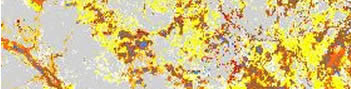
During the first developmental phase of the project: (1) basic data for both independent (environmental characteristics) and dependent (archaeological events) variables were gathered through conversion of existing data, new field surveys, and an examination of Minnesota Statewide Archaeological Survey manuscripts on file at the SHPO office; and (2) prototype models were developed (Figure 2.1 a, 2.1 b, 2.1 c).
The most accurate cultural resource predictive models are based on field information gathered through probability-based search procedures. In a probability-based search procedure, a controlled chance process is used to select areas for survey. Places surveyed may be completely randomly distributed or distributed randomly within selected areas of interest. Models based on such surveys are more precise because their use of randomly located field units reduces bias. Unlike intuitive or expert systems models, they do not assume that the distribution of known archaeological properties is necessarily a reliable guide to the distribution of all similar resources. The model must apply equally well to parcels of land that do not contain cultural resources as well as to those that do. Consequently, survey results must also include information places that were surveyed, but where no archaeological resources were found. The State of Minnesota was fortunate in this project to already have a very large, if still untapped, database gathered using "probability-based" search procedures to some extent. This database was a product of the late 1970s LCMR funded Minnesota Statewide Archaeological Survey (MnSAS), which investigated more than twenty counties (Minnesota Historical Society 1981). The Phase 1 prototype models were built on that database, on the results of Mn/Model field surveys in 1995 and 1996, and on qualified Cultural Resource Management (CRM) surveys (Chapter 5). Data from CRM surveys in the state were considered qualified if a probabilistic or 100 percent search procedure was utilized (in a 100 percent search procedure, an entire project area is surveyed and rigorous field methods are employed).
Although the original statewide survey was able to provide much of the project’s archaeological data for developmental Phase 1, that survey, when compared to current survey standards, was both procedurally and statistically flawed. There were four problems in interpreting statewide survey data. First, a 50 m transect and shovel-testing interval was used, which meant that fewer sites might have been encountered than using the contemporary standard 15 m interval. Second, possible statistical errors occurred in selecting quarter-quarter (40 acres) sections for survey. Although the initial selection of quarter-quarter sections was random, the procedures used to stratify some counties and to select random quarter-quarter sections for survey might have been biased. Third, the absence of a standard stratification procedure meant that most survey data were not directly comparable either between counties or to the Mn/Model surveys. Finally, although a probabilistic search procedure was used, the fact that it was stratified on the basis of archaeologists’ expectations involved some circular reasoning, for the stratification procedure was designed to support archaeologists’ expectations by focusing survey on areas where sites were thought to occur.
Because of these problems, two small but more rigorous seasons of field surveys were conducted as part of Mn/Model Phase 1 in 1995 and 1996. Besides providing additional, rigorously collected field data, the purpose of the Mn/Model surveys was to allow an assessment and standardization of the original probabilistic database so that it could be interpreted appropriately for this project. The MnSAS database was compared to the databases of these two surveys by the project statistician to determine: (1) the probability that smaller sites are under represented in the results of MnSAS because of the transect width; and, (2) whether the stratified sampling strategy adopted in MnSAS produced a biased sample of all existing surficial sites (see Chapter 5).
2.3.1.1 Archaeological Field Surveys
The goals of the Phase 1 Mn/Model archaeological field surveys were: (1) to critically assess the effectiveness of the MnSAS in locating sites of all sizes; (2) to add new field data to the archaeological database using probability-based field procedures; and (3) to ensure that all landscape types selected within the sampling frame (see below) were tested regardless of their suspected site potential. The third goal was as important in this project as the first two, for it is necessary to state with equal confidence in a cultural resource predictive model where sites will most likely not be found as where they most likely will be located. In addition, the model-building process proceeds by contrasting the environmental associations of archaeological sites with non-site locations. This sampling procedure ensured the location of land parcels lacking archaeological resources.
Predictive models of archaeological resource location are based upon a variety of basic landscape, vegetative, and hydrological variables that differ widely in scale and nature. Some of these variables, such as slope and aspect, are continuous while others, such as landform and vegetation type, are discrete. A primary goal of a modeling project like this one is to determine which combination of these variables produces the highest accuracy in predicting resource presence or absence. Effective combinations may vary both locally, within different parts of the landscape, and regionally, between different environmental zones. Thus, the state-wide model is composed of a series of submodels, each specific to an identifiable environmental region. Since an essential component of the modeling process was to assess the relative importance of landscape variables in environmentally different regions, the first archaeological field survey was carried out in three different archaeological resource regions (see Chapter 3) for which MnSAS data were available.
The first field surveys were conducted in the Prairie Lakes, Central Lakes Deciduous, and Central Lakes Coniferous archaeological resource regions. Three field crews conducted the survey during the warm weather months of 1995. Portions of Nicollet County (Prairie Lakes region), Stearns County (Central Lakes Deciduous region), and Beltrami County (Central Lakes Coniferous region) were inventoried for archaeological properties.
To ensure compatibility for comparison with data derived from the MnSAS, an enhanced version of the stratified random sampling procedure was adopted. MnSAS surveys were conducted by sampling various landscape types. The most basic distinction between types was simply "adjacent to" and "away from" water. Finer subdivisions included "lakeshore," "streamshore," "marsh/wetlands," and "lake inlet/outlet." Since the landscape types in the three surveyed archaeological resource regions vary slightly, a stratification scheme based upon the basic adjacent-to-water and away-from-water division used in MnSAS was employed. Each of these basic divisions was further subdivided in accordance with the terminology used in MnSAS and the landscape types present in each survey region. For example, in Stearns County, "adjacent-to-water" was divided into "Stream/River," "Lake," and "Wetland," and "Lake" into "Larger than 40 acres" and "Smaller than 40 acres" (a Minnesota Statewide Archaeological Survey division). Besides providing a more detailed sample of regional landscape formations than in MnSAS, the strategy ensured comparability with those earlier surveys, for the survey results could be compared at different levels of landscape hierarchy.
Public Land Survey System (PLSS) quarter-quarter (40 acres) sections representing the complete range of landscape types were selected from United States Geological Survey (USGS) topographic maps using a stratified random sampling procedure. These were then field surveyed for the presence or absence of archaeological resources. In this survey, the sampling frames in the three archaeological resource regions varied in size of unit surveyed, in portion of county surveyed, and in number of sections surveyed. This was because of differences in landscape variability between counties and differential ease of survey (e.g., forested areas are more time-consuming to survey than are agricultural fields). A detailed rationale and description of this sampling strategy, its results, and field procedures were provided in the field report (see Appendices C and D).
The second Mn/Model Phase 1 archaeological field surveys, carried out during the warmer months of 1996, were originally intended to focus on scattered landscape types identified by the earliest prototype models and sampled using a probability-based procedure. The main goal was to determine whether particular landscape types consistently contained archaeological properties. They were to provide data to test the first models and to test the integrity of Minnesota’s archaeological resource regions (Figure 2.2). The surveys were to occur in the northeast corner of the state (the Border Lakes, Lake Superior Shore, and eastern Central Lakes Coniferous regions), in the Red River Valley and Southeast Riverine regions, in the Twin Cities Metro area, and in MnDOT District 8 (Figure 2.2) in the southwestern portion of the state.
However, there were a number of problems with this approach. First, Mn/SAS surveys were not conducted in many of these areas, so probabilistic-based data were not available to build the prototype models for them. Second, continuing to use a landscape stratification regime was likely to reinforce the sampling bias inherent in MnSAS and other previous surveys. Using the MnSAS approach of sampling locations near water (a relatively small portion of the landscape), in preference to locations away from water, was almost certain to find that the majority of sites would be near water. Likewise, building models based on such biased sampling, then further designing surveys to specifically test these models, as was planned, would fail to extend our understanding of archaeological site location in Minnesota.
The survey approach was altered to better suit the project’s needs. The alternative focused on sampling selected 10 to 40 acre parcels of land identified by GIS using computer generated random points for three counties (simple random sample). The goals of this survey were (1) to compare the results of a completely random survey to those of the geographically stratified, and therefore potentially biased, survey adopted the first summer; (2) to provide data that could be used to test any future predictive models; and (3) to estimate the a priori probability of finding an archaeological site. A priori or "by chance" probabilities can be used (but are not necessary) to rate the performance of predictive models. They can also provide valuable information about how often sites occur across the landscape. These surveys took place in Wabasha County (Southeast Riverine archaeological resource region), in Wright County (Central Lakes Deciduous archaeological resource region), and in Cass County (Central Lakes Coniferous archaeological resource region). A detailed rationale and description of this sampling strategy, its results, and field procedures are provided in Appendices C and D.
2.3.1.2 Geomorphic Methods
The two major contributions geologists and geomorphologists can make to a project of this nature are to interpret: (1) the age of strata and surfaces; and (2) the likelihood of preservation of archaeological resources within strata. The first contribution assists in determining which land surfaces people could have occupied in the past. The first people in Minnesota probably arrived as long ago as 12,000 B.P.; therefore, older buried surfaces can be ignored in surveys here. The second contribution helps archaeologists determine the probable presence and remaining integrity of buried sites. Sites in retransported sediments are disturbed and, therefore, less significant according to National Register criteria than those in undisturbed sediments.
Geomorphologists prepared a detailed high resolution map of landform sediment assemblages within seven major river valleys and one ancient lake basin. This layer was converted to GIS format at the end of Phase 2. Attributes include landform units and, for each of these, general sediment sequences, age estimates, and surface and buried potential for archaeological sites. Fieldwork was necessary to document the underlying geology and to correlate it with surficial patterns recognized on soils maps, vegetation maps, or aerial photographs for development of the GIS database.
Fieldwork included describing undisturbed core samples collected from uplands to bottomlands along predetermined transects within each of the eight MnDOT districts. MnDOT drill-rig teams were utilized when cores were required within existing highway right-of-ways; otherwise, a combination of a Giddings soil-probe and contracted drillers were used on private property. Selected organic materials were collected, identified (when possible), and radiocarbon-dated to help determine the absolute ages of buried horizons and bracket the ages of land surfaces. Geomorphology was used to bracket the ages of strata and land surfaces based on crosscutting relations (for example, a terrace inset beneath a higher terrace is younger than the higher terrace because of the principle of down-cutting relations in a stream system). Eighty radiocarbon dates were included in the geomorphic study to build a time framework for the predictive model (see Chapter 12 and Appendix E).
2.3.1.3 The Archaeological Database
Because Mn/Model is designed to predict high, medium, and low probability zones for the location of precontact and contact period archaeological sites, one of the early priorities of this project was to establish the locations of known sites and areas where no sites were identified. The information used to compile this archaeological database was gleaned from several different sources (see Chapter 5). Chief among them was the recently digitized archaeological database from the State Historic Preservation Office (SHPO), which contains all known and verified sites in the state except more recently discovered sites on federal lands, which are in the process of being added. Other sources of archaeological site information were the Chippewa and Superior National Forest databases, the National Park Service database, and data from the Mn/Model archaeological surveys in 1995 and 1996.
All known sites were represented in the database by the UTM coordinates of their centroids, as originally recorded in archaeologists’ survey reports. There was no attempt to establish or include information about site boundaries. It was felt that site boundaries were often too nebulous to digitize as finite entities. Moreover, digitizing site boundaries could not have been accomplished within the budget and time frame of the project. In addition to the archaeological sites, negative survey points (nonsites), which are necessary for building an accurate predictive model, were collected from a variety of survey projects (MnSAS, Mn/Model, and CRM). All points, positive and negative, were incorporated into a separate database for each of Minnesota’s 87 counties. Because of other considerations, some counties had more than one database. Chapter 5 discusses the data collection, database assembly, and quality control methods in detail.
The predictive model was intended to forecast the spatial locations of both precontact (pre-A.D. 1650) and contact (A.D. 1650-1837) period archaeological sites. Although these periods together lasted for ca. 11,000 years, archaeological sites dating to this time span share many features, including common locational factors, the rarity of visible, standing structures, and a need for field search procedures in their location. No attempt was made in this project to model the location of postcontact (historic) period sites. The reasons for their location are different from those of the precontact and contact periods. In addition, their location can usually be more easily and reliably accessed through archival records. Historic sites will be added as a thematic layer to the GIS database as a later enhancement, but will never be used for modeling.
The total number of sites employed in the Mn/Model archaeological database that contain a contact period component but lack a precontact occupation (45) is less than one percent of the total sites occupied during the precontact period (5,743). Twenty-eight of these sites are placed within the functional types of trading post (n=9), mortuary (n=10), basecamp (n=1), wild ricing (n=6), sugar mapling (n=1), and quarries (n=1). The remaining 17 sites have not been assigned a function. The 45 contact period sites lacking any precontact components are spread out over 15 of the 20 Ecological Classification System subsections in Minnesota (Figure 3.11), including the Anoka Sand Plain (n=6), Aspen Parklands (n=1), Big Woods (n=1), Border Lakes (n=5), Chippewa Plains (n=3), Glacial Lake Superior Plain (n=1), Hardwood Hills (n=1), Mille Lacs Uplands (n=6), Minnesota River Prairie (n=3), North Shore Highlands (n=1), Rochester Plateau (n=2), Pine Moraines and Outwash Plains (n=8), St. Croix Moraines and Outwash Plains (n=2), North Shore (n=1) and the Tamarack Lowlands (n=4). Given the relatively small number of these contact period sites, their inclusion has a minimal impact on the Phase 1, 2, and 3 models.
2.3.2 Developing the Initial GIS Models
The end-products of this phase of the project were prototype GIS models for five archaeological resource regions. These models were based on the assumptions and principles discussed earlier in this chapter. Among the steps involved in developing the models were: (1) the selection of environmental attributes and variables; (2) the conversion of these data to a standard GIS format; (3) the addition of the locations of known precontact and contact period sites and negative survey points as a cultural resources thematic layer; (4) the definition of measurement standards for the independent and dependent variables; and (5) the statistical analyses of these data to derive the prototype models. More than 40 environmental variables were incorporated into the GIS model as thematic layers in Phase 1. Statistical analyses eventually reduced this number to fewer than 12 for most models. Specifics of these procedures are discussed in Chapters 4, 6, and 7, and in Appendix B.
Following the first archaeological field survey in 1995, the modeling tasks were carried out in a pilot project for Nicollet County. The purpose of the pilot was to assess how these five components of model building could be most efficiently executed. The first major deliverable consisted of a conceptual model for Nicollet County. Methods developed in the process of building this conceptual model were refined and applied to the development of the Phase 1 prototype models.
By the end of Phase 1, information from the two seasons of field survey and all counties included in the MnSAS was incorporated into five regional models. The Phase 1 models were: (1) based on a modest sample of precontact and very small sample of contact period archaeological resources from probability-based surveys; (2) high resolution (30 m x 30 m cells); and (3) delineated low, medium, and high probability zones for the presence of archaeological resources. These Phase 1 models were applied to 27 counties in five archaeological resource regions. These were the only counties in the state in which probability-based surveys had been conducted.
2.4 PHASE 2: FORMAL MODEL DEVELOPMENT
The goals of the second phase of the project were to add additional archaeological and environmental data to the GIS database, to refine modeling techniques, and to extend modeling to the entire state. An additional goal was to develop information on major river valley sediments and the paleoclimate of Minnesota, so that the state’s paleoenvironments could be better represented.
2.4.1 Refining and Extending the Models
Archaeological and environmental data from counties not considered in Phase 1 were incorporated into the GIS in this phase. This allowed the model to be extended statewide.
Additional statewide environmental databases incorporated into this modeling phase included historic vegetation from the Minnesota DNR (based on Marschner, 1974) and low resolution quaternary geology from MGC100 (see Chapter 6). Statewide environmental data are referred to as "basic" data and were used to develop a set of consistent, statewide models. Additional layers that were not available statewide were developed and tested in certain areas. These included high resolution soils data (available for only 48 counties), bedrock geology (for selected counties in southeastern Minnesota), and Trygg maps of historic cultural features (digitized for 20 counties). These data were incorporated into "enhanced" models for the areas they covered. Comparison of these models to the basic models allowed evaluation of whether the contribution of the enhancement data sets contributed significantly to model improvement.
Lessons learned in developing the Phase 1 prototype models were used to refine the original modeling techniques (Chapter 7). Evaluation of Phase 1 prototype models showed the locations of negative survey points to be closely associated with site locations because of the stratified sampling procedure adopted and SHPO survey recommendations based on intuitive site probability areas. To be certain that characteristics of sites were compared with a representative sample of the landscape, the Phase 2 modeling procedures used truly random points, generated by the GIS, as nonsites. Although the random points were not surveyed for the presence of sites, site density figures generated for regions of the state (see Chapter 5) indicated that the likelihood of a site falling on a random point was very low. It was felt that the availability of large numbers (usually several thousand per subregion) of true random points captured the environmental diversity of an area and more than compensated for this risk.
Another important Phase 2 refinement was in the use of S-Plus statistical software, rather than ARC/INFO GRID, for the logistic regression (Chapter 7). S-Plus provided more rigorous methods for narrowing down the very large number of environmental variables for inclusion into the models. This assured that the best combinations of variables would be incorporated into the models. The S-Plus output also provided information about the regression analysis that aided in the comparison and evaluation of the models.
Another change in Phase 2 procedures was in the assignment of areas to high, medium, and low probability classes. In Phase 1, raw model values were classified into high, medium, and low probability areas that each occupied 33% of the landscape. In Phase 2 a weighted technique was used that aimed to: (1) minimize the size of the areas classified as high and medium probability; while (2) capturing a large proportion of known sites in those areas; and, (3) maximizing the gain statistic for the model (Chapter 7).
Two types of models were developed in Phase 2. They used exactly the same modeling procedures, but were based on different databases. First, "basic" models were developed using only the basic (statewide) data. Since all archaeological resource regions share these data layers, these models are comparable with one another. After basic models were developed, "enhancement" data were added to the database for certain areas, and "enhanced" models were built. These enhanced models could be compared with the basic models to determine the contribution of the additional higher resolution data. Since the enhanced data layers seldom overlapped, models enhanced by Trygg data were often in different parts of the state than models enhanced by soils data.
Throughout the early stages of Mn/Model, there was discussion as to the contribution of single artifacts and lithic scatters to the archaeological database (see Section 6.4.1.1). It was determined early on that single artifacts could be found almost anywhere in the landscape, so they were excluded from the analysis in Phase 1. However, at the beginning of Phase 2, the value of lithic scatters was still unclear. Consequently, two sets of Phase 2 basic and enhanced models were developed. The first excluded single artifact find spots from the population of known sites, as did the Phase 1 models. The second set also excluded lithic scatters. This permitted evaluation of the contribution of lithic scatters to the performance of the Phase 2 models (Section 8.6.2 and Table 8.6.4).
Together with the larger site populations available for modeling, these model refinements resulted in significant improvements over the Phase 1 models (see Section 8.6.2).
2.4.2 Developing the Third and Fourth Dimensions of the Model
In nearly all large-scale archaeological site location predictive models, modeling the location of deeply buried sites is absent. These are sites often encountered in river valley projects, such as bridge repairs or construction, and they are expensive to excavate. Development of a three-dimensional predictive model of archaeological site location in such areas was essential to this project.
Of equal importance in cultural resource management is understanding the fourth dimension of the age of strata and surfaces in alluvial deposits. Not all deeply buried sites are of equal National Register significance. Very old Paleoindian camp sites, for example, tend to be small in area, with light artifact scatters. However, they are highly significant because of their age and rarity in the state. Modeling the fourth, or temporal, dimension of buried deposits is a means of providing information to cultural resource managers that will help them assess site significance and integrity. As mentioned earlier, 80 radiocarbon dates included in the geomorphic study were used to build an alluvial valley temporal framework for the geomorphic model. The geomorphic information gathered in Phase 1 was incorporated into a GIS format in Phase 2 to add depth and time dimensions to the database. These dimensions are represented in maps of the distribution, in major river basins, of sediments that may or may not contain buried archaeological sites with contextual integrity (Chapter 12).
As a companion to the geomorphically-derived temporal dimension within river valleys, a paleoclimate team provided additional temporal data to the GIS team in Phase 2. The paleoclimate team modeled the climate (temperature/precipitation) and vegetation of Minnesota for the past 12,000 years, using a paleoclimate reconstruction tool developed by Dr. Reid Bryson at the University of Wisconsin-Madison. Their paleoclimatic models were linked to eight different types of pollen, from pollen profiles, to model climate/vegetation shifts across the state at a temporal resolution of every 100 years.
Since it is assumed that precontact people in Minnesota settled near critical resources, such as water and shelter, it is important to determine, when developing a predictive model, how these resources shifted through time. Raw output from the paleoclimate and paleovegetation models were provided to the GIS team. Surface modeling techniques were used to convert these raw data to maps (trend surfaces). However, evaluation of the results determined that these data were too coarse to be useful for the purposes of this project (see Chapter 6).
2.5 PHASE 3: MODEL REFINEMENT AND IMPLEMENTATION
Major research tasks initially identified for the third phase of the project were to: (1) develop a model of suitable pre-Woodland habitats for predicting locations of very old or buried sites; (2) test the geomorphic models with archaeological data; and (3) enhance the statewide predictive model with additional data and refined methods, developing a model of areas not adequately surveyed, and developing a layer of confidence in the model. Simultaneously, the preliminary Phase 2 models were applied to cultural resource management projects and, based on this experience, development of an implementation plan was begun.
2.5.1 Modeling Pre-Woodland Habitats
The intention was to use data from the Minnesota Department of Natural Resources (DNR) statewide geomorphic mapping project as the basis for modeling pre-woodland habitats statewide. However, these data were not ready in time, so this part of the project was abandoned.
2.5.2 Testing Geomorphic Models with Archaeological Data
Geomorphic models of river valleys and selected upland quads were developed in all phases of Mn/Model without reference to the locations of archaeological sites. In Phase 3, these models were tested using the archaeological database. Details of these tests are provided in Section 12.17.
2.5.3 Enhancing the Statewide Predictive Model
The results of the basic models through Phase 2 of this project produced gain statistics ranging from 0.28 to 0.89. They classified between 8 percent and 63 percent of the landscape as high and medium probability and correctly predicted 59 percent to 87 percent of the known archaeological sites. A project goal was to develop models with a minimum gain statistic of 0.61. This means no more than 33 percent of the landscape is classified as high and medium probability, and at least 85 percent of the known sites are correctly predicted in each region. The primary objective of Phase 3 was to improve the models to achieve this project goal. Improved models should have the following characteristics:
- They should predict known sites at least as well as the preliminary models.
- Less land area should be occupied by medium and high probability values.
- The model should have fewer variables, to minimize storage space and processing time and to facilitate model interpretation. There are also reasons to believe that fewer variables will increase the model’s ability to predict future data sets, as additional variables may simply reflect noise or anomalies in the data set used to build the model.
A second modeling objective in Phase 3 was to develop a model of survey bias. Phase 1 and 2 models predicted negative survey points almost as well as they predicted sites in some regions. This indicated a degree of bias in the selection of places to survey. Knowing this posed an interpretation problem: were areas classified as low probability because there were no sites there, or because they had not been surveyed? By developing a model of survey bias, undersurveyed areas can be distinguished from low probability areas.
The third Phase 3 modeling objective was to develop a layer of confidence in the model. Model results depend on the quality of the data used. Data quality is not constant across the state. It was determined that a GIS thematic layer indicating the degree of confidence to place in the model, as a function of the quality of data input, would help interpretation and implementation.
2.5.3.1 Improving the Model
Several approaches were taken to improve model performance. These included: changing the model regionalization scheme; incorporating new environmental data layers; increasing the number of sites used to develop the models; and simplified procedures for classifying raw model values into high, medium, and low probability categories.
Phase 2 models exhibited patterns that were artifacts of the boundaries of the archaeological resource regions (Anfinson 1990) used for model development (Figure 3.10). These consisted of high probability cells clustered along regional boundaries (Figure 8.4). Often, these boundaries did not represent natural features. Also, some of the archaeological regions were more environmentally homogeneous than others. The more homogeneous regions tended to produce better models. At the beginning of Phase 3, the Ecological Classification System (Hanson and Hargrave 1996) sections and subsections became available as a GIS layer from Mn/DNR (Figure 3.11). It was adopted as the Phase 3 regionalization scheme because its units were based on combinations of environmental factors (geomorphology, hydrology, soils, historic vegetation) and its boundaries followed natural features.
In Phase 3, two new datasets from Mn/DNR were incorporated into the development of the models. These were the major and minor watershed boundaries and the distribution of bearing trees from the PLSS records. Watershed boundaries were used to determine locations of divides (ridges) and watershed areas. Bearing tree data were substituted for the very low resolution tree species distribution data used in Phases 1 and 2.
Phase 1 and 2 model performance was clearly related to the numbers of archaeological sites used to build the models. Two tactics increased the numbers of sites used to build the Phase 3 models. First, lithic scatters were always included in the training dataset. Second, sites from all sources were included. This was a difficult decision because it was a departure from using data only from probabilistically-based surveys. However, site numbers were so low in part of the state that it was deemed necessary. Even with these concessions, models suffered from the paucity of sites. Finally, after most regions had been modeled, the project team, in consultation with the project advisors, decided to combine the training and testing datasets and use the entire population of known sites (excluding single artifacts) to build the last round of Phase 3 models.
In Phase 2 models, raw model values were reclassified into high, medium, and low probabilities based on a complicated system that was intended to maximize the gain statistic. However, the procedures were difficult to use consistently and the results often maximized the gain statistic at the expense of the numbers of sites predicted. After a re-consideration of the project goals, it was determined that the numbers of sites predicted was more important than the gain statistic or size of the area classified as high and medium probability. Phase 3 procedures were simplified to emphasize consistency in site predictions, with a specific objective of including as close to 85 percent of the sites as was possible in the high and medium probability areas. This sometimes came at the expense of the size of the area classified as high and medium probability and of the gain statistic.
2.5.3.2 Modeling Survey Bias
Evaluation of Phase 1 and 2 models provided evidence of an already suspected bias in the locations of past surveys. Extensive parts of the state not only contained no sites, they also contained no negative survey points. It was suspected that the primary bias had been for archaeologists to look for sites near water bodies. However, it seemed it should be possible to model this bias using the same methods as were used to model site potential. In Phase 3, models of survey probabilities were developed using all surveyed places (negative survey points and sites of all types from all sources) as the instance "resources present" and random points as the instance "resources absent" (Chapter 7). High, medium, and low probabilities in these models indicate the likelihood that places like those so classified have been adequately sampled. These models were then combined with the site probability models to make the survey implementation models, which indicate site probabilities weighted by the probability that an area has been adequately surveyed. Where low survey probabilities and low site potential intersect, the area is classified as "unknown." This is designed to prevent misinterpretation of extensive areas as low site potential, when they have not been adequately surveyed and will help MnDOT justify surveys in such places.
2.5.3.3 Developing a Layer of Confidence
Originally, the confidence layer had been intended as an indicator of data quality. However, given the amount of information available at the end of Phase 3 modeling, it became feasible to develop two different confidence layers. The first was, as originally envisioned, an indication of the varying quality of data across the state (Figure 4.1). Data quality is considered an important determinant of model results. The second confidence layer was based on measures of the stability and performance of the preliminary Phase 3 models (Figure 7.3). Methods for developing these layers are discussed in Chapter 7.
While the Phase 3 models were being developed, MnDOT Cultural Resources Staff began using the Phase 2 models to help scope/review projects. Models, as well as underlying data layers, were viewed in ArcView. Consultants were asked to map their own intuitive models for the project area before field work commenced. The consultant was never shown Mn/Model. The MnDOT Cultural Resources Staff determined which areas would be surveyed. These surveys were designed to test both Mn/Model and the consultant's intuitive model. Refer to Chapter 9 for more information about these procedures.
Final implementation of Mn/Model at MnDOT began in late 1999, following completion of the project documented in this report. It involved a number of tasks, including data preparation and distribution, application development, platform transfer, and completion of documentation.
First, the data and models were made accessible to MnDOT staff. All project deliverables were inventoried at MnDOT and missing items were requested from the consultant. Then, the data and models were organized and copied to the MnDOT GIS server. A user interface was developed as an ArcView Extension to simplify access to these GIS layers. Separate training sessions were prepared for the use of Mn/Model environmental and archaeological data and predictive models and for use of the geomorphic models. These training sessions were provided to selected MnDOT staff and representatives from other government agencies.
Because Mn/Model was developed on the UNIX platform, the ARC/INFO AMLs and S-Plus scripts used in Phase 1 through 3 contained UNIX system commands. During the course of the project, MnDOT changed its standard GIS platform from UNIX to Windows NT. So that they will be useful for future rounds of modeling, the Mn/Model AMLs and S-Plus scripts are being edited to replace UNIX system commands with the equivalent NT commands. At they same time, they are being thoroughly documented.
Project documentation was also being improved and completed. This report was extensively edited and reformatted to make it ready for publication on the Internet. A web site was designed, and additional information about the project was prepared for inclusion. A manual was prepared for use by future geomorphology consultants who may be hired to perform further mapping of landform sediment assemblages. Metadata were edited and updated. A process model was developed to facilitate transfer of knowledge about the modeling process to future staff or to other states. Data modeling occurred simultaneously with the process model, to both document and improve the Mn/Model database design.
Finally, the Mn/Model Implementation Plan was drafted. It guides the use of Mn/Model by MnDOT and other agencies. It defines both who can use the models and how the models are to be used.
During the implementation phase, Cultural Resources staff continued using Mn/Model for planning, scoping, and reviewing projects at MnDOT. Ongoing test of the model with project data, combined with periodic data and model updates, will ensure that Mn/Model's performance improves over time.
An instructive result of large-scale projects like Mn/Model is the actual time involved in completing the numerous tasks that together represent the phases of the project. Because of the size and complexity of the project, a long-range, coordinated strategy was established to guide the development of the predictive models in a timely manner. Primary project activities were identified and assigned a task number. All of the tasks were organized within work plan flow charts that indicated the relationship between tasks, their estimated dates of completion, and the level of effort required for each task. Figure 2.3 contains the preliminary and final project schedule. Figure 2.4 contains the preliminary and final deliverable schedule.
Overall, the project extended for more than a year beyond its originally intended end date. Conversion of environmental data to GIS format was one reason for this extension. At the onset of the project, the scope specified a model with a 100 m resolution. A number of statewide environmental data layers were available at that cell size. However, in the early project stages, team archaeologists began demanding a higher resolution model, with a 10 m cell size. A compromise was reached for a 30 m cell size, the resolution of the 1:24,000 USGS digital elevation models (DEMs). However, very little data from 1:24,000 sources had been converted to GIS format. The DEMs were not complete for the entire state. The National Wetlands Inventory (NWI) had just been completed, but was in the process of being converted to ARC/INFO format by the Land Management Information Center (LMIC). County soil surveys, when available digitally, were in EPPL7 format.
State agencies were very cooperative in providing data as quickly as they could. Mn/DNR had already converted the available 1:24,000 DEMs to ARC/INFO GRID format and provided them to the project. LMIC accelerated their schedule for conversion of NWI data to ARC/INFO coverages and provided us with sets of coverages as soon as they were ready. LMIC also acted as an intermediary in acquiring the available soil data. Still, a large number of conversion tasks remained for the Mn/Model GIS team once data were received. The statewide extent and high resolution of the environmental databases required that conversion tasks be done by regions because of hard drive and processor limitations.
When data conversion was completed for one region, modeling of that region commenced, and data conversion for another region began. Simultaneous data conversion and modeling provided some efficiencies. However, the need to work out conversion and modeling procedures during this phase mitigated against optimum progress. Consequently, Phase 1 was extended eight months beyond its originally intended end date. Doing the work over again, with procedures already developed, would take much less time.
Another under-estimate was in the time required to map river valleys and upland landforms and convert these geomorphic maps to GIS format. The project geomorphologists, who had no previous experience with preparing data for GIS, did not anticipate the amount of time that would be required for quality control and preparation of attribute data. Consequently, these GIS layers could not be ready soon enough to incorporate them into the site probability models in any way.
Another task slighted in the original research plan was that of interpreting the models. This time-consuming task was initiated towards the end of Phase 2. However, since Phase 2 models were still considered preliminary and there was little time remaining, a rigorous interpretation was attempted for only one region. This provided an opportunity to work out interpretation procedures that could be applied to the Phase 3 models. Still, interpretation of a large number of regional models takes time and cannot be started until a complete set of models is completed for at least one region. Moreover, in the careful examination of models that occurs in interpretation, inconsistencies pointing to data or modeling errors sometimes become apparent. Correcting these problems and creating new models should be an option at this point. In future projects, several months at the end of the final model development phase should be set aside for interpretation.
Finally, the original research plan under-estimated the time required to adequately document such a complex project. Originally, only two months were allotted for preparation of the reports for Phases 1 and 2. Seven months were allotted for documenting the project at the end of Phase 3. Report preparation, review, and revision took a total of six months each at the ends of Phases 1 and 2. Although the additional work done in those Phases provided a solid foundation for much of the final project report, no one anticipated the extent to which methods would change in Phase 3 or the time it would take to interpret and document each subregional model. Moreover, there were key personnel changes during the documentation phase that delayed the projected for four months. In addition, the requirement to provide this report in Web-ready format added time to its completion. Finally, the time required to perform quality control on the deliverables, in particular this report, far exceeded the original expectations.
Anfinson, S.F.
1988 Annual Report Minnesota Municipal County Highway Archaeological
Reconnaissance
Study. Appendix 3. Minnesota Historical
Society, St. Paul.
1990 Archaeological Regions in Minnesota and the Woodland Period.
In The Woodland Tradition
in the Western Great Lakes: Papers
Presented to Elden Johnson, edited by G. E. Gibbon,
p. 135-166. University of Minnesota
Publications in Anthropology No. 4. Department of
Anthropology, University of Minnesota,
Minneapolis.
Bettinger, R.L.
1980 Explanatory/Predictive Models of Hunter-Gatherer Adaptation.
In Advances in
Archaeological Method and Theory, vol.
3,. edited by M.B. Schiffer,pp. 189-255. Academic
Press, New York.
Bonham-Carter, G.F.
1994 Geographic Information Systems for Geoscientists: Modeling
with GIS. Pergamon
(Elsevier Science Ltd.): Tarrytown, N.Y.
Bradley, J.E., W.R. Killam, G.R.
Burns, and M.A. Martorano
1986 An Archaeological Survey and Predictive Model of Selected
Areas of Utah's Cisco
Desert. Cultural Resources Series 18.
Bureau of Land Management, Utah.
Brandt, R., B.J. Groenewoudt and
K.L. Kvamme
1992 An Experiment in Archaeological Site Location: Modeling in
the Netherlands using GIS
Techniques. World Archaeology 24:268-282.
Brown, M.K. (editor)
1981 Predictive Models in Illinois Archaeology: Report Summaries.
Division of Historic Sites,
Illinois Department of Conservation, Springfield.
Carr, C.
1985 Introductory Remarks on Regional Analysis. In For Concordance
in Archaeological
Analysis: Bridging Data Structure, Quantitative
Techniques, and Theory, edited by C. Carr,
pp. 114-127. Westport Press, Kansas City.
Congalton, R.G., R.G. Odeerwald,
and R.A. Mead
1983 Assessing Landsat Classification Accuracy Using Discrete Multivariate
Analysis Statistical
Techniques. Photogrammetric Engineering
and Remote Sensing 49:1671-1678.
Custer, J. F., T. Eveleigh, V. Klemas,
and I. Wells
1986 Application of Landsat Data and Synoptic Remote Sensing to
Predictive Models for
Prehistoric Archaeological Sites: An Example
from the Delaware Coastal Plain. American
Antiquity 51:572-588.
Green, E.L.
1973 Location Analysis of Prehistoric Maya Sites in Northern British
Honduras. American
Antiquity 38:279-293.
Hammer, J.
1993 A New Predictive Site Location Model for Interior New York
State. Man in the Northeast
45:39-76.
Hanson, D.H. and B.C. Hargrave
1996 Development of a Multilevel Ecological Classification System
for the State of Minnesota.
Environmental Monitoring and Assessment
39:75-84. Kluwer Academic Publishers.
Netherlands.
Hasenstab, R. J.
1983 A Preliminary Cultural Resource Sensitivity Analysis for
the Proposed Flood Control
Facilities Construction in the Passaic
River Basin of New Jersey. Soil Systems, Inc.
Submitted to the Passaic River Basin Special
Studies Branch, Department of the Army. New
York District Army Corps of Engineers,
New York.
Hord, R.M., and W. Brooner
1976 Land-Use Map Accuracy Criteria. Photogrammetric Engineering
and Remote Sensing
42:671-677.
James, S.E., and R. Knudson
1983 Predicting Site Significance: Management Applications of High-Resolution
Modeling. Paper
presented at the 48th Annual Meeting of
the Society for American Archaeology, Pittsburgh.
Jochim, M. A.
1976 Hunter-Gatherer Subsistence and Settlement: A Predictive
Model. Academic Press, New
York.
Judge, W. J.
1973 Paleoindian Occupation of the Central Rio Grande Valley
in New Mexico. University of
New Mexico Press, Albuquerque.
Judge, J. W., and L. Sebastian (editors)
1988 Quantifying the Present and Predicting the Past: Theory,
Method, and Application of
Archaeological Predictive Modeling.
U.S. Department of the Interior, Bureau of Land
Management, Denver. U. S. Government Printing
Office, Washington D.C.
Kohler, T.A., and S.C. Parker
1986 Predictive Models for Archaeological Resource Location. In Advances in Archaeological
Method and Theory, vol. 9, edited by
M. B. Schiffer, pp. 397-452. Academic Press, New
York.
Kvamme, K.L.
1983 Computer Processing Techniques for Regional Modeling of Archaeological
Site Locations.
Advances in Computer Archaeology 1:26-52.
1984 Models of Prehistoric Site Location Near Piñon Canyon, Colorado.
In Papers of the
Philmont Conference on the Archaeology
of Northeastern New Mexico, edited by C. J.
Condie, pp. 347-370. Proceedings of the
New Mexico Archaeological Council 6(1),
Albuquerque.
1985 Determining Empirical Relationships Between the Natural Environment
and Prehistoric Site
Locations: a Hunter-Gatherer Example. In For Concordance in Archaeological
Analysis:Bridging Data Structure, Quantitative
Technique, and Theory, edited by C. Carr,
pp. 208-238. Westport Press, Kansas City.
1986 The Use of Geographic Information Systems for Modeling Archaeological
Site Distributions.
In Geographic Information Systems in
Government, vol. 1, edited by B. K. Opitz, pp. 345-
362. A. Deepak Publishing, Hampton.
1988a Development and Testing of Quantitative Models. In Quantifying
the Present and
Predicting the Past: Theory, Method, and
Application of Archaeological Predictive
Modeling, edited by W. J. Judge and
L. Sebastian, pp. 325-428. U.S. Department of the
Interior, Bureau of Land Management, Denver.
U. S. Government Printing Office, Washington,
D.C.
1988b Using Existing Archaeological Survey Data for Model Building.
In Quantifying the Present
and Predicting the Past: Theory,
Method, and Application of Archaeological Predictive
Modeling, edited by W. J. Judge and
L. Sebastian, pp. 301-323. U. S. Department of the
Interior, Bureau of Land Management, Denver,
U. S. Government Printing Office, Washington,
D.C.
1989 Geographic Information Systems in Regional Archaeological
Research Data Management. In
Studies in Archaeological Method and
Theory, vol. 1, edited by M.B. Schiffer, pp. 139-202.
University of Arizona Press, Tucson.
1990b The Fundamental Principles and Practice of Predictive Archaeological
Modeling. In
Mathematics and Information Science
in Archaeology: A Flexible Framework, edited by A.
Voorrips, pp. 257-295. Studies in Modern
Archaeology, Vol. 3. Holos-Verlag, Bonn, Germany.
1992 A Predictive Site Location Model on the High Plains: An Example
with an Independent Test.
Plains Anthropologist 37:19-40.
1997 Ranters Corner: Bringing the Camps Together: GIS and ED. Archaeological
Computing
Newsletter 47:1-5.
Kvamme, K.L., and M.A. Jochim
1989 The Environmental Basis of Mesolithic Settlement. In The
Mesolithic in Europe: Papers
Presented at the Third International Symposium,
edited by C. Bonsall, pp. 1-12. John
Donald Publishers, Edinburgh.
Kvamme, K.L., and T.A. Kohler
1988 Geographic Information Systems: Technical Aids for Data Collection,
Analysis, and Display.
In Quantifying the Present and Predicting
the Past: Theory, Method, and Application of
Archaeological Predictive Modeling,
edited by J.W. Judge and L. Sebastian, pp. 493-547. U.
S. Department of the Interior, Bureau of
Land Management, Denver. U. S. Government Printing
Office, Washington D. C.
Larralde, S.L., and S.M. Chandler
1981 Archaeological Inventory in the Seep Ridge Cultural Study
Tract, Uintah County,
Northeastern Utah: With a Regional Predictive
Model for Site Location. Cultural Resources
Series 11. Bureau of Land Management, Salt
Lake City.
Limp, W.F., and R.H. Lafferty III
1981 Conclusions and Recommendations. In Settlement Predictions
in Sparta: A Locational
Analysis and Cultural Resource Assessment
on the Uplands of Calhoun County, Arkansas,
edited by R. Lafferty, J. Ottinger, S.
Scholtz, W.F. Limp, B. Watkins, and R.D. Jones, pp. 223-
237. Arkansas Archeological Survey Research
Series 14. Fayetteville.
Limp, W.F., S.C. Parker, J.A. Farley,
D.B. Waddell, and I. Johnson
1987 An Automated Processing Approach to Environmental Resource
Management for
Military Installations. Construction
Engineering Research Laboratory, Champaign.
Marozas, B.A., and J.A. Zack
1987 Geographic Information Systems Applications to Archaeological
Site Location Studies. Paper
Presented at the GIS 1987 Conference and
Workshop, San Francisco.
Marschner, F. J.
1974 The Original Vegetation of Minnesota. Compiled from
U.S. General Land Office Survey
notes. North Central Forest Experiment
Station, Forest Service, U.S. Department of Agriculture.
Maynard, P.F., and A.H. Strahler
1981 The Logit Classifier, a General Maximum Likelihood Discriminant
for Remote Sensing
Applications. Proceedings of the Fifteenth
International Symposium on Remote Sensing of
Environment, pp. 213-222. International
Society of Electrical and Electronic Engineers, Ann
Arbor, Michigan.
Minnesota Historical Society.
1981 Minnesota Statewide Archaeological Survey Summary: 1977-1980.
Minnesota Historical
Society, St. Paul.
Mosteller, F., and J.W. Tukey
1977 Data Analysis and Regression. Addison-Wesley Publishing
Company, Reading,
Massachusetts.
Nance, C.R., H. Holstein, and D.C.
Hurst
1983 Evaluation of Multiple Regression Models Predicting Archaeological
Site Distributions at Fort
McClellan, Alabama. Paper presented at
the 48th Annual Meeting of the Society for American
Archaeology, Pittsburgh.
Parker, S.C.
1985 Predictive Modeling of Site Settlement Systems Using Multivariate
Logistics. In For
Concordance in Archaeological Analysis:
Bridging Data Structure, Quantitative
Technique, and Theory, edited by C.
Carr, pp. 173-207. Westport Press, Kansas City.
1986 The Role of Geographic Information Systems in Cultural Resource
Management. In
Geographic Information Systems in Government,
edited by B.K. Opitz, pp. 133-140. A.
Deepak Publishing, Hampton, Virginia.
Press, S.J., and S. Wilson
1978 Choosing Between Logistic Regression and Discriminant Analysis. Journal of the American
Statistical Association 73:699-705.
Roper, D.C.
1979 Archaeological Survey and Settlement Pattern Models in
Central Illinois. Scientific
Papers, Vol. XVI, Illinois State Museum,
Springfield, Illinois, and Special Paper Number 2,
Midcontinental Journal of Archaeology,
Kent, Ohio.
Rose, M.R., and J.H. Altschul
1988 An Overview of Statistical Method and Theory for Quantitative
Model Building. In
Quantifying the Present and Predicting
the Past: Theory, Method, and Application of
Archaeological Predictive Modeling,
edited by J.W. Judge and L. Sebastian, pp. 173-256.
U.S. Department of the Interior, Bureau
of Land Management, Denver. U. S. Government
Printing Office, Washington D. C.
Scholtz, S.C.
1981 Location Choice Models in Sparta. In Settlement Predictions
in Sparta: A Locational
Analysis and Cultural Resource Assessment
on the Uplands of Calhoun County, Arkansas,
edited by R. Lafferty III, J. L. Ottinger,
S.C. Scholtz, W.F. Limp, B. Watkins, and R.D. Jones,
pp. 207-222. Arkansas Archeological Survey
Research Series No. 14. Fayetteville.
Sebastian, L. and W.J. Judge
1988 Predicting the Past: Correlation, Explanation, and the use
of Archaeological Models. In
Quantifying the Present and Predicting
the Past: Theory, Method, and Application of
Archaeological Predictive Modeling, edited by W.J. Judge and L, Sebastian, pp. 1-18. U.S.
Government Printing Office, Washington,
D.C.
Shermer, S.J., and J.A. Tiffany
1985 Environmental Variables as Factors in Site Location: An Example
From the Upper Midwest.
Midcontinental Journal of Archaeology 10:215-240.
Stone, D.F.
1984 A Regional Synthesis and Archaeological Site Location Prediction
Model for South
Coastal Santa Barbara County, California.
Unpublished Master's thesis, Department of
Anthropology, University of California,
Santa Barbara.
Thomas, D.H., and R.L. Bettinger
1976 Prehistoric Piñon Ecotone Settlements of the Upper Reese
River Valley, Central
Nevada. Anthropological Papers of the
American Museum of Natural History 53(3). New
York.
Tipps, B.L.
1983 Cultural Resource Inventory and Locational Modeling in
South Central Utah. Ms. on
file, Bureau of Land Management, Utah.
Warren, R.E.
1990 Predictive Modeling in Archaeology: A Primer. In Interpreting
Space: GIS and
Archaeology, edited by K.M.S. Allen,
S. W. Green, and E.B.W. Zubrow, pp. 90-111. Taylor
and Francis, London. Warren, R.E., S.G.
Oliver, J.A. Ferguson, and R.E. Druhot.
1987 A Predictive Model of Archaeological Site Location in the
Western Shawnee National
Forest. Illinois State Museum Contract
Archaeology Program. Submitted to the Shawnee
National Forest.
Wansleeben, M.
1988 Applications of Geographical Information Systems in Archaeological
Research. In Computer
and Quantitative Methods in Archaeology
1988, edited by S. P. Q. Rahtz, pp. 435-451.
British Archaeological Reports, International
Series, 446(2). Oxford.
Williams, L., P.H. Thomas, and C.L.
Bettinger.
1973 Notions to Numbers: Great Basin Settlements as Polythetic
Sets. In Research and Theory in
Current Archaeology, edited by C.L.
Redman, pp. 215-238. John Wiley, NewYork.
Wood, J.J.
1978 Optimal Location in Settlement Space: A Model for Describing
Locational Strategies.
American Antiquity 43:258-270.
Woodward-Clyde Consultants
1978 Appendix E: Well-Field Development Plan for the Wasson Field-Denver
Unit C02 Project
Environmental Impact Report. Ms. on file,
Woodward-Clyde Consultants, San Francisco.
Wrigley, N.
1977 Probability Surface Mapping. Concepts and Techniques in
Modern Geography 16. Geo
Books, Norwich.
Zimmerman, L.J.
1977 Prehistoric Locational Behavior: A Computer Simulation.
Office of the State
Archaeologist Report No. 10. University
of Iowa Press, Iowa City.
Zubrow, E.B.W., and J.W. Harbaugh
1978 Archaeological Prospecting: Kriging and Simulation. In Simulation
Studies in Archaeology,
edited by I. Hodder, pp. 109-122. Cambridge
University Press, Cambridge.
The Mn/Model Final Report (Phases 1-3) is available on CD-ROM. Copies may be requested by visiting the contact page.

Acknowledgements
MnModel was financed with Transportation Enhancement and State Planning and Research funds from the Federal Highway Administration and a Minnesota Department of Transportation match.
Copyright Notice
The MnModel process and the predictive models it produced are copyrighted by the Minnesota Department of Transportation (MnDOT), 2000. They may not be used without MnDOT's consent.