MnModel Phase 4 Methods
Surface hydrography model
Phase 4 modeling procedures are now being developed. Models of historic and prehistoric surface water and updated statistical procedures will be key components of the model updates.
Historic/Prehistoric Surface Hydrography Models
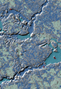
Water and wetlands are important resources for prehistoric humans and key predictors of archaeoalogical site locations. Maps of modern water bodies do not reflect past conditions. Lake levels have fluctuated up and down over the past 10,000 years. Dams have been constructed, enlarging lakes or transforming streams into lakes. Consequently, some sites are in areas that are now covered with water. Some features that are now wetlands may once have been lakes. Wetlands and lakes that have been drained by natural or anthropogenic causes in the past 100 years may now be represented by remnant patches of organic or hydric soils.
In Phase 3 the assumption was made that contemporary features could serve as surrogates for features from the past. This assumption was sufficient for modeling relatively recent sites. Most recorded sites in Minnesota are thought to be relatively recent. For Phase 4, prehistoric and prehistoric surface water features will be modeled based on an interpretation of modern natural surface water features, soils, geomorphology, landscape sediment assemblages, and historic maps. Modeling procedures developed for MnDOT in 2008 will be enhanced to develop these models.
Phase 4 Statistical Methods
A 2007 study developed enhanced statistical procedures for MnModel. Its objectives were to find the best prediction method for MnModel Phase 4 that can be implemented reasonably within GIS and to produce S-Plus software to implement this prediction method.
The project compared eight prediction methods. Of these, bagged trees (bagging) provided the best prediction with the test data. Overall, bagging and boosting (booted trees) had the best predictive ability, but bagging is easier to implement in GIS and the results are easier to interpret. The software developed allows MnDOT to select from any of the eight prediction methods, however, as well as providing enhanced tools for comparing and evaluating model results.