MnModel Phase 3
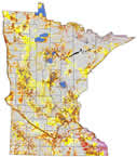
Phase 3 Survey Implementation Model
The third phase of MnModel (1998) was the first to account for survey bias in interpreting the model results.
Phase 3 Research Design
The research design for Phase 3 included several innovations. The archaeological database included all sites, except for single artifacts, in files of the Minnesota State Historic Preservation Office (SHPO) that were deemed to have reliable location information. This greatly enlarged the number of sites available for modeling. Second, the Ecological Classification System subsection boundaries became available in GIS format, and these were used to regionalize the models. Third, models of survey bias were developed, then combined with the probability models to create Survey Implementation Models. These models provide archaeologists with better information for making decisions about where archaeological surveys are needed.
Phase 3 Results
The Phase 3 models predicted sites 44%-90% better than by random chance alone. At the low end, this was a considerable improvement over the Phase 2 models. Moreover, the new ecological regionalization scheme eliminated the sharp contrasts in probability values between modeling regions that were apparent in the Phase 2 models. Finally, it was possible to assign a measure of confidence to the site probabilities based on the likelihood that environments had been adequately surveyed.
Lessons learned from Phase 3
The expanded archaeological database was probably the single largest factor in improving model performance in Phase 3. As time goes on and more archeological sites are discovered in Minnesota, it should be possible to continue to improve models that do not yet perform optimally. Although using the Ecological Classification System subsections resulted in models with smoother transitions between regions, artifacts from other datasets, notably elevation and low resolution soils data, remained. The next phase of modeling will focus on the acquisition of better, higher resolution data and spend more time on data quality control prior to modeling.
The significance of survey bias was stressed in the Phase 3 models. By identifying environments for which we have little data, we can target surveys to include those areas and expand our understanding of archaeological site distributions in Minnesota.