Projects
Current projects
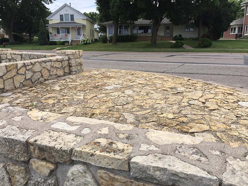
Location: West of Hwy 100 between Broadway Ave and Bottineau Blvd, on Lakeland Ave in Robbinsdale, MN
Eligibility for listing on the National Register of Historic Places: Determined eligible for the National Register in January 2024! National Register Nomination process anticipated to begin in summer 2024. This process may take 6-9 months.
Original Construction: 1940-41
Designed by: Arthur R. Nichols, Consulting Landscape Architect
Constructed by: Works Progress Administration (WPA)
Proposed scope: Several phases of work have been undertaken to complete different work on the site.
Construction update: Work has been completed in three different projects in the summer of 2021 through 2023 and a final project is underway in 2026:
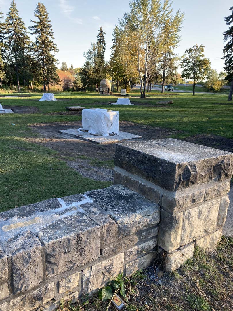
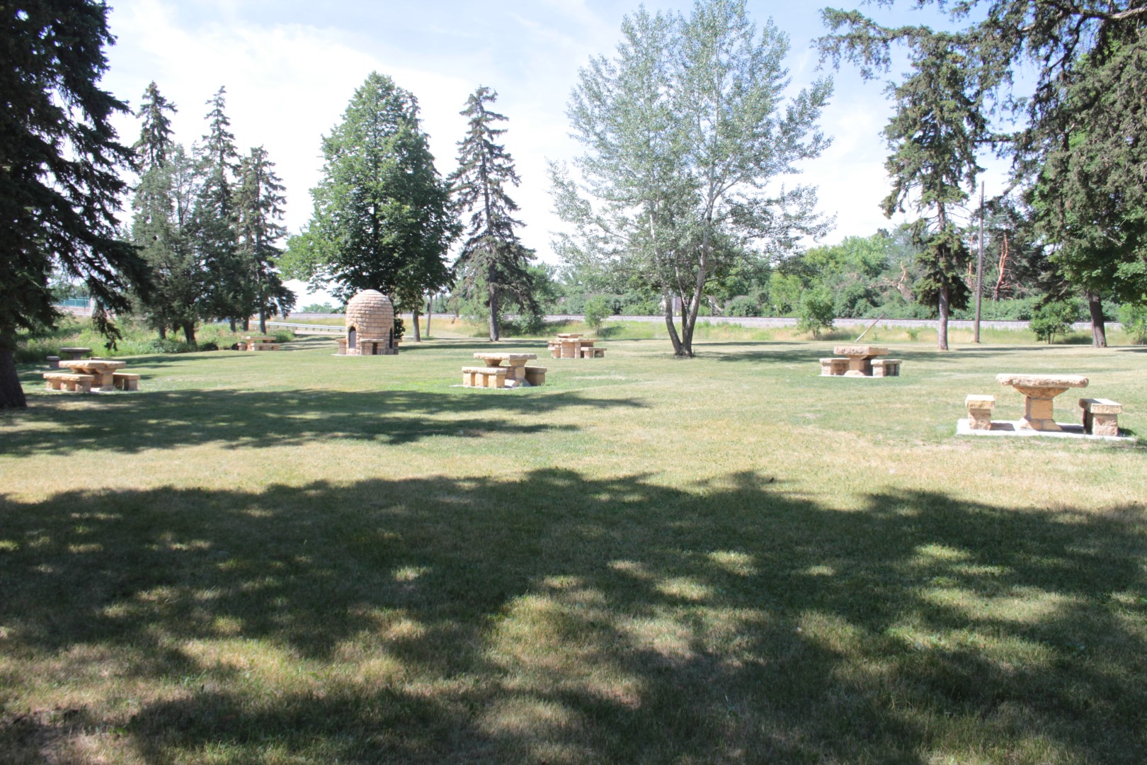
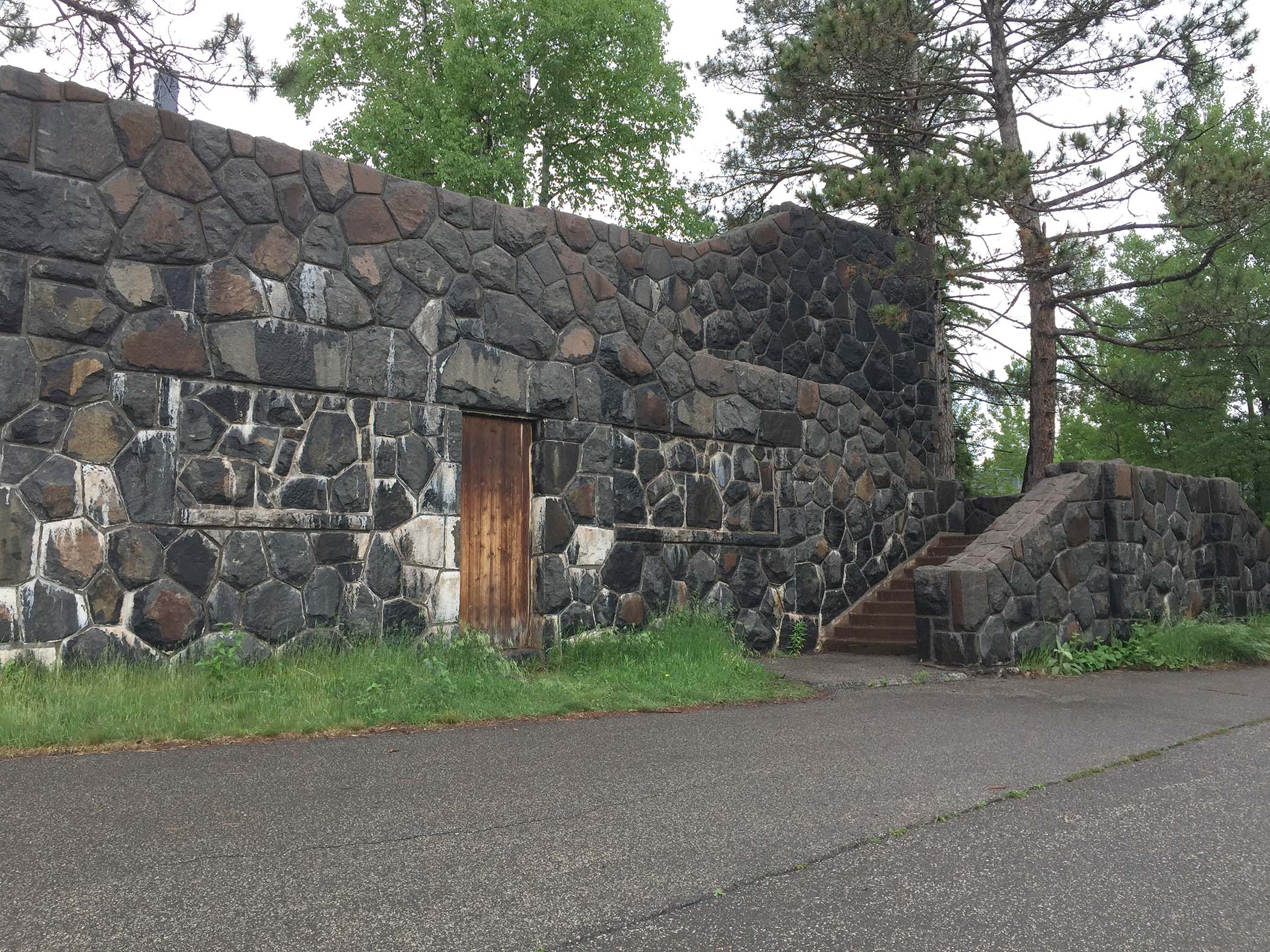
- Completed: Tree removal: 4 “volunteer” trees growing in the rock garden were removed in March 2021. Two of these trees were growing in paths and 2 were growing close to a bench built in the embankment.
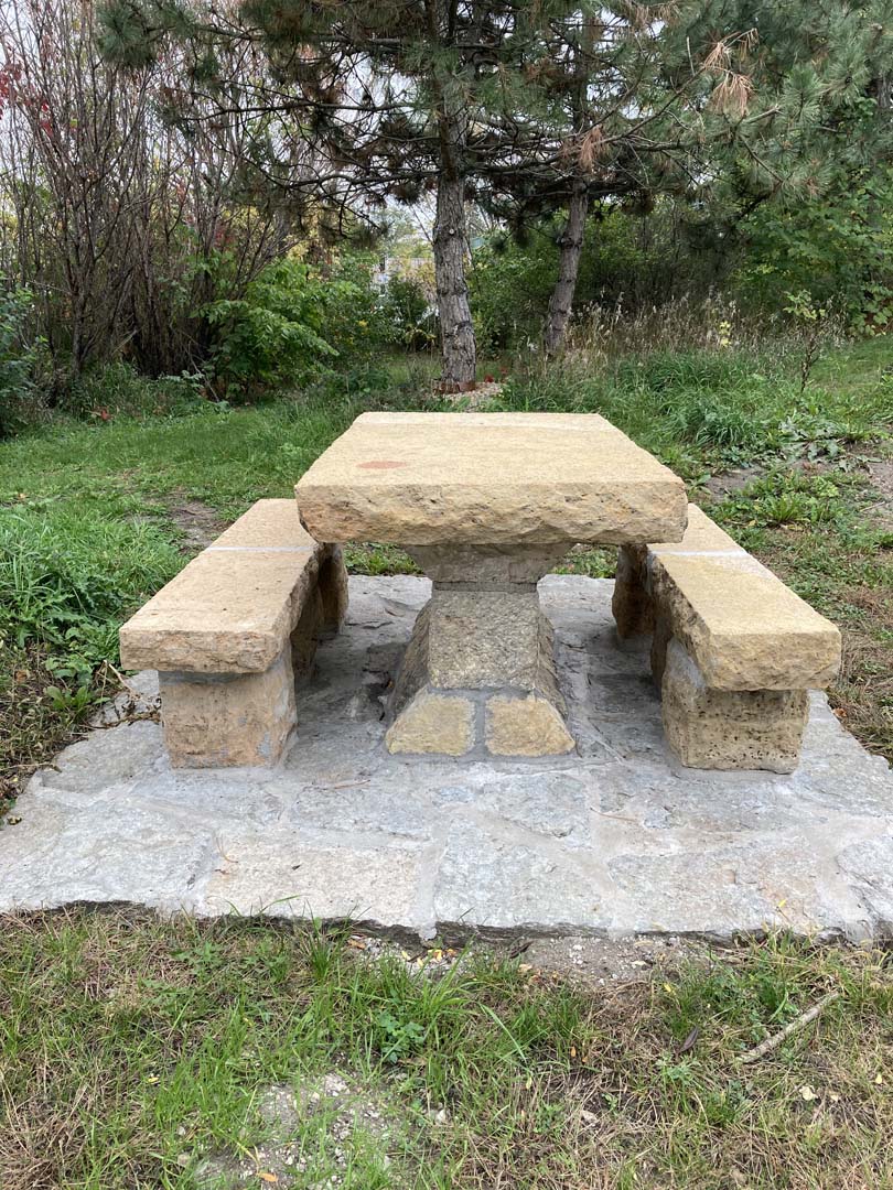
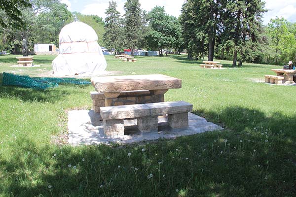
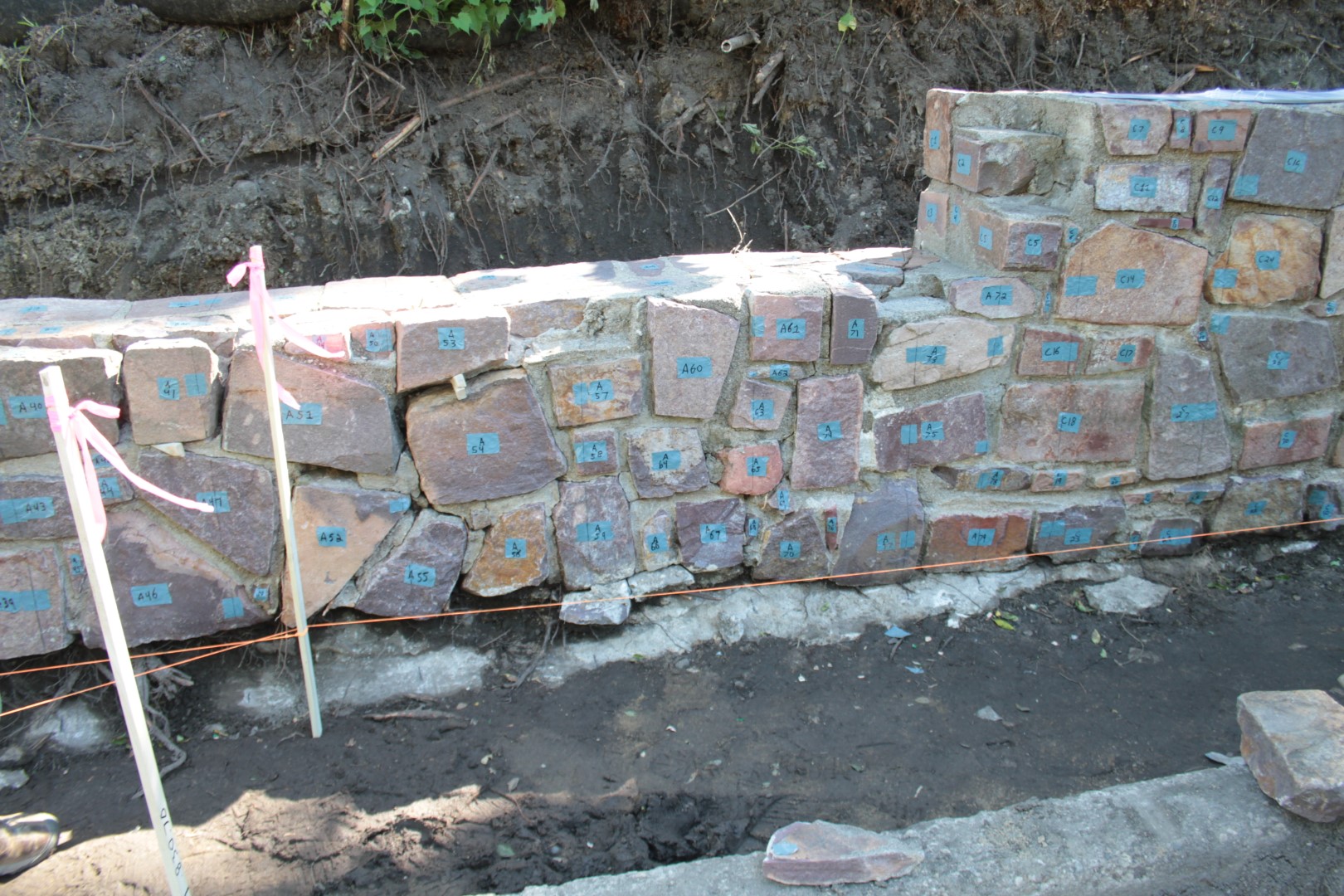
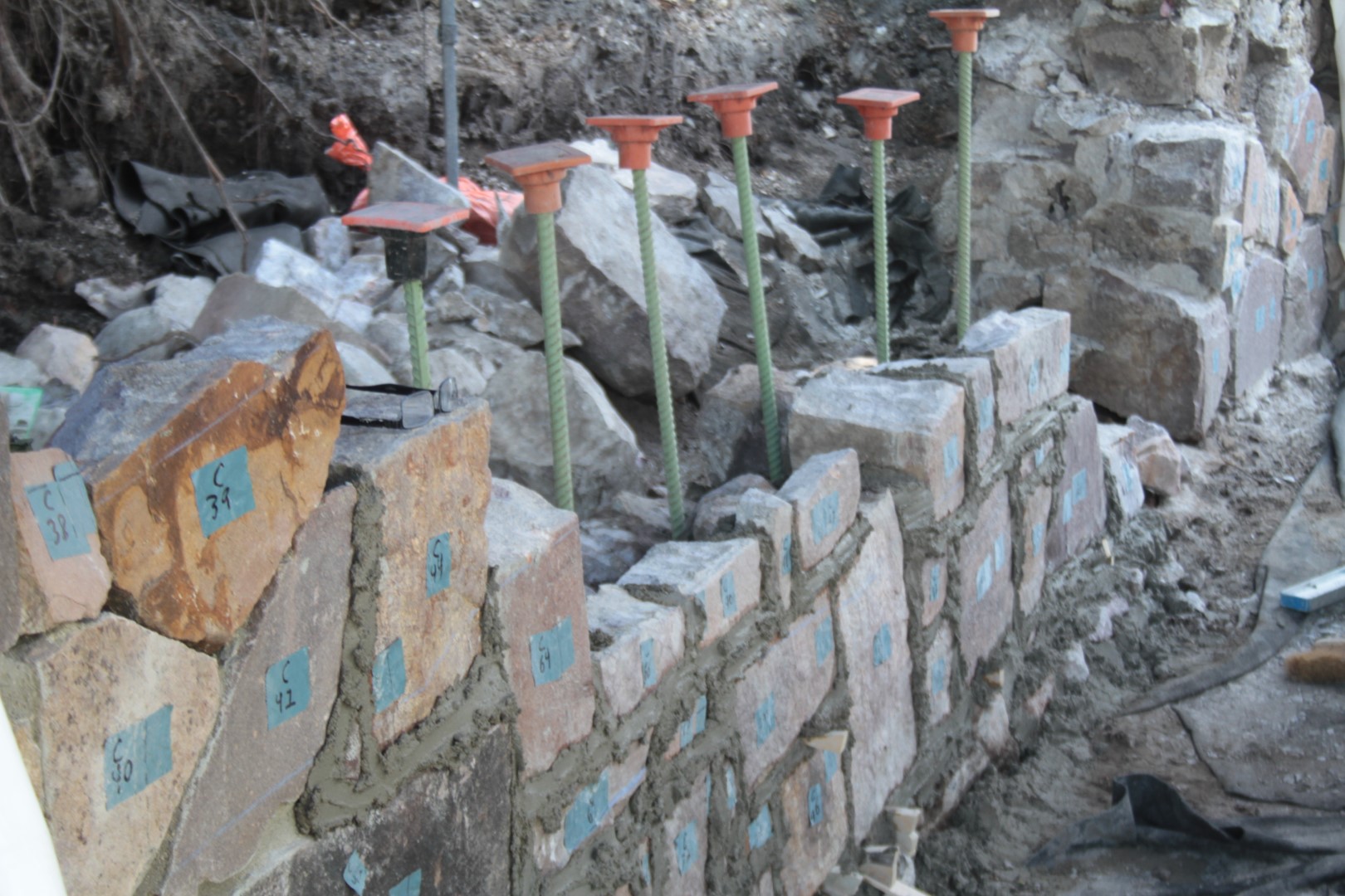
- Completed: Stone picnic table restoration-Northern Bedrock Historic Preservation Corps. The Corps members worked with a technical expert from Advanced Masonry Restoration to repoint two picnic table pads, clean off another pad, and rebuild one picnic table from salvaged stone in the rock garden. Work was completed in July 2021.
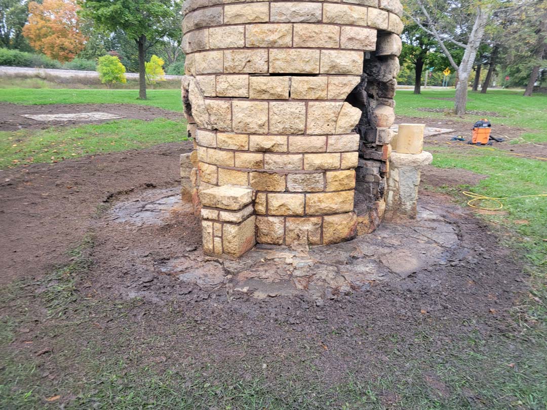
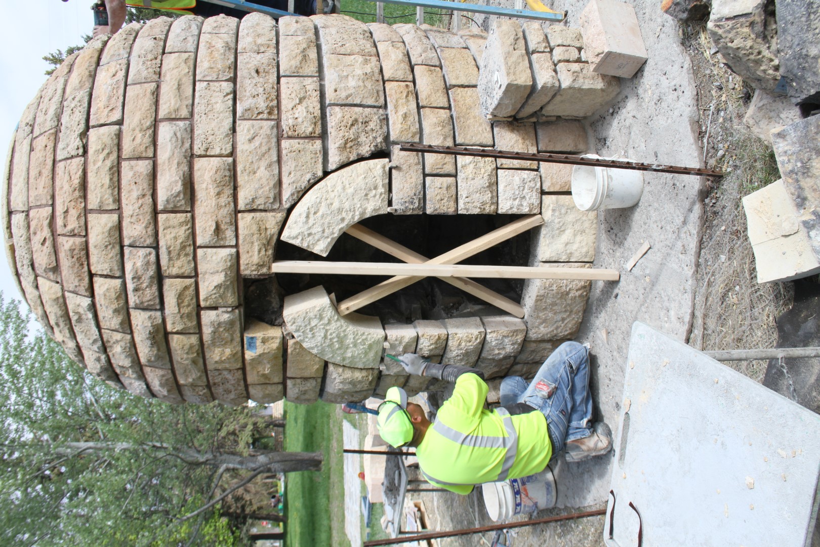
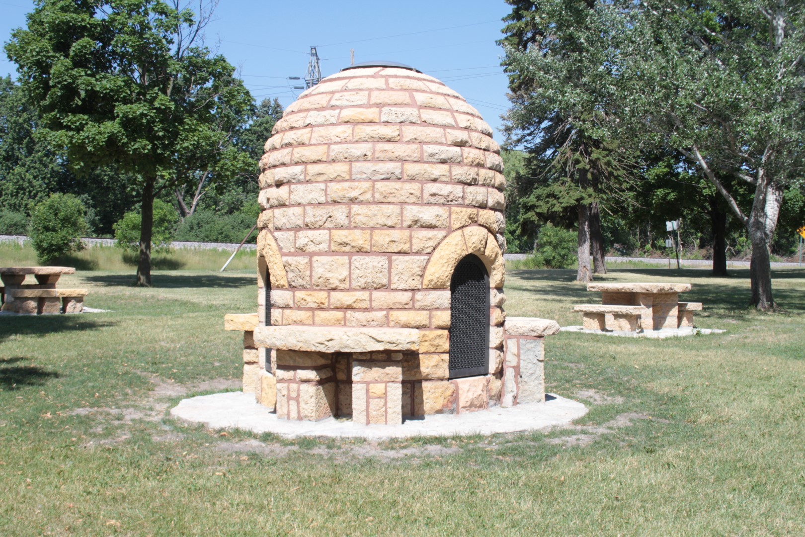
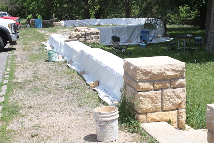
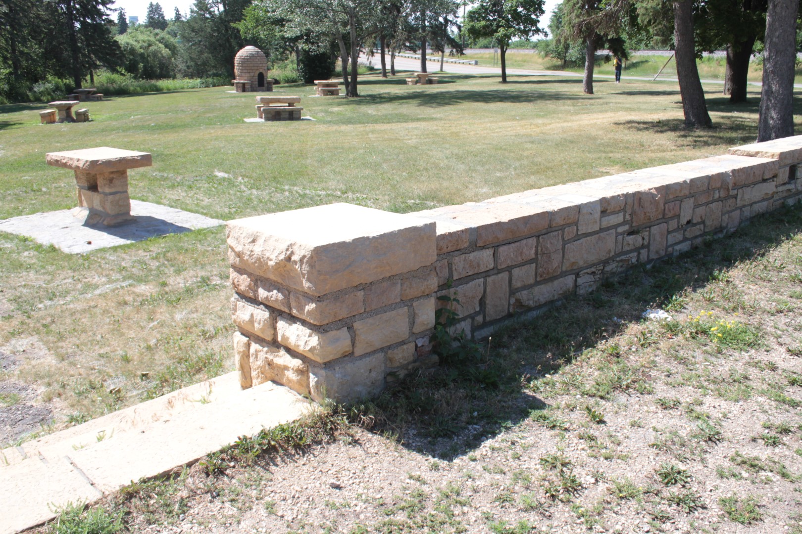
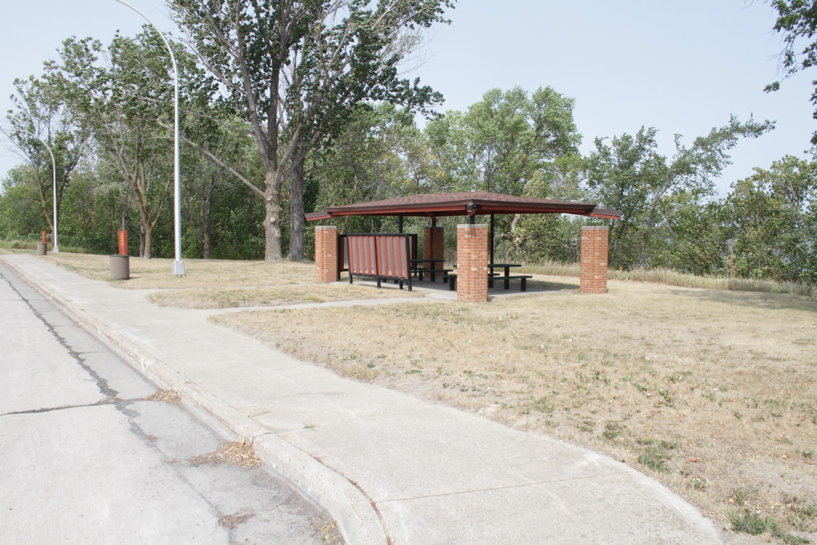
- Completed: Stone Mason Contract- Environmental Associates, Inc. was contracted to rebuild 10 picnic tables, re-point 9 pads, and repair and repoint the beehive. Work took place during the month of October 2021and then from May through June 2022. In addition, to the planned above, a flagstone base around the beehive was discovered and repointed, the top of the beehive was covered with a metal cap and woven wire covers were added to the firebox openings to protect the beehive from future damage. The overlook wall along the parking area was cleaned, the top was repointed, and end piers were rebuilt.
- Completed: One more phase of work is underway focusing on safety and accessibility. Work includes: Repointing the rock garden pond walls and benches, adding a new accessible walk along Broadway from the bridge to the parking area, with a loop into the picnic area to a new accessible picnic table near the beehive. Plantings between the new picnic table and bench in the rock garden and re-graded and seeded grass areas in the rock garden. A new interpretive sign was installed near the parking bay.
- Volunteer tree planting April 2025. Nine donated trees and 4 re-blooming lilac shrubs were planted in the picnic area and rock garden with the help of the Robbinsdale Lions, Restore Lilac Way, and Autumn Ridge Landscape. Autumn Ridge provided the labor and donated materials to complement fundraising by the Lions and RLW.
- Overlook wall rehab 2025-6: The corners at the “bandshell” plaza area of the overlook wall will be repaired in 2026. The work will rebuild the corner piers, relacing missing stones and repointing the piers. Pre-cast concrete curb stops will be installed to prevent accidental driving onto the plaza. Added work includes removing loose mortar and debris in the flagstone of the bandshell area and in the rock garden paths. The joints will be filled with polymeric sand. This will protect the stones and reduce weed growth.
- National Register Nomination. The site was Listed on the National Register in December 2025!
- The site was accepted for the Historic American Landscape Survey and is now in the Library of Congress.
Timeline: Summer 2021 through June 2026
Additional information: This site is intended to be conveyed to the City of Robbinsdale after work is completed. A full rehabilitation of the site and rock garden and garden fountains and pools is not planned by MnDOT.
The Robbinsdale Lions Club has submitted a permit for volunteer weeding at the site through 2026 For more information, visit robbinsdale.org/graeser-park or contact graeserpark@gmail.com.
Location: Hwy 6 approximately 3.3 miles south of intersection with CSAH 28 near Remer, MN.
Not Eligible for listing on the National Register of Historic Places: Previously eligible
Original Construction: 1939-40
Designed by: Arthur R. Nichols
Constructed by: CCC Camp F-46
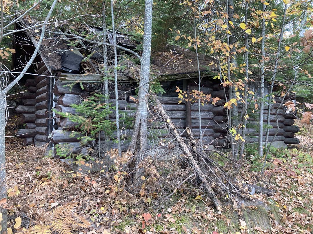
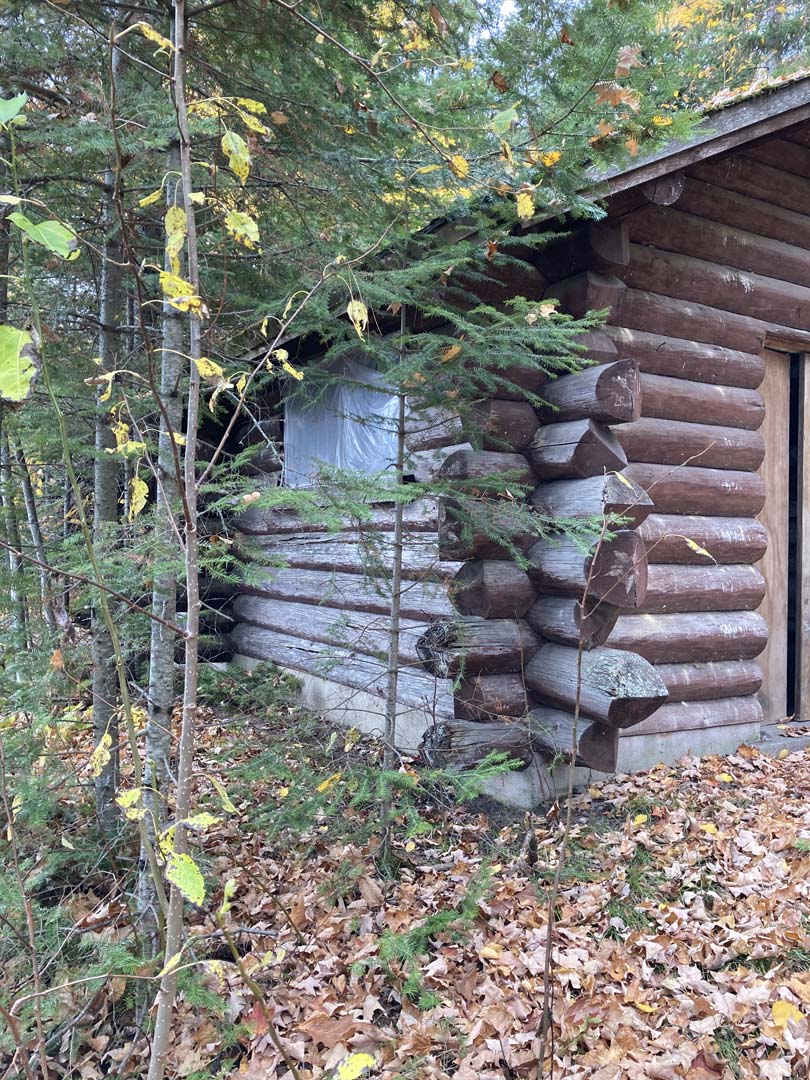
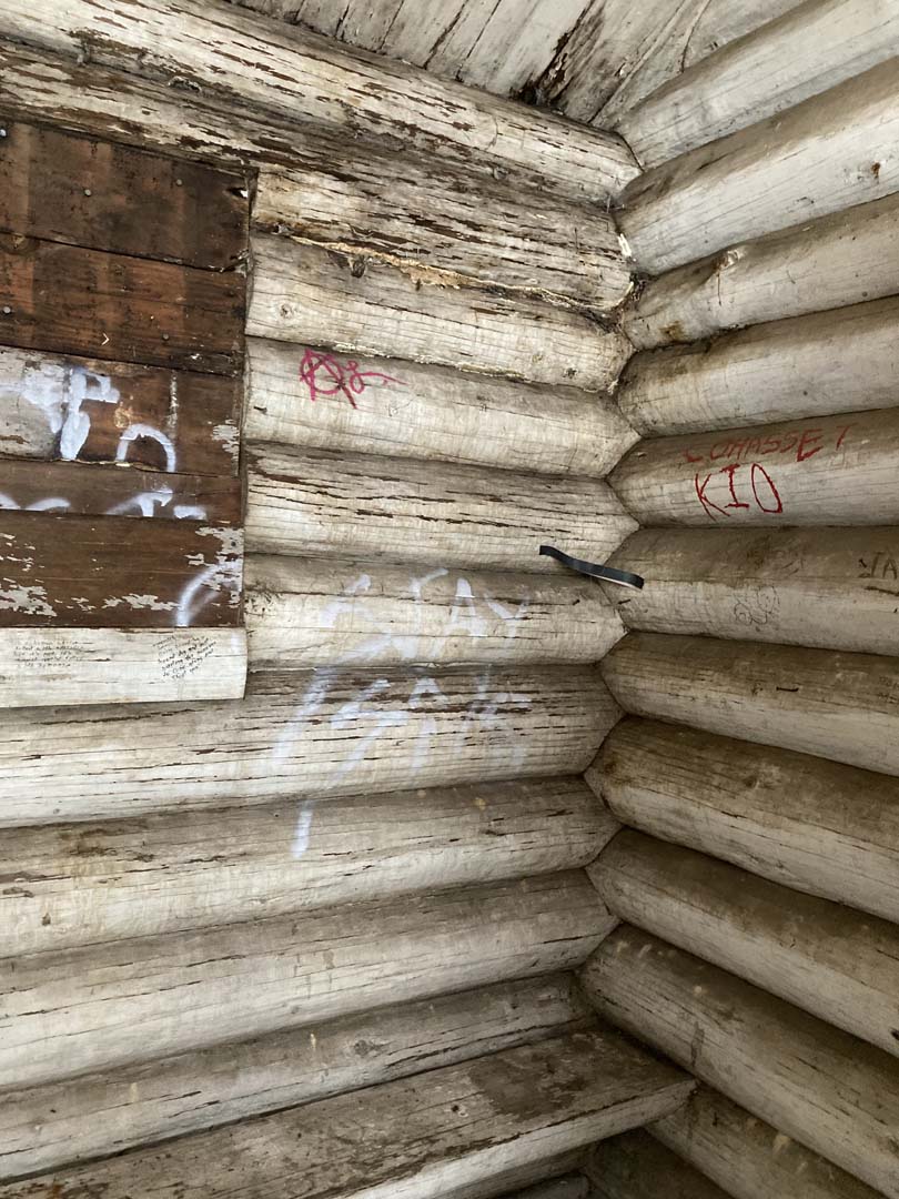
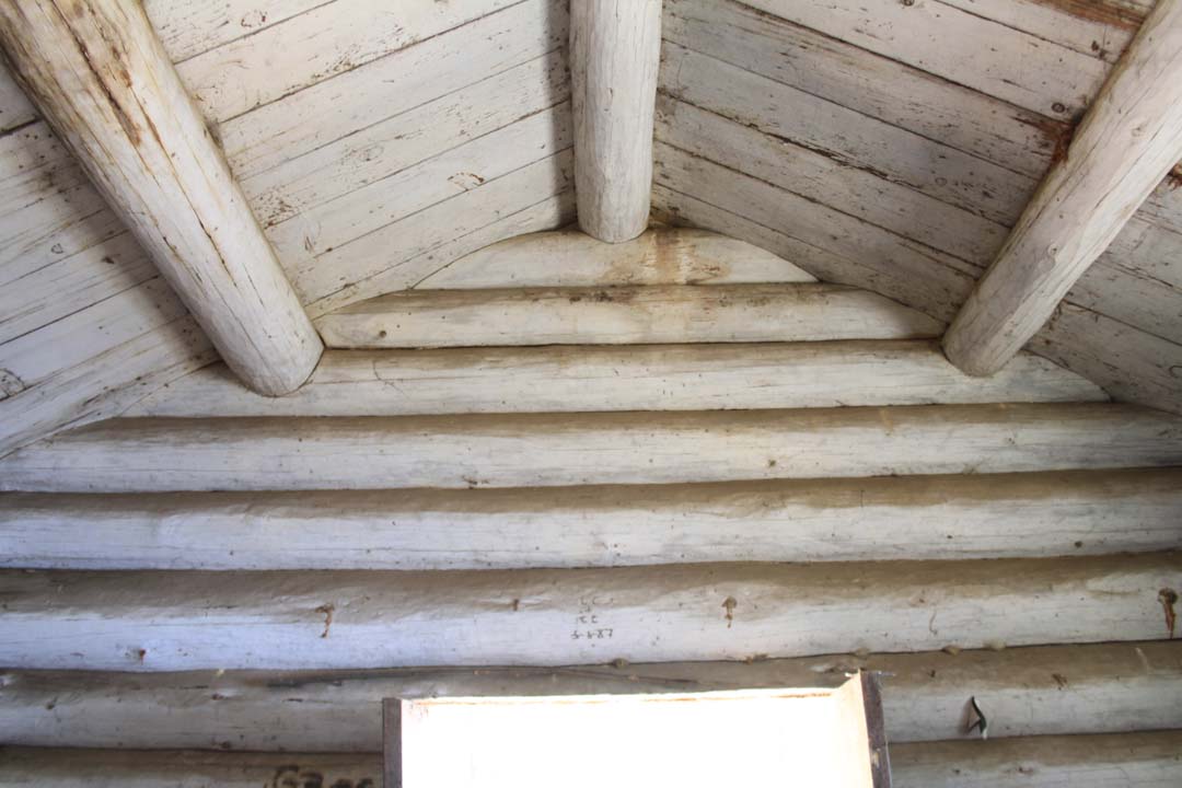
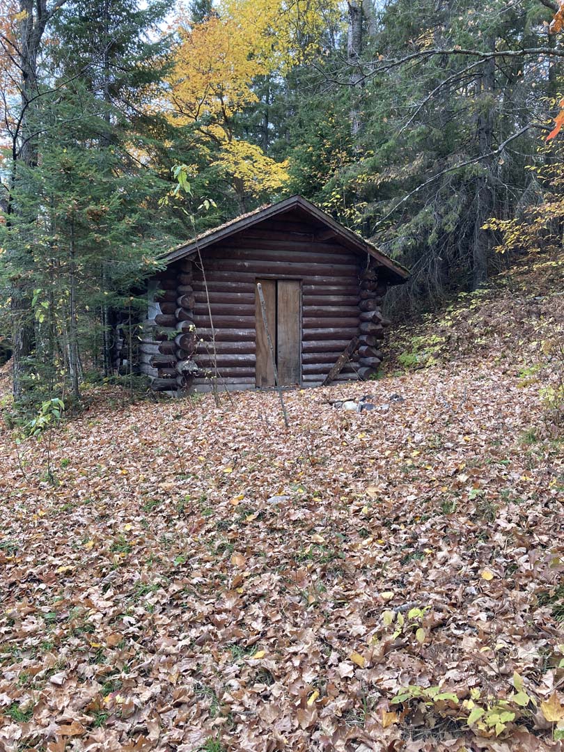
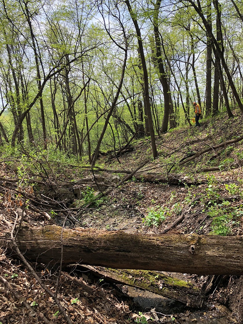
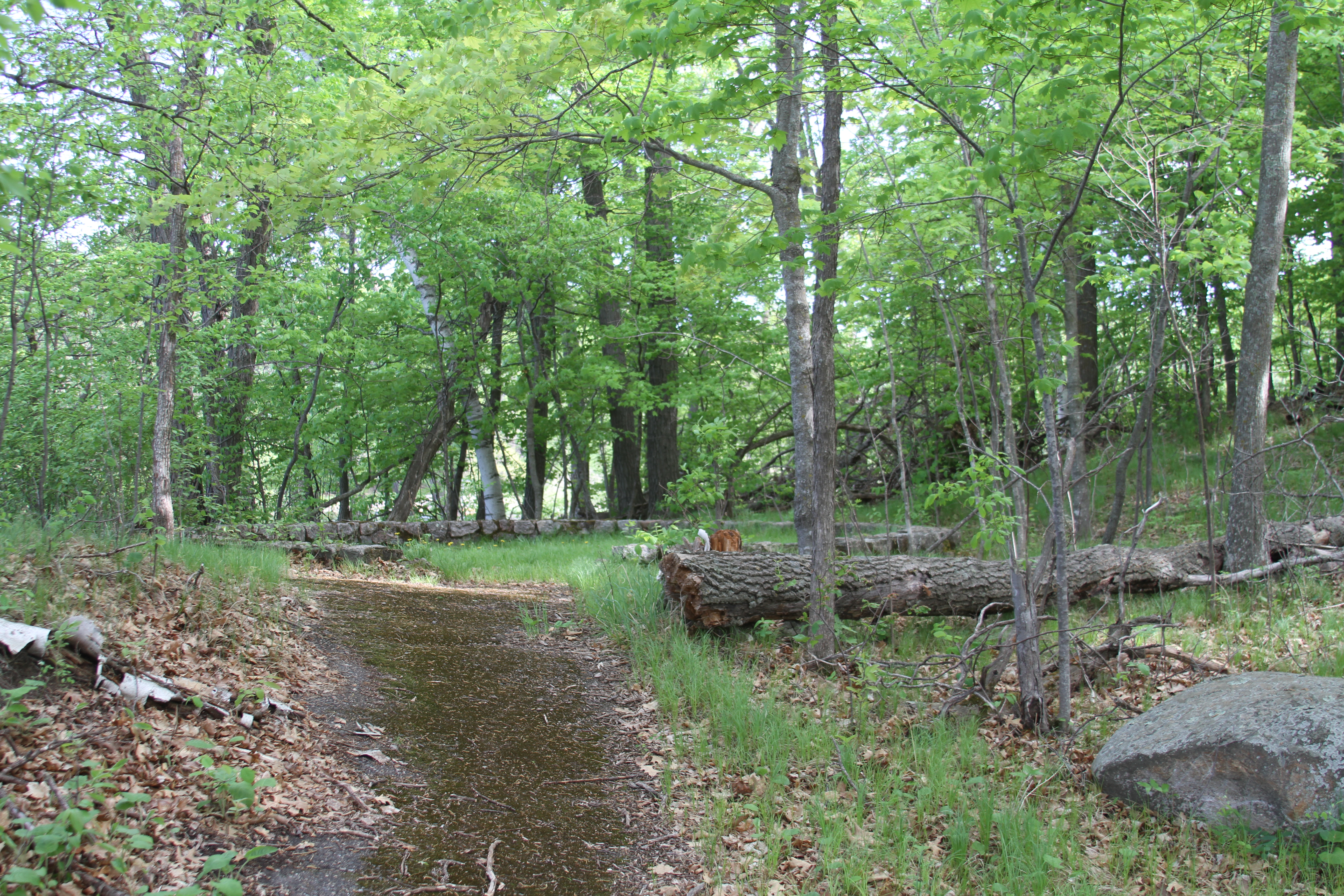
Project background: The log changing structure at Willow Lake was part of a large site development that is only partly visible today. The Rest Area, which has a stunning rock overlook wall, and stone curbed island to park along, once had a viewing tower, picnic area, and the changing structure was situated along the shore where a swimming area was established. An historic road, called “the Old Tote Road” follows the shore and connected to the overlook to the southern part of the site, which now has a DNR constructed and operated boat launch.
Project scope: The project will stabilize the log changing structure. The structure will be partially dis-assembled and sound logs and wood parts will be re-used. New logs will match the original materials. The structure will have secured windows and doors. The intent is not to use the structure, but to preserve it. Interpretation will show the interior and describe the site.
Timeline:This project has been delayed and is anticipated is on hold.
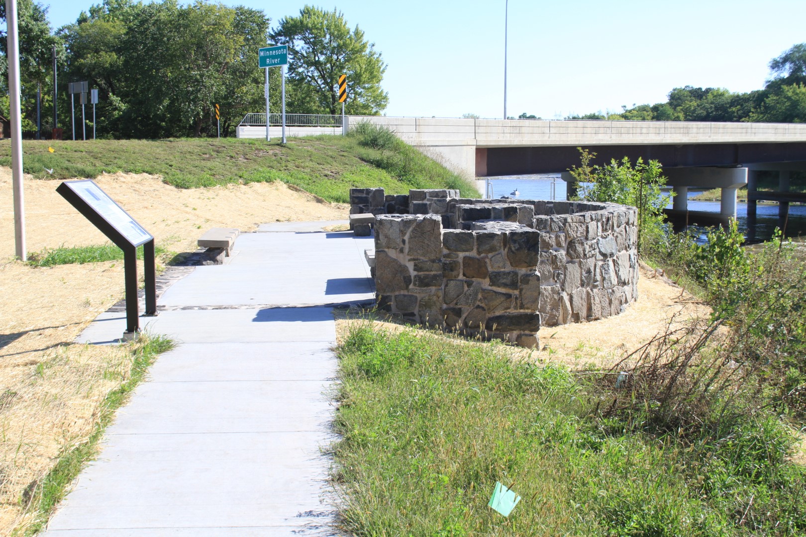
Location: MN 61, RP 100, at the mouth of the Cascade River on Lake Superior, 10 miles south of Grand Marais, Cook County.
Listed on the National Register of Historic Places in June 2003.
Original Construction: 1934-5
Designed by: Arthur R. Nichols
Constructed by: Civilian Conservation Corps (CCC) and Minnesota Highway Department (MnDOT).
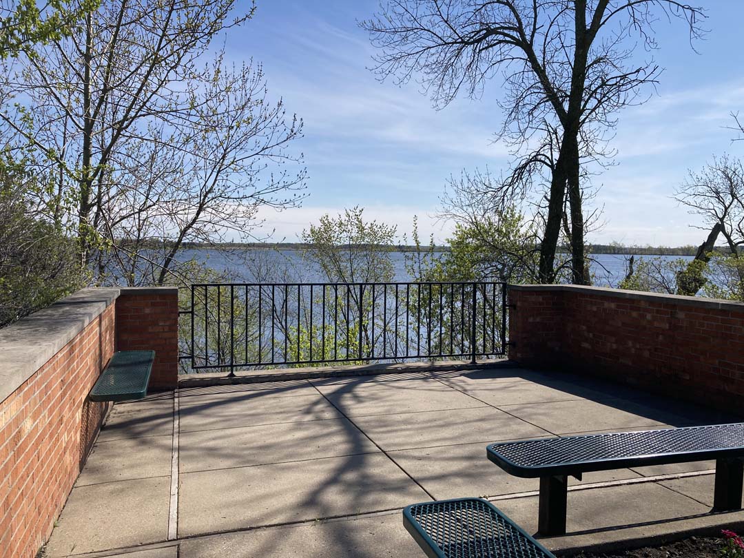
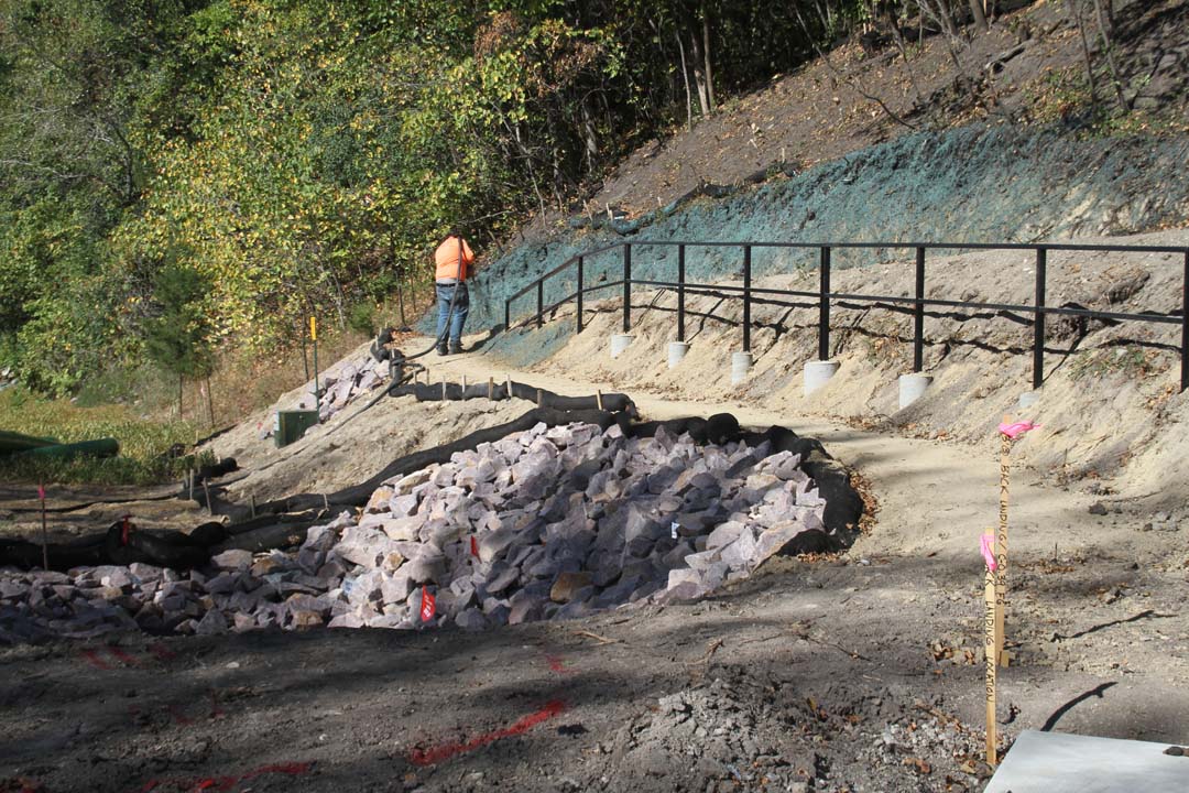
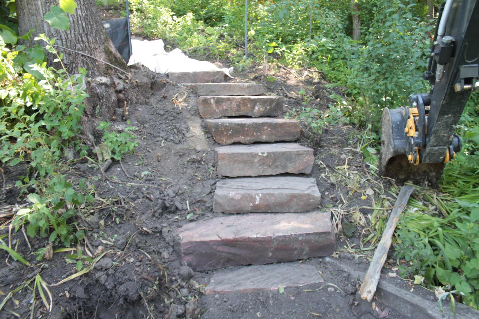
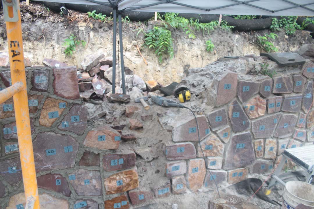
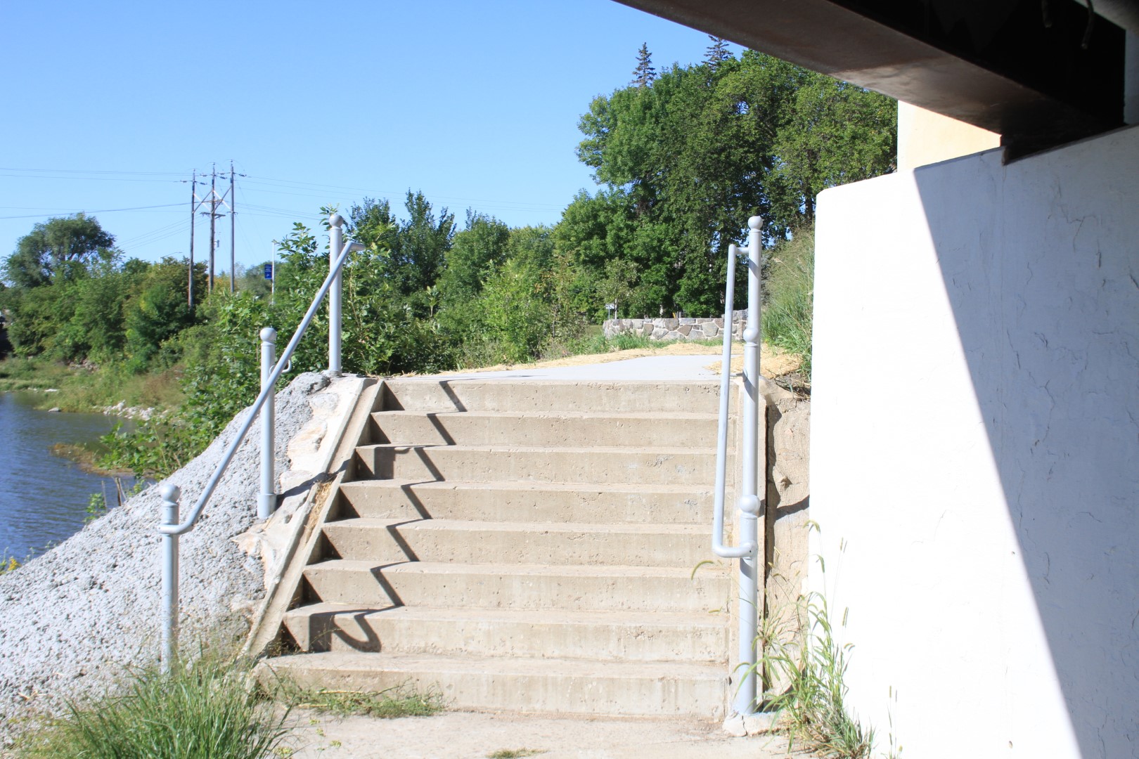
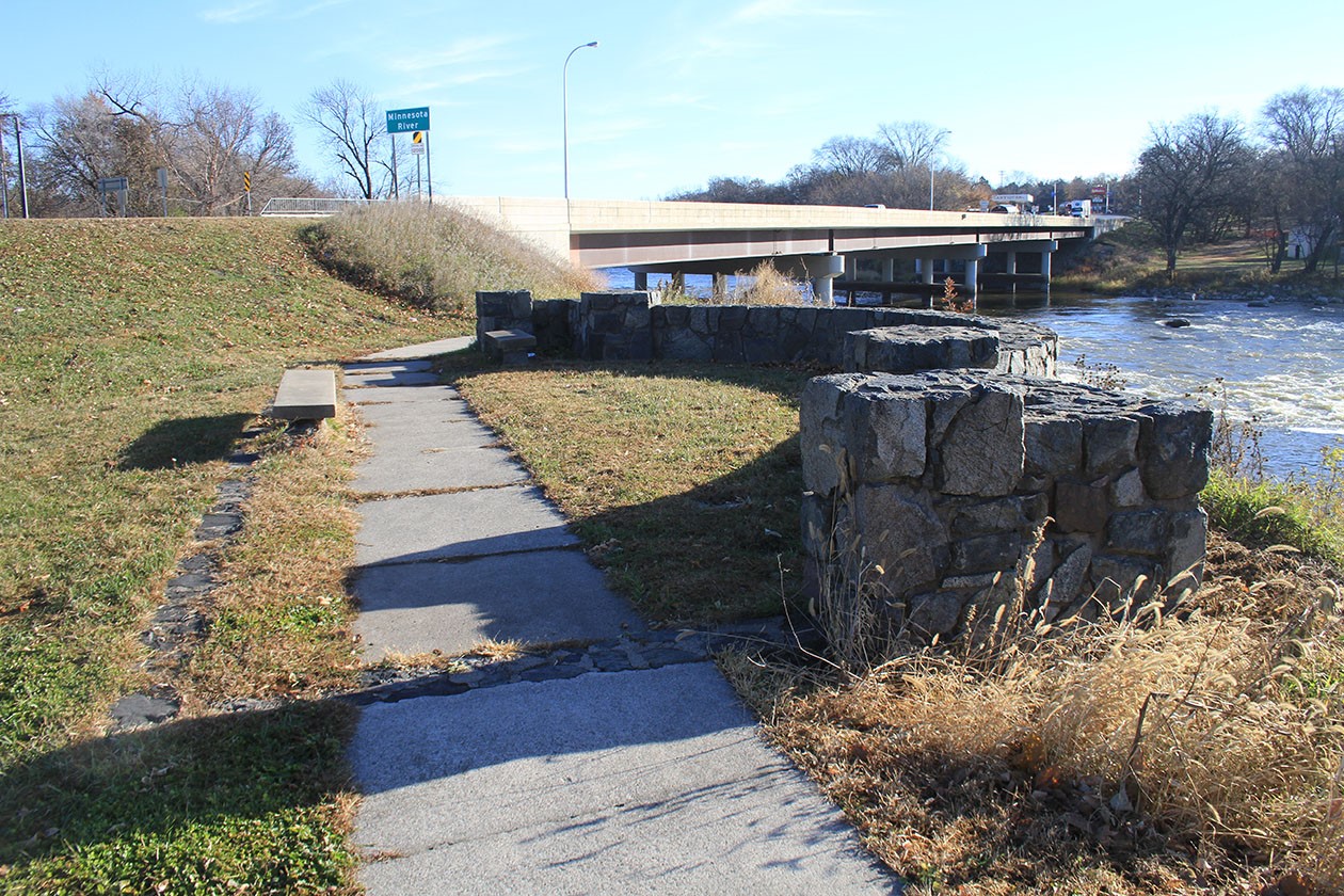
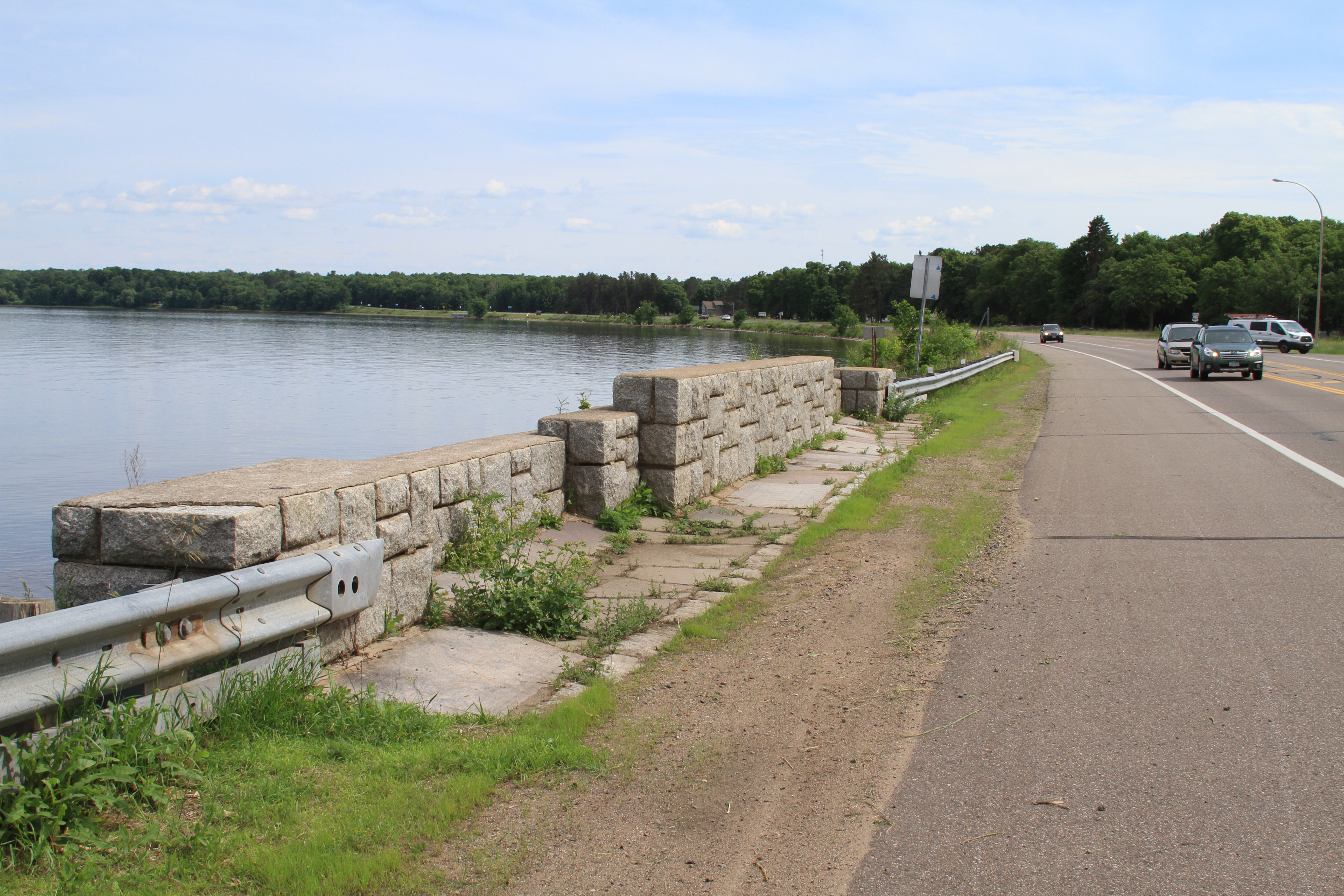
Project background: The wayside was actually built in 1934-5, by the Civilian Conservation Corps (CCC) before the State Park of the same name, and the wayside included the trail loop up the river with the first bridge crossing. The trail still exists and can be accessed off of the wayside. The wayside contains a 535’ long stone overlook wall, parking on both sides of the highway, and steps down to the ledge rock shoreline on both sides of the river. The overlook wall is integral with the bridge crossing the Cascade River, which was actually realigned as part of the wayside a construction. A lower retaining wall was constructed on the ledge rock shore in the 1980s and is in poor condition.
Project scope: Work will begin in summer 2025 with masonry repairs to the overlook wall and salvaging stone from the lower shore-level retaining walls for use elsewhere. Improvements to drainage, paving in the lake side parking, new walk along the lake overlook, a new stair on the west (south) side of the river, repairs to the eastern stair, and improved pedestrian crossing will be completed in summer 2026.
Parts of the parking area will be barricaded off for contractor use. Some parking will be retained open throughout the project. The overlook wall pulloff parking and stairs to the shore will be closed during the 2026 construction seasons as the stairs are replaced/repaired and the lower wall repaired and drainage pipes are installed in the overlook. A new sidewalk and pedestrian crossing will be constructed at the overlook crossing Hwy 61. The crosswalk will include concrete plazas and accessible curb ramps on both sides along with striping across the highway. During the crosswalk work, traffic may be reduced to a single lane of traffic with an automatic light.
All work will follow the Secretary of Interior Standards for Treatment of Historic Properties.
Future project- planned in 2028- An accessible overlook and pedestrian improvements will improve the connectivity of the wayside by reconstructing the gravel pedestrian path on the shoulders of the site in the northeast and southwest quadrants of the site. A new pedestrian crossing will be located on the northeast side of the river and a new accessible overlook to view Lake Superior will be added to the south-west of the site.
This project is planned for 2028 construction and will be in design soon.
Timeline: Work on the lake side Overlook wall will begin in summer 2025 and is expected to be completed in August 2025.
Work on the remaining pedestrian, drainage, and other site Improvements will be completed between June and August 2026.
Construction updates: Construction will resume in June 2026.


Location: US 61 north of Lake City
Historic Status: Not Eligible for listing on the National Register of Historic Places, SHPO number GD-FLC-054
Original Construction date : 1939-40, 1968, 1994, 2014
Designed by: Arthur Nichols, Attributed (historic masonry structures)
Constructed by: NYA (historic masonry structures)
Project background: This site contains a historic Roadside parking Area with several historic masonry structures, and a modern Class 1 (plumbed, year-round facility) added to the site. Because of the extensive additions and changes to the site, it is not eligible for the National Register of Historic Places, but it still has historic features to maintain.
Project scope: The 2026 project will create an accessible walk connecting to the Maiden Rock historic marker from the main parking area. The walk will end at a new plaza with benches, signage, and plantings. The historic marker will be rehabilitated and a concrete picnic table will be connected to the walk and made accessible. The existing gates for flood protection will be replaced.
The stone council ring near the river will have a new accessible walk and a picnic table will be modified for accessibility. The ring will be reconstructed.
The stone overlook wall to the south end of the site will have a few stone replacements and minor mortar repointing. A relocated historic sign is planned to be moved to the overlook wall form the Reads Landing Overlook.
Project Timeline: Construction began in April 2026 and will be completed by the end of June 2026.
Public use impacts: The site will remain open to the public but portions of the site will be fenced or barricaded off while work is underway.
Additional information: New interpretive signs will provide historical information on the area and on the Maiden Rock story found on the historic marker.
.
Location: US 52 at the south end of the City of Chatfield
Historic Status: not Eligible for listing on the National Register of Historic Places, SHPO number FL-CHC-034
Original Construction date: 1955
Designed by: Mn Dept of Highways (MDH), Roadside Development Division
Constructed by: MDH
Project background: This historic marker was a relatively late design, still following the WPA era rustic design.
Project scope: The project in 2026 will rehabilitate the stone historic marker and reconstruct the concrete plaza in front of it to remove the single step and make the plaza accessible. Curb ramps will be added to both sides of the drive lane, and new plantings will be added. The hillside behind the historic marker will be cleared of invasive vegetation and a few evergreens will be interplanted.
On a different site (Hwy 58 at 350th St) the plaques for the Red Wing Claybank Pits historic marker will be refurbished as part of this project.
Project Timeline: Construction began in April 2026 and will be completed by the end of June 2026.
Public use impacts: The historic marker and drive lane will be closed during the work.
Additional information: A planned interpretive sign has been removed from the project due to workload limitations. The footings will be included in the project so a sign can be added in the future.
Location: US 61 1.5 mi North of Reads Landing
Historic Status: Listed on the National Register of Historic Places, SHPO # WB-PEP-012
Original Construction date: 1939
Designed by: Arthur Nichols
Constructed by: National Youth Administration, NYA
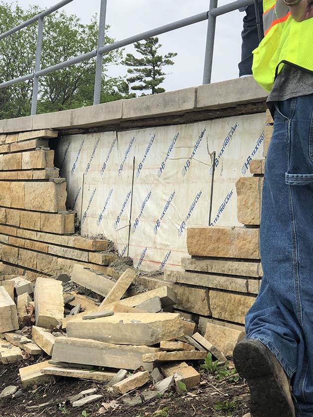
Project background: The shrine style historic marker, an integral part of the overlook structure, was damaged in the winter of 2025. The structure was completely knocked down and broken into pieces.
Project scope: Fully reconstruct the marker, adjacent walls, and repair the damaged step. Reconstruction may include frost footing and additional protective structures. As much material as possible will be salvaged and re-used. Work will follow the Secretary of Interior Standards for Treatment of Historic Places.
Project Timeline: Summer 2026
Public use impacts: The Overlook is barricaded off and will not open to the public until the repair is completed. There are several other paved pull off waysides near this overlook. That are available to use.
Additional information: The freestanding post-mounted metal historic sign may potentially be relocated. It was also damaged over the winter, but it is not known if it was during the same incident.
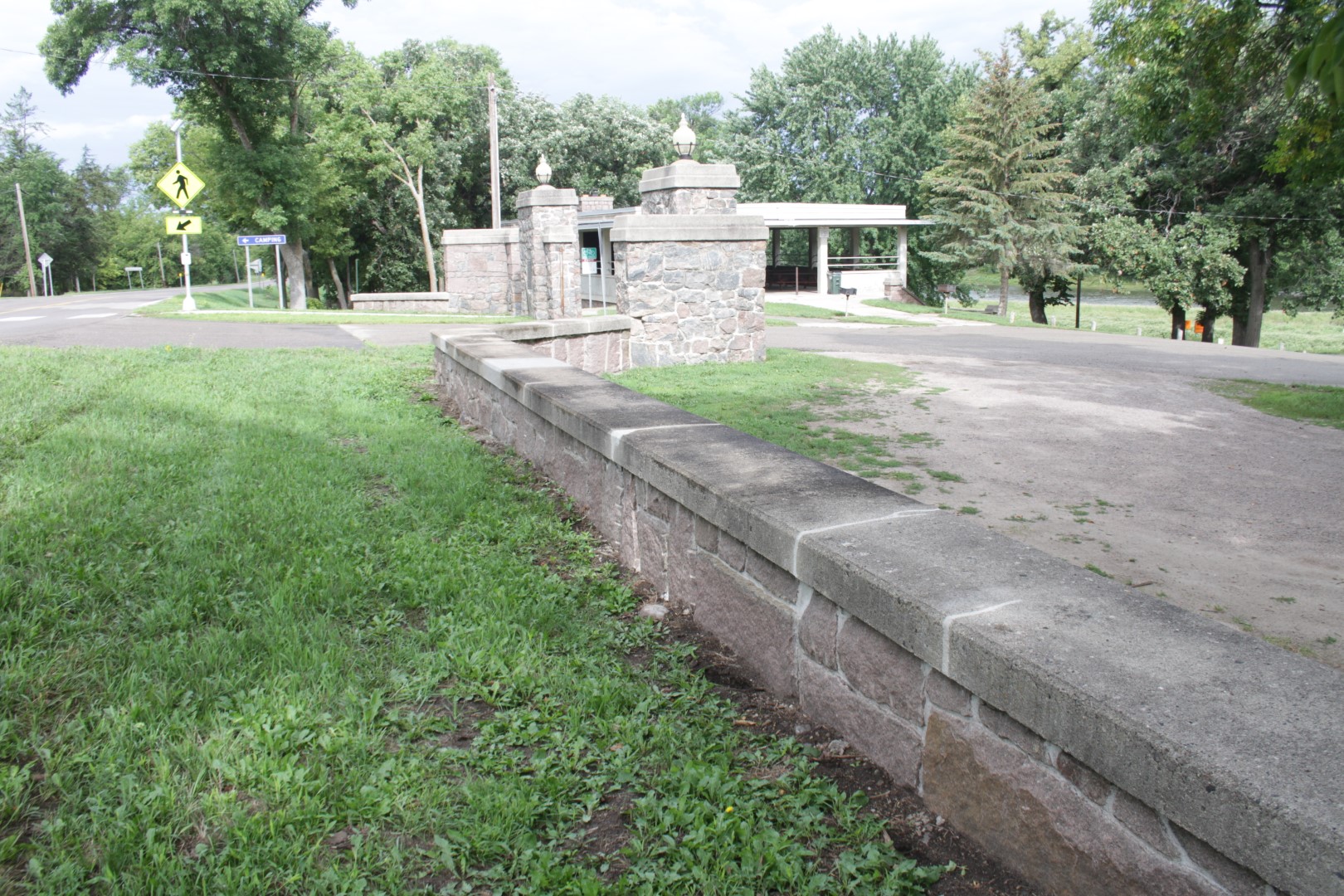
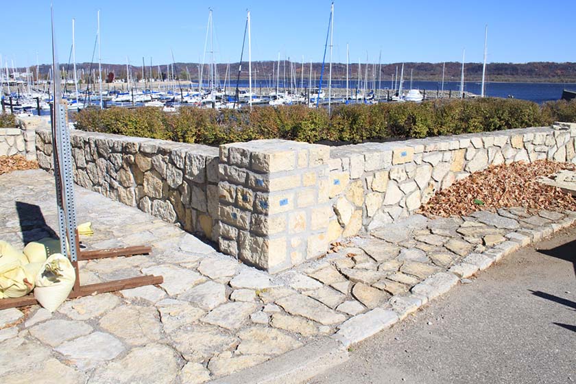
Location: US 61 and W. Elm Street in Lake City
Historic Status: Eligible for listing on the National Register of Historic Places
Original Construction date: 1940
Designed by: Arthur R. Nichols, attributed
Constructed by: National Youth Administration, NYA
Project background: The Lake City Concourse consists of a series of short stone walls on either side of a semicircular parking area. The northernmost wall, across from W. Elm St was damaged in spring 2026. A concrete planter (not part of the historic property) was damaged and a corner of the wall was damaged.
Project scope: The damaged stone wall will be repaired using salvaged materials following the Secretary of Interior Standards for Treatment of Historic Places.
Project Timeline: June 2026
Public use impacts: The work area and adjacent shoulder may be temporarily barricaded during work. No walk/trail, traffic lane, or closure of the concourse parking at the overlook are anticipated.
Additional information: This work will be added to an active project nearby.
Location: MN 78 west shore of Otter Tail Lake, between CR 5 and 430th Ave.
Historic Status: Eligible for listing on the National Register of Historic Places
Original Construction date: 1969
Designed by: MHD
Constructed by: MHD
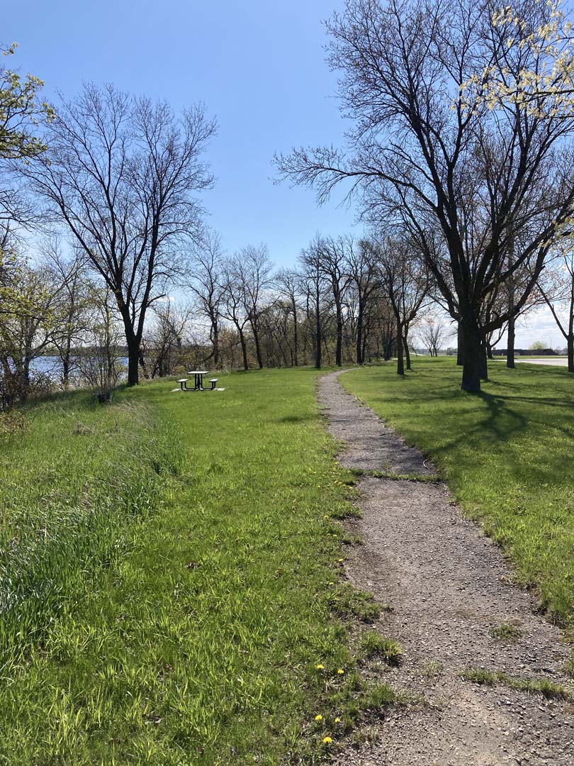
Project background: The Otter Tail Lake Rest Area, also called “Day Use Area’” is on a large parcel of lakeshore on Ottertail Lake. It has a small vault toilet building and two large parking lots with a picnic area between them. There has not been significant rehabilitation work to the property since the addition of the donated picnic shelter in 1987.
Project scope: The project will repave the bituminous walks, add access ramps, add accessible picnic tables and connection to the picnic shelter. Small repairs to the Vault toilet and picnic shelter will be included. Picnic tables will be replaced with the original table style. Wood bollards will be replaced. New interpretation will be added and the existing scenic byway sign will be relocated to an accessible walk.
Project Timeline: Construction may begin in fall of 2026 and will continue in spring of 2027. Completion will be at the end of June 2027.
Public use impacts: Construction impacts will close off the picnic area between the parking lots. Smaller areas may also be closed off for accessible picnic table construction. The parking lots themselves will not be re-paved but will be striped as part of the project.
Additional information: Due to the many closely spaced trees in the picnic area, some tree removal is required to reconstruct the trails and open views to the lake. Tree removal will take place over the winter of 2026-7 to protect wildlife.
Recently completed projects
Recent projects are completed, but still under contractor warranty. These projects may still have short duration warranty work and small repairs completed.
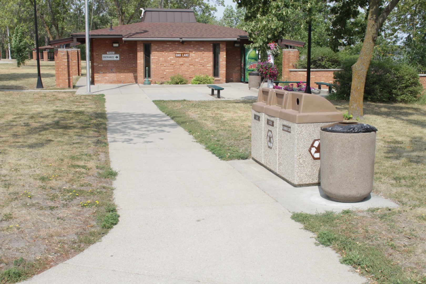
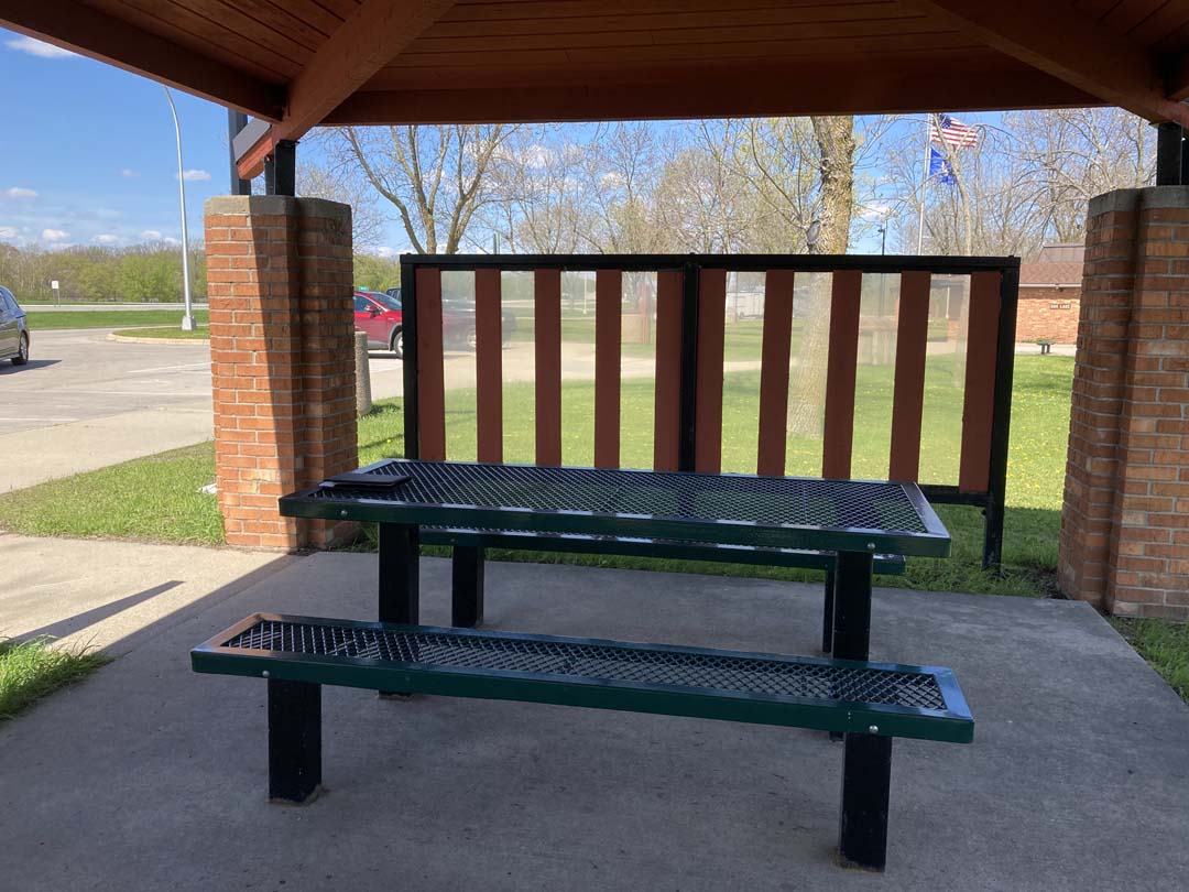
Location: Hwy 2, 1 mile east of intersection with Hwy 59, near Erskine, MN.
Eligible for listing on the National Register of Historic Places
Original Construction: 1972-4
Designed by: Virgil Siddens, architect and MHD
Constructed by: MHD
Project background: Oak Lake Rest Area was evaluated in a study published in 2020 and was determined eligible for the National Register of Historic Places for its outstanding early modern rest area design and its intact setting. Three other sites share the same building designs; Lake Hansel, Lake Latoka and Burgen Lake. Only Oak Lake and Burgen Lake remain, but Burgen will require significant capacity additions, being on I-94 near Alexandria. Oak Lake, in a relatively quiet location in the northwest corner of the state, has remained nearly fully intact. A site rehabilitation was completed in 2023. A building rehabilitation will follow in the future. Both rehabilitations will follow the Secretary of Interior Standards to retain historic integrity of this historic property..
Project scope: The project will rebuild parking pavements, walks, trails, and site furnishings. Two picnic shelters will be rehabilitated. Unique wood directional signage will be rebuilt and plantings will be replaced.
Timeline: The site project has been completed.
Public use impacts:The site is fully open.
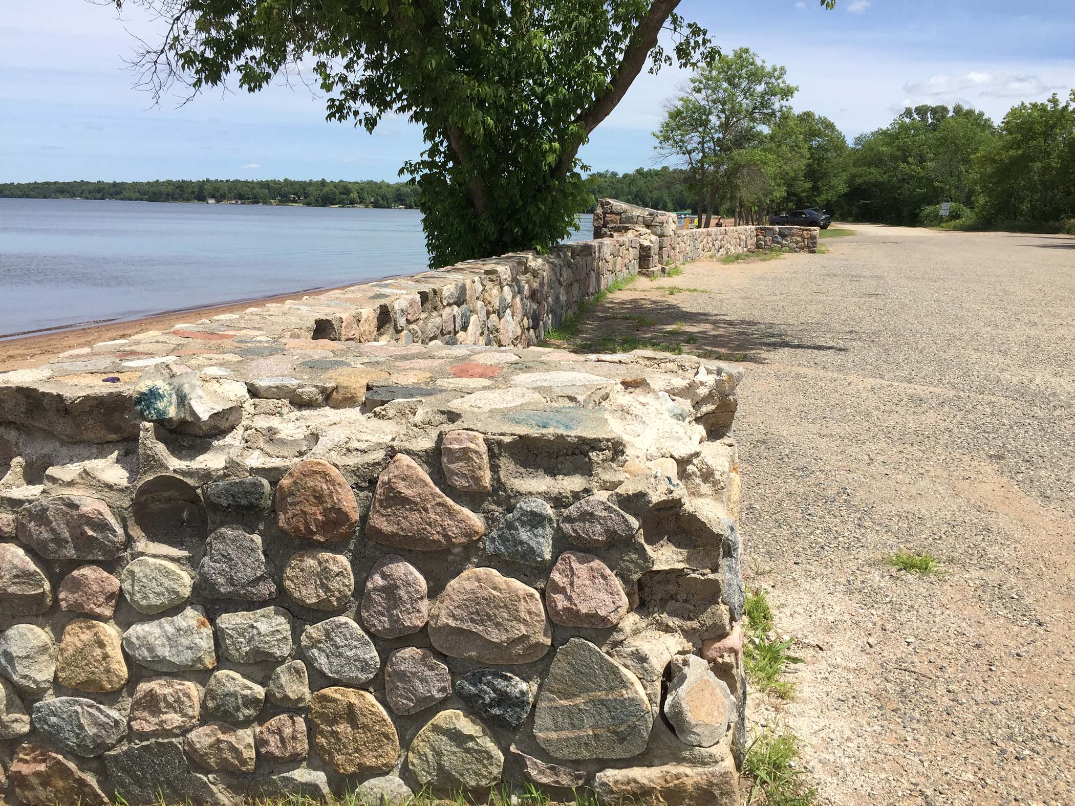
Location: US 52, RP 110, on the north end of the City of Orr, St. Louis County.
Listed on the National Register of Historic Places in July, 2002.
Original Construction: 1938
Designed by: Arthur R. Nichols
Constructed by: Civilian Conservation Corps (CCC) and Minnesota Highway Department (MnDOT).
Project background: The wayside includes two entries, a small parking lot leading to a beach and picnic area on the south end and a stone overlook wall adjacent to the highway with pull off parking on the north end. Many people think of the south entry as a city park, and the north as the wayside but all of this property was part of the original wayside on the shore of Pelican Lake. The area is maintained and operated by the City of Orr since it was built in 1938 by the Civilian Conservation Corps (CCC).
Project scope: The property will have two separate projects in summer which may extend into next summer 2025. The historic masonry work on the overlook wall was completed in 2025. However, there were not enough bids received to move forward with the site and accessibility work. This work will be combined with the project planned for 2028 construction.
All work will follow the Secretary of Interior Standards for Treatment of Historic Properties.
Future 2028 projects-Fishing pier, cribbing, and accessible trail connections.
Future projects will reconstruct the timber cribbing connecting the land to the wooden fishing pier. The fishing pier will also be replaced. Another future project complete an accessible connection from the overlook to the lakeside trail and construct accessible gravel trail to the south parking. Accessible parking and new interpretation will be added. Over time, playground equipment will be replaced and accessible surfacing installed for the play area
Timeline: Work on the Historic Masonry Overlook was completed in July 2025.
Construction updates: Construction updates will be available when the 2028 project design is ready for letting.


Location: Hwy 59 on the northern edge of the City of Pelican Rapids at the intersection with CR 9, in Ottertail County.
Not Eligible for listing on the National Register of Historic Places: previously was considered eligible. In 2020 study it was found to be not eligible.
Original Construction: 1946
Designed by: Minnesota Highway Department (MnDOT).
Constructed by: Minnesota Highway Department (MnDOT).
Project background: This project will rehabilitate the Pelican Rapids Historic Marker Wayside (Class IV Rest Area), which is part of the Historic Roadside Property Program. In the late 1990s, the site was determined eligible for the National Register of Historic Properties, but in a 2020 statewide re-evaluation, it was determined not eligible. The loss of eligibility was for reasons lack of complex design, unknown designer and of deterioration since the previous review.
This project goal is to re-establish the integrity of the site and replace elements lost from the original design. All work will follow the Secretary of Interior Standards for Treatment of Historic Properties.
Project scope: Scope includes stone masonry repointing and partial rebuilding of planter box area of historic marker. Adding drainage to the planter box. Add plantings to planter box. Install a new flagpole. Replace 2 concrete benches. Reconfigure concrete plaza with added plaza to original dimensions. Add walk and base for mill stone and plaque across drive lane from historic marker. Add interpretive signage with accessible pad adjacent to mill stone. Restore original shrub plantings on both sides of site.
A subsequent road project (SP 5618-117) will construct accessible curb ramps and walks to the plaza and mill stone from drive lane and to CR 9. The access lane will be permanently closed off from Hwy 59 but retained from CR 9.
Timeline: Work began in May 2024 and was completed in November 2024.
Construction updates: Construction is complete.
Location: Hwy 301 west of Hwy 10 North Side, adjacent to Minnesota Correctional Facility St. Cloud
In Historic District listed on the National Register of Historic Places: Minnesota State Reformatory for Men Historic District (SH-SCC-013)
Original construction: ca. 1930
Designed by: not documented
Constructed by: WPA-MHD
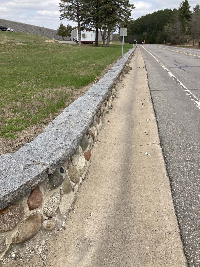
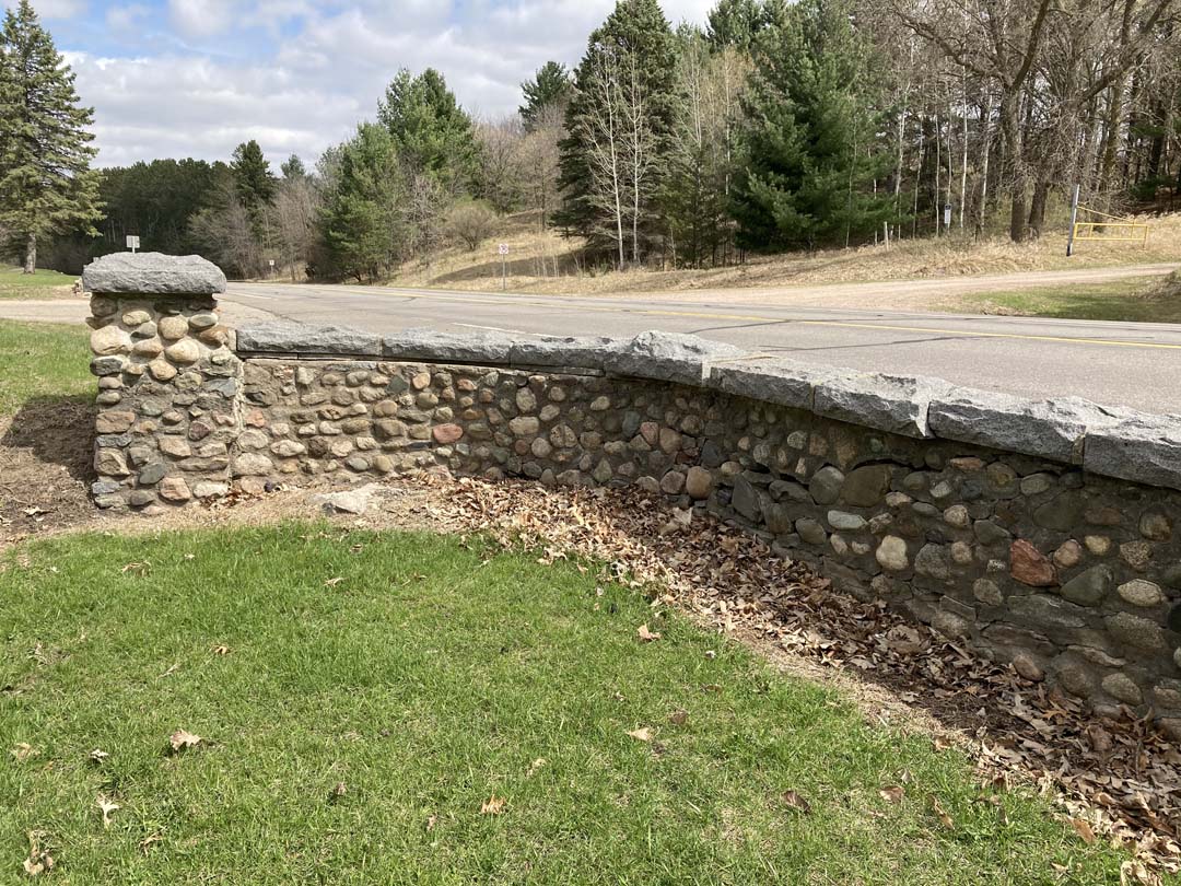
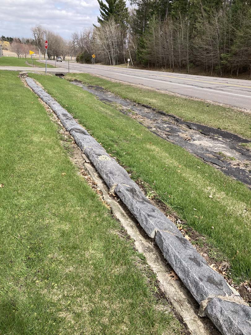
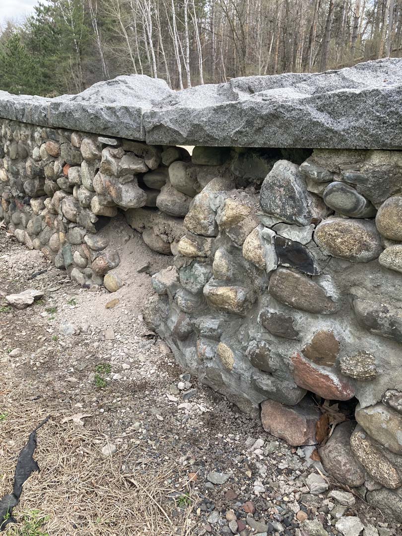
Project description: In conjunction with the reconstruction of TH 301, this historic retaining wall is the edge of a National Register Listed Historic District encompassing the St. Cloud Correctional Facility (Prison). The cobblestone wall has grey granite caps which match the stone of the correctional facility buildings. The stone was quarried within the facility itself where the quarries remain as part of the exercise yard.
Project scope: The road will be reconstructed, storm water facilities repaired, and the walls will be reconstructed. The tall section of the wall will be rebuilt with a concrete core and stone facing. Shorter walls will be rebuilt as original fieldstone walls.
Project timeline: This project was completed in Fall 2023. The rod has been turned over to the City of St. Cloud.
Location: Hwy 78, at Hwy 108, northwest corner, edge of Ottertail City, in Ottertail County.
Not Eligible for listing on the National Register of Historic Places: previously was considered eligible. However, in a statewide survey in 2020 it was determined to be not eligible.
Original Construction: 1948
Designed by: Attributed to Arthur R. Nichols.
Constructed by: Minnesota Highway Department (MnDOT).
Project background: This project will rehabilitate the Ottertail City Historic Marker Wayside (Class IV Rest Area), which is part of the Historic Roadside Property Program. In the late 1990s, the site was determined eligible for the National Register of Historic Properties, but in a 2020 statewide re-evaluation, it was determined not eligible. The loss of eligibility was for reasons lack of complex design, unknown designer and of deterioration since the previous review. There has not been any previous work documented on the marker or site.
This project goal is to re-establish the integrity of the historic marker and site. All work will follow the Secretary of Interior Standards for Treatment of Historic Properties.
Project scope: Scope includes stone masonry repointing to the entire historic marker, replacement of stone as needed. Repairs will be made to the existing concrete plaza. Add an accessible curb ramp to the concrete plaza from the parking area, replacing curb as needed, re-dress gravel parking. Install a new pad at relocated interpretive signage and add a new interpretive sign.
Timeline: Work will begin in May 2024 and be completed in June 2024. Work will be concurrent (but is a separate project) with road reconstruction on Hwy 59, called SP 5618-117. The site will be closed during construction, but there are no other traffic impacts anticipated.
Construction updates: Construction schedule will be available in early May 2024.
Location: Hwy 14 about 1 mile south of intersection with Hwy 15 on east side of Minnesota river near New Ulm.
Now Eligible for listing on the National Register of Historic Places: Determined eligible for the National Register in March 2024..
Original construction: 1938-39
Designed by: Arthur R. Nichols
Constructed by: National Youth Administration, a federal New Deal work relief program during the depression.
Project background: This project will rehabilitate the New Ulm Spring Roadside Parking Area (Class IV Rest Area), which is part of the Historic Roadside Property Program. In the late 1990s, the site was determined eligible for the National Register of Historic Properties, but in a 2014 re-evaluation, was determined not eligible. The loss of eligibility was mainly for reasons of deterioration since the previous review. This project goal is to re-establish the integrity of the site and improve its potential for eligibility. This is the only remaining WPA-era wayside in this part of the state (MnDOT District 7) and one of only 3 remaining sites in the Historic Roadside Property Program which were built around springs. All of them have been capped or disconnected. All work will follow the Secretary of Interior Standards for Treatment of Historic Properties.
Project scope: Repair and repoint (removing and replacing mortar) the stone wall, replacing the gravel walk with a concrete walk, repaving the parking area, re-introducing the curbed island in/right out one-way access. Rebuild natural surface trails, stone steps and two picnic areas above the wall. Interpretation will be added, and ADA accessibility improved by adding an accessible picnic table at the south end of the wall and curb ramps on the walkway. The spring outlet pipe will be stabilized, but water will not be restored due to contamination of the water source.
Vegetation management will include strategic removal of invasive shrubs such as buckthorn and invasive perennial plants such as garlic mustard, along with selective tree removal and pruning to open views of the river valley from the picnic areas on the hill.
Timeline: Work began in spring 2022. Work will be concurrent (but is a separate project) with road reconstruction on Hwy 14, called SP 5202-58. The site will be closed during construction as the Hwy 14 construction will close the road.
Construction updates: The project was delayed a year from the original 2021 construction due to a bidding problem.
Construction began in May 2022 and substantially complete in September 2022. The site re-opened until in fall 2023.
Volunteers needed: This special site needs your help. MnDOT is looking for volunteer groups to help maintain this site. Please contact the Historic Roadside Property Program Manager andrea.weber@state.mn.us if you are interested.
2025-6 Trail Rehabilitation: A small project in 2025-6 will reconstruct the natural surface trail leading form the north end o f the wall up into the picnic area. This trail was constructed in 2022 using natural surface trail standards, but due to steep slope, poor vegetation growth, and growth of invasive weeds, the trail has not been able to be maintained. Options for a more durable surface will be evaluated and constructed in a small project in fall 2025 or spring 2026.
Location: Hwy 78, west side, near the Balmoral Golf Course, in Ottertail County.
Listed on the National Register of Historic Places in December 2002.
Original Construction: 1940
Designed by: Arthur R. Nichols
Constructed by: National Youth Administration (NYA) and Minnesota Highway Department (MnDOT).
Project background: This project will rehabilitate the Craigie Flour Mill Historic Marker Wayside (Class IV Rest Area), which is part of the Historic Roadside Property Program. This site was listed on the National Register in 2002 and its most recent rehabilitation was in 2012.
This project goal is to repair the stone structure as needed, to increase accessibility to the site for people with all levels of mobility, and to re-establish the visual connection to Balmoral Creek. All work will follow the Secretary of Interior Standards for Treatment of Historic Properties.
Project scope: Scope includes stone masonry repointing and site drainage improvements. Adding a new accessible curb ramp and walk to base of existing marker. Relocate existing interpretive signage and add a new interpretive sign panel. Re-plant trees (several ash trees were recently removed due to suspected Emerald Ash Borer). Vegetation removal and management to open view to creek.
Timeline: Work was completed in September 2024.
Construction updates: Construction is complete..
Location: Hwy 212/23 on west side of MN River south of 212 river bridge in Granite Falls, MN.
Not Eligible for listing on the National Register of Historic Places This site was re-evaluated for eligibility for the National Register as a roadside property and as part of the adjacent Veterans’ Memorial Park. It was not found eligible under these contexts.
Original Construction: 1938
Designed by: Arthur R. Nichols
Constructed by: Minnesota Department of Highways Staff and federal relief program workers.
2021 project scope: Granite Falls Overlook Rehabilitation; the overlook wall was repointed (replace deteriorated mortar between stones), benches were repaired, walkways were repaired, the gravel plaza surface was replaced with concrete, and stone curb was repointed, new trees were planted, and an interpretative sign was added. All work followed the Secretary of Interior Standards for Rehabilitation.
At a separate location in Granite Falls Veteran’s Memorial Park, Repointing on the south wing wall of the entrance to Granite Falls Memorial Park on Hwy 67 was completed. This part of the entry structure is in the MnDOT right of way.
This project was completed in September 2021. Ongoing warranty and maintenance activities will be ongoing for 1-2 years.
Reads Landing is Listed on the National Register of Historic Places
Location: Hwy 61 approximately 9 miles southeast of Lake City Concourse
Original Construction: 1939
Designed by: A.R. Nichols, attributed
Constructed by: National Youth Administration
2020 Rehabilitation included Work will include the rehabilitation of the brick and stone overlook, plaque repairs and restoring a stone retaining wall on the upland side of the overlook.
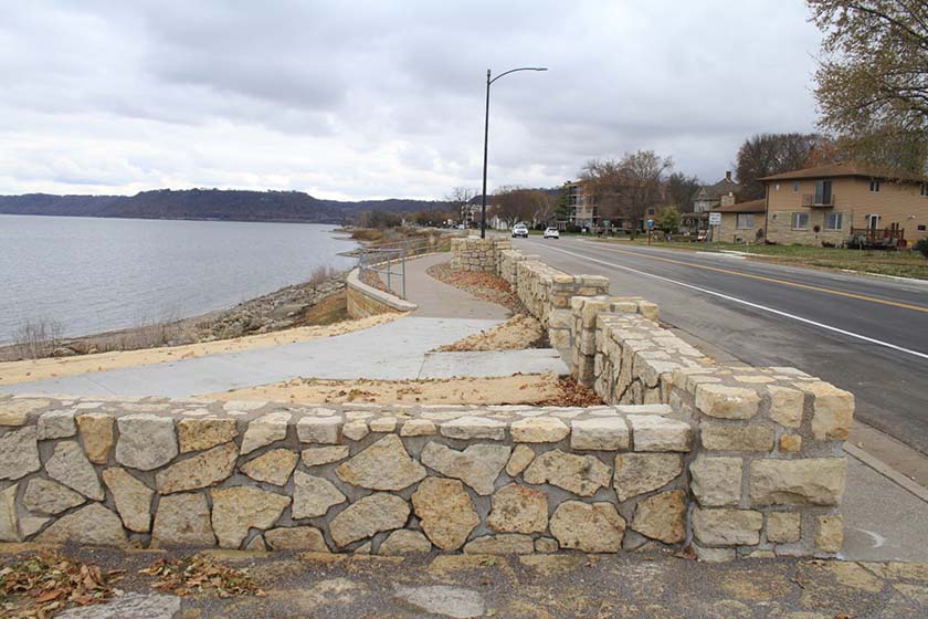
Lake City is Eligible for Listing on the National Register of Historic Places
(confirmed eligibility in March 2024)
Location: Hwy 61 in Lake City south of W. Elm Street.
Original Construction: 1938-40
Designed by: A. R. Nichols, attributed
Constructed by: National Youth Administration (1940 phase)
2020 Rehabilitation included repointing and stone replacement at the stone overlook and walls adjacent to Hwy 61, repair of flagstone paving areas and some sidewalk replacements. Interpretive signage was restored.
Not Eligible for listing on the National register of Historic Places
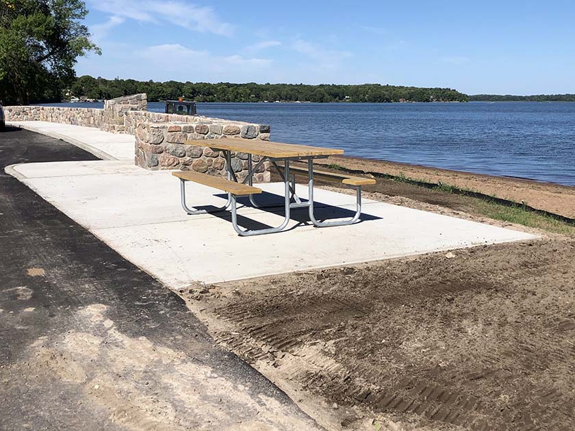
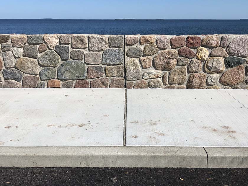
Whipholt RPA
Location: Hwy 200 about a half-mile east of 16th Ave (CR2108) on the south shore of Leech Lake
Original Construction: 1941, resumed and completed 1951
Designed by: Arthur Nichols, attributed
Constructed by: WPA and Minn. Dept. of Highways
2020 Project scope: included restoration of the stone overlook wall, improve interpretive elements and signage, repave the access road and parking area (within the existing paved area limits) and add plantings , picnic tables and a portable toilet screen.
Listed on the National Register of Historic Places under: Gooseberry Falls State Park CCC/Rustic Style Historic Resources, an Historic District, as a contributing feature in 1989
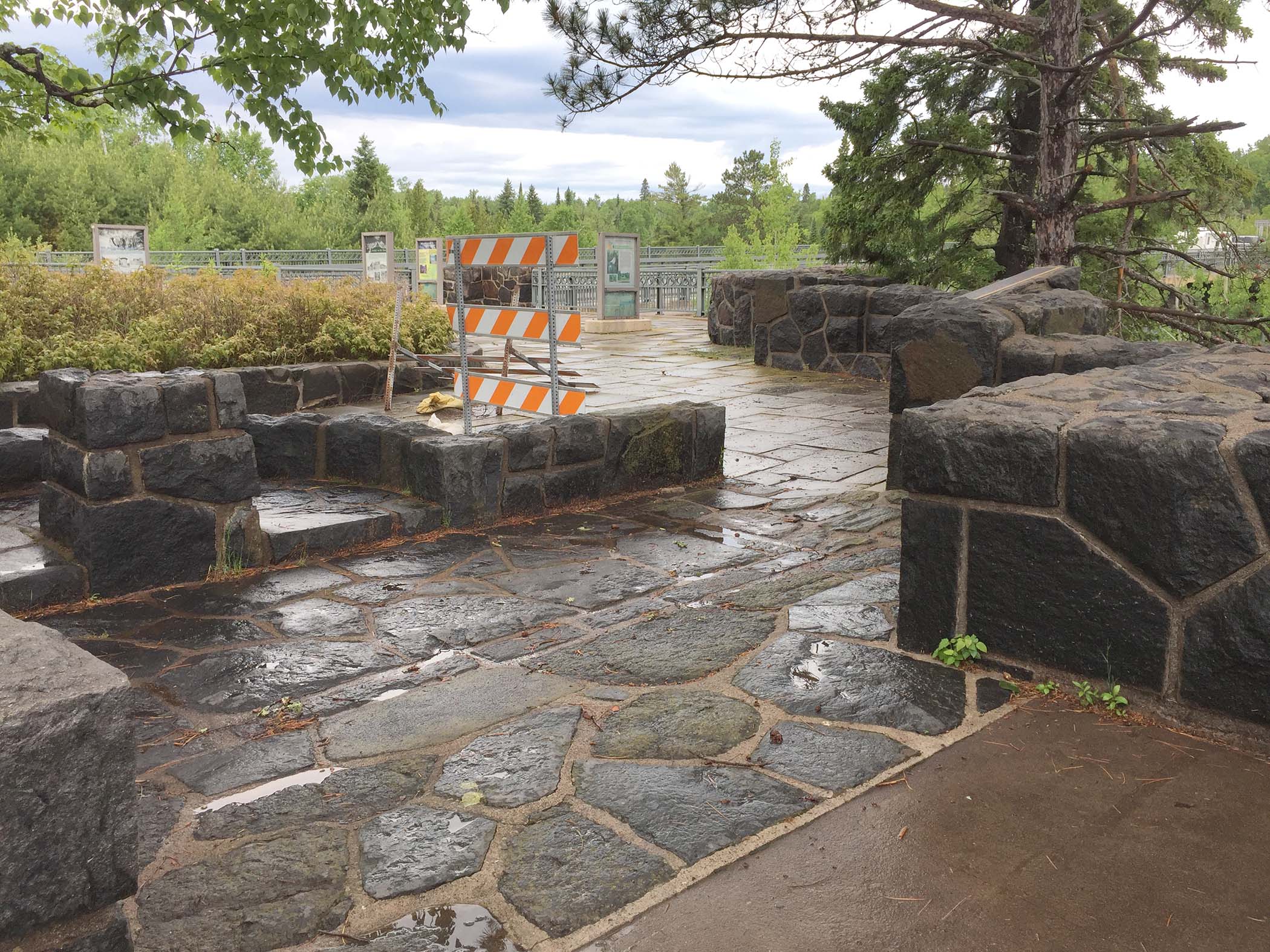
Original Construction: 1936-40
Designed by: Edward W. Barber
Constructed by: Civilian Conservation Corps
2019 Rehabilitation Project completed safety and accessibility improvements to the historic concourse and bridge overlook and repointed the historic concourse structure (repointing is the replacement of the mortar between the stones). The concourse plaza and overlook plaza was cleared of vegetation and gravel placed in original parking area with the Gitchi Gami trail running through is lined by trees and grasses to distinguish it as new. The bridge monument was moved from the plaza to the north side of the river. The Upper plaza (former bridge abutment) was paved in concrete with a planting bed separating it from the road level gravel concourse.
Listed on the National Register of Historic Places
Pine-Hickory (PDF) (link to inventory form)
Original Construction: 1938
Designed by: Arthur Nichols, Consulting Landscape Architect
Constructed by: National Youth Administration (NYA)
2019 Project included restoration of several historic stone features, repaving the parking area with accessibility improvements to the picnic area, portable toilets and addition of a new fishing pier will be installed by the DNR on Little Pine Lake. An existing paved trail was repaved to a fire ring on Little Pine Lake, while other trails to an overlook, fire ring and walk in canoe launch on Hickory Lake remain turf.
Read more about the site on this link to the new interpretive sign:
Listed on the National Register of Historic Places
Original Construction: 1939
Designed by: Arthur Nichols, Consulting Landscape Architect and National Park Service
Constructed by: Civilian Conservation Corps
2019 Project included rehabilitation of the stone bridge, stone bridge abutments, flagstone walks and guardrail stone wall. The bridge deck and approach lanes were reconstructed and an integral Wyoming guardrail will be installed.