Blowing Snow Control Systems Asset Class
Standardizes deliverable format for Blowing Snow Control Systems As-built Survey Data.
Blowing Snow Control Systems Feature Collect Index
Blowing Snow Control Systems are linear and area features with coordinates recorded as linestring text.
Blowing Snow Control Feature |
Coordinates collect point |
Attribute Collect Information |
Grading Control Area |
At perimeter: every corner, every 250’ along straight, and every 25’ along curves (perimeter is outer edge of grading) [points will form a polygon area] |
|
Temporary Snow Fence |
At base of fence: begin and end point, and every 250’ along straight, and every 25’ along curves [points will form a line] |
|
Living Snow Fence |
At perimeter: every corner, every 250’ along straight, and every 25’ along curves (perimeter is outer edge of fabric or extents of landscaped area) [points will form a polygon area] |
|
Structural Snow Fence |
At base of fence: begin and end point, and every 250’, and every 25’ along curves [points will form a line] |
|
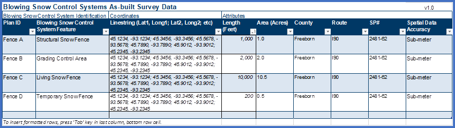
Example
Blowing Snow Control Systems As-built Survey Data template filled out (lat/long for illustrative purposes only)