Geographic Information Systems (GIS)
Historic Hydrographic Model
A Geographic Information System (GIS) incorporates the essential elements of computer cartography and relational databases into one system. This linkage between maps and tabular data makes analysis of geographic data possible. GIS has many applications in archaeology, including mapping the locations of sites, mapping features and artifacts within sites, and developing models to predict possible site locations. Very little archaeological predictive modeling was done prior to the development of Geographic Information Systems because such modeling is computationally intensive and impractical for large areas.
GIS Modeling
MnModel is a GIS-based predictive model. Environmental variables are derived (e.g. modeled or mapped) through the interpretation of basic datasets such as elevation and hydrography. Variables represent attributes of these data, such as slope or distance to lakes, that would have been important to hunter-gatherers. Once all of the environmental variables have been derived, their values are sampled at locations where archaeological resources are known to be present as well as where they are known to be absent. The environmental variable values at these locations are submitted to a statistical analysis program (S-Plus in Phase 3, R in Phase 4) for a multi-variate analysis. The results of this analysis may be an equation or a set of rules. The GIS applies these results to the geographic data to create the final model (map) of archaeological site potential.
Phases 1-3
In the initial phases of MnModel, only geographic data already in a digital format were used. Both vector and raster data were acquired and converted to a standard 30-meter raster cell size, corresponding to the USGS 30-meter (1:24,000 scale) Digital Elevation Model (DEM) for Minnesota. The most important environmental data for modeling (elevation and hydrography) had a source scale of 1:24,000. Other data, however, were available only at source scales ranging from 1:100,000 to 1:500,000. Some data for small areas were digitized from paper maps and their utility for modeling was evaluated. Since the cost and time involved in converting any of these maps to a statewide GIS layer was prohibitive, they were not used to develop the final models. Archaeological site locations were converted to points based on UTM coordinates in database files. After experimentation with a set of surveyed locations, random points were used to represent non-site locations.
Variables and models were implemented using Arc/Info GRID (v. 7.03) on UNIX workstations, with the exception of a few procedures that were run in ArcView 3.0 Spatial Analyst. External hard drives were added to the system to provide enough space to model multiple regions simultaneously (approximately 32-52 GB available at any given time).
GIS standards and modeling procedures used in Phases 1-3 of MnModel are described in Chapter 4 and Appendix B of the MnModel Final Report.
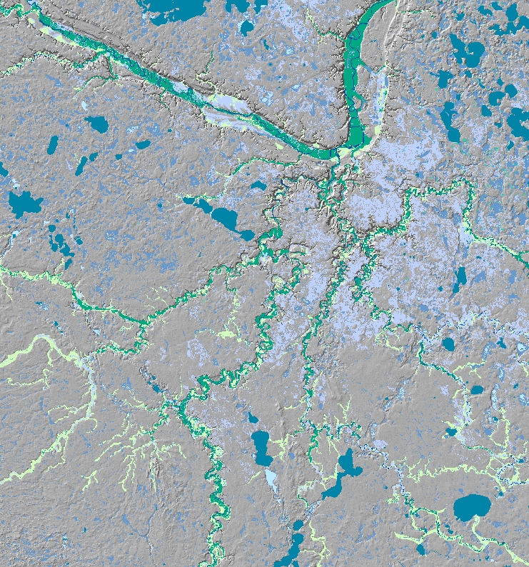
Phase 4
Phase 4 of MnModel was developed using ArcGIS and ArcGIS Spatial Analyst on desktop computers. Procedures were automated in ArcGIS ModelBuilder and in Python. R was used for statistical analysis. Phase 4 benefited from a larger set of 1:24,000 scale data than were available previously. These include SSURGO soil survey data from NRCS and geomorphology data developed for MnModel. In addition, GIS modeling was used to model historic and prehistoric surface water features and historic vegetation. All ArcGIS tools used for Phase 4 are available upon request.