MnModel Statewide
MnModel is the first archaeological predictive model to be developed and implemented for an entire state. Minnesota's statewide archaeological predictive model is actually a composite of 20 regional models
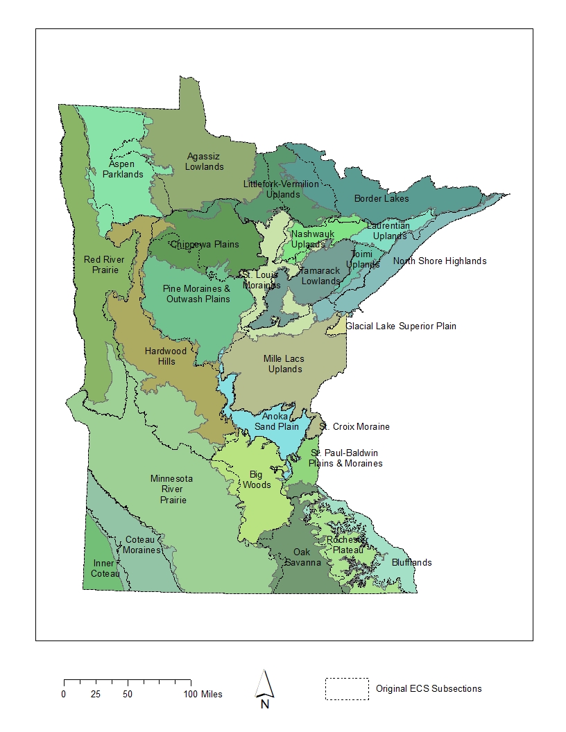
Regionalization
Minnesota is climatically, geomorphologically, and ecologically diverse. Hunter/gather economy, transportation modes, seasonal activities, and preferred village or camp site attributes most likely varied across the state. To capture this diversity, MnModel was developed as a set of regional models. Phase 1 and Phase 2 models were regionalized by Archaeological Resource Regions. Because this system in part relied on political, rather than natural, boundaries models did not match well at their edges. The Phase 3 and 4 models were regionalized using the Ecological Classification System (ECS) subsections or groups of subsections. Each region has a separate and distinct model. A discussion of these different regionalization schemes is found in Chapter 4 of the MnModel Final Report (2002).
Phase 3 models were based on analysis of a set of 44 environmental variables. The variable set was the same for each region, although the statistical analysis ultimately selected different combinations of variables for each region's model. Phase 3 models were created using stepwise multiple logistic regression. When the composite statewide Phase 3 model was evaluated, 86 percent of all modeled sites in the state, excluding single artifacts, occurred in high and medium site potential zones that constituted only 23 percent of the state's area.
Phase 4 regions were also based on ECS subsections, though the boundaries of these subsections had been revised since Phase 3. A suite of 59 environmental variables were used to develop the Phase 4 models. Unlike Phase 3, which relied on modern environmental data, Phase 4 derived environmental variables from models of historic and prehistoric terrain, landforms, surface waters, and vegetation. The statistical method used was Random Forest. The composite statewide Phase 4 model captures 95 percent of all modeled sites in the high site potential zone while classifying only 13 percent of the state as high site potential.