MnModel History
Project Background
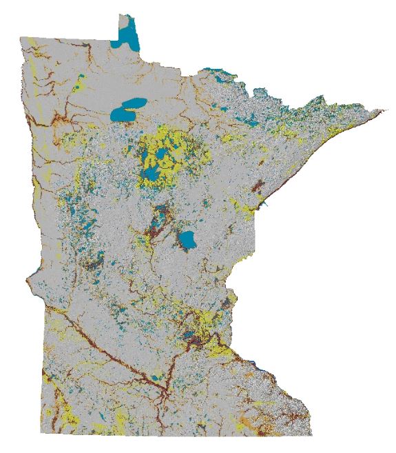
Phase 4 Survey Implementation Model
MnModel development began in 1995 as part of a major environmental streamlining project. The $4.5 million project was funded by the Federal Highway Administration (FHWA). The goal of the project was to use Geographic Information Systems (GIS) and statistical analysis to produce archaeological predictive models that could be replicated by anyone using the same data and following the same procedures. The aim was that these models be accurate enough to predict 85 percent of known archaeological sites without designating more than 33 percent of the state's area as high and medium site probability. The Phase 2 models, completed in 1997, achieved this goal. The Phase 3 models exceeded it.
MnModel Phase 3 was developed by spatial modeling and stepwise logistic regression using GIS, statistical software, and a variety of geographic data. Environmental variables were analyzed to find the most effective combination and weight of predictors for archaeological sites in each of 20 modeling regions in the state. In the survey implementation model, which is displayed as a map, each 30-meter cell is classified for its potential to contain an archeological site and the probability that places like it have been adequately surveyed. Areas with low site potential that have not been adequately surveyed, and therefore lack sufficient archaeological data to model accurately, are classified as "unknown." The Phase 3 models were released in 1998 and were used for 20 years. Over that time period, the archaeological database grew, more high quality, high resolution GIS data became available, and PC-based computing and GIS and statistical software improved. All of these made it possible to conceive of improving the predictive models.
Work on Phase 4 of MnModel began in 2000 with the mapping of additional high resolution geomorphic data. In 2007, we reviewed and improved our statistical procedures. Techniques for modeling historic and prehistoric surface water features were developed in 2008. FHWA funding, obtained in 2012, allowed for the digitization of archaeological site and survey polygons, creating and conditioning the digital terrain model, development of statewide models of landforms and historic vegetation, updating the historic/prehistoric hydrographic model, and updating statistical procedures. Phase 4 models were completed in February 2019.
Statewide, the Phase 4 model’s high probability zones occupy only 13 percent of the state’s area. At the same time, they predict 95 percent of Minnesota’s known archaeological sites, indicating that MnModel performs about 86 percent better than by chance alone.
Since late 1997, MnModel results have helped MnDOT determine where surveys are needed or not needed. They have also been used to suggest project alignments or modifications that reduce the potential for impacts on cultural resources. These applications of MnModel have expedited project clearance, reduced costs, and done a better job of protecting cultural resources. MnModel Phase 4 data and results are now available to other agencies. Archaeological data developed for MnModel, including the predictive models, are shared via the Office of the State Archaeologist (OSA) Portal. Environmental data are made available via the Minnesota Geospatial Commons.