Bicycling in Minnesota | Routes and Maps | U.S. Bicycle Route 20 | About U.S. Bicycle Route 20
About U.S. Bicycle Route 20
U.S. Bicycle Route 20 connects Moorhead and North Dakota to Hastings and the Wisconsin border.
Location and length
USBR 20 travels west to east across the state. The route is 188 miles from Moorhead and the North Dakota border to the junction of USBR 45/Mississippi River Trail in St. Cloud, where it then follows the same route another 124 miles to Hastings. Two-thirds of the route uses state, regional and local trails. The remaining parts are on the shoulders of paved roads or on lanes shared with motor vehicles.
Bicyclist and route profile
Two-thirds of USBR 20 is on regional and state bicycle trails. These portions of the route are safe for all skill levels. Bicyclists riding the entire route must have prior experience and be willing to share the road with cars and trucks.
People planning to ride the route should review conditions ahead of time. Most roads on the route do not have bicycle infrastructure. Travelers must assume responsibility for their own safety and practice defensive cycling. For young or less-experienced riders, there are many miles of trail included in the route.
Between Twin Cities and St. Cloud
From Champlin, the route mostly follows higher-speed county roads with paved shoulders until St. Cloud. Posted road speeds range from 30 mph within cities to 55 mph between cities.
St. Cloud and Waite Park
USBR 20 in St. Cloud and Waite Park uses low speed, low volume roads and paved trails to cross the cities to the start of the Lake Wobegon regional trail.
Between Waite Park and Fergus Falls
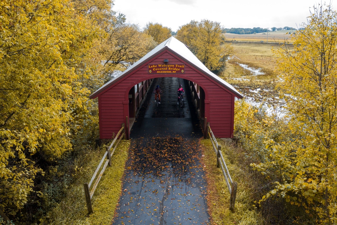
The route follows the 65-mile Lake Wobegon Regional Trail from Waite Park to Osakis. The trail is fully paved and 10 feet wide, with infrequent and marked roadway crossings. In Osakis it transitions into the Central Lakes State Trail, a 14-foot wide, 55-mile long, paved trail. Both trails pass through communities with various amenities. Services along the route include shelters, bathrooms, picnic tables, benches, parking areas, connecting community trails, and nearby lodging.
Both trails are used for snowmobiling in the winter months. Conditions are generally not suitable for bicycling from Dec. 1 to April 1.
Between Fergus Falls and Moorhead
Most of the route between Fergus Falls and Moorhead uses state highways and county roads. From Fergus Falls the route follows County Road 1 and County Road 3 through Maplewood State Park. Here, roadway shoulders are generally under 4 feet or not present. The Heart of the Lakes Trail connects the park to Pelican Rapids. North of Pelican Rapids the route returns to the roadway. Highway 108, County Road 30, and County Road 32 have limited to no shoulders.
Shoulders are generally 4 feet wide or greater on County Road 52 from Barnesville to Moorhead. Shoulders may narrow at guardrails, bridges, rumble strips and right turn lanes. The final miles of the trail through Moorhead are mostly on trails, with some short on-road segments.
Posted road speeds range from 30 mph within cities to 55 mph between cities. Daily motor vehicle traffic ranges from under 150 to 4,600 vehicles per day on shared roadway segments. The highest volumes exist south of Moorhead on County Road 52 and on County Road 1 north of Fergus Falls.
See the MnDOT Traffic Mapping Application for traffic volumes.
Safety
On-road segments
Bicyclists should be experienced with riding on roadways share lanes with cars and trucks. Travelers should use defensive bicycling and must follow the rules of the road.
There are many miles of trail included in the route for young or less-experienced riders. This includes 120 continuous miles from Waite Park to Fergus Falls. USBR 20 panel maps show where shoulders are narrower than 4 feet and where trail exists.
Rules of the road
When traveling on roads, bicycles are a vehicle. Bicyclists are encouraged to "drive" appropriately:
- Ride safely and abide by the rules of the road.
- Ride single file with traffic.
- Follow best practices and position yourself appropriately based on the road speed, volume and shoulder/lane conditions.
- Use hand signals to indicate turns and movements.
- Stop at stop signs and signals.
- Be considerate about when and where your bike is parked and locked.
Off-road segments
Parts of the route on paved trails suit bicyclists of all abilities and experience levels. Interactions with car and truck traffic occurs at intersections and trail crossings. Share paved trail spaces with other bicyclists, pedestrians, and families with small children. Make sure to alert them of your presence. In winter months, some trails are snowmobile trails. Snowmobiles have the right of way on trails at these times.
Grades and accessibility
USBR 20 has few hills, especially along the Lake Wobegon and Central Lakes trails. These trails meet Americans with Disabilities Act grades whenever possible. Some trails exist on abandoned railroad grades and have a peak slope of 4 percent. Trails were constructed with accessibility considerations important to many users. Steeper slopes may exist on parts of trails away from the railroad grade and at road crossings. The USBR 20 panel maps include elevation profiles.
Destinations, accommodations, and points of interest
Some of the points of interest along the route include:
- Twin Cities: Mississippi National River & Recreation Area
- St. Cloud: Mississippi River, Munsinger Clemens Gardens, Stearns History Museum
- Alexandria: Runestone Museum
- Fergus Falls: Prairie Wetlands Learning Center, Otter Tail River, Pebble Lake
- Maplewood State Park
- Moorhead/Fargo: Hjemkomst Center Viking Ship, Red River of the North, Moorhead Center for the Arts
- Dozens of lakes for fishing, swimming and boating
Private and public camping sites are available. Hotels can also be found in many of the towns located on the route. Communities are spaced about every 20 miles in the northern section and every 7-10 miles in the southern section.