Bicycling in Minnesota | Routes and Maps | U.S. Bicycle Route 41 | Route maps
U.S. Bicycle Route 41 maps
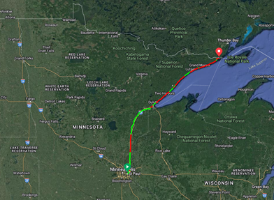
Maps and route guidance
View USBR 41 printable maps and turn-by-turn instructions (PDFs). Options are:
- A one-page overview map (not suitable for navigation) (PDF)
- Panel maps (route maps that include map segments and inset maps with large-scale detail, simple turn-by-turn instructions, and elevation profiles; suitable for navigation).
- Detailed turn-by-turn instructions (suitable for navigation).
- Northbound turn-by-turn instructions (Saint Paul to Grand Portage) (PDF)
- Southbound turn-by-turn instructions (Grand Portage to Saint Paul) (PDF)
- Use these in combination with the one-page overview map to supplement the simple panel map turn-by-turn instructions and to supplement the digital maps.
- Digital maps
- View the web-based Minnesota Bikeways Map
- View USBR 41 on a digital map or download to your mobile device (links to external Adventure Cycling site)
- Or, download a KMZ file to upload to Google Earth
Note:
Service information on the maps, such as restrooms, campgrounds, bike shops, etc. may be limited to available state-managed data sets. Riders are encouraged to use supplementary tools such as Google Maps or other sites listed above to identify additional services available.
Alternative Format
To request a MnDOT document in an alternative format, email adarequest.dot@state.mn.us.