Stewart River Bridge history
Stewart River Bridge history
In 1921, Minnesota inaugurated a state trunk highway system that was intended to connect all county seats with a state-owned network of well-engineered and well-maintained arterial roads. One of the longest routes, and the most heavily traveled during the system's first decade, was Trunk Highway 1 (later re-designated as Trunk Highway 61). Stretching from Iowa to Canada, by way of Albert Lea, Minneapolis, Duluth, Two Harbors and Grand Portage, Trunk Highway 1 was a crucial conduit for the state's economic life, equally serving southern Minnesota farmers, Twin Cities manufacturers and Lake Superior resort owners.
By 1931, Trunk Highway 1 boasted 300 miles of continuous pavement from Albert Lea to Two Harbors, providing the smoothest, longest ride in the state system. The vehicular route between Two Harbors and Schroeder followed an inland alignment that passed through Finland. From 1923 to 1925 though, the department constructed a new TH 1 alignment along the shore in order to provide a more scenic route, offering tourists with what one department engineer described as “a fine view of the lake, the rocky rugged shore line and the wooded hills of Encampment Forest.” The new alignment shortened travel times and made it easier for a traveler to access popular tourist destinations, such as the Split Rock Lighthouse and Palisade Head, which were previously only viewed from Lake Superior by steamboat. The trunk highway diverged from the previous road on the east side of the Stewart River (the former alignment is now CSAH 3), and the Stewart River crossing served as the gateway to the new, scenic alignment.
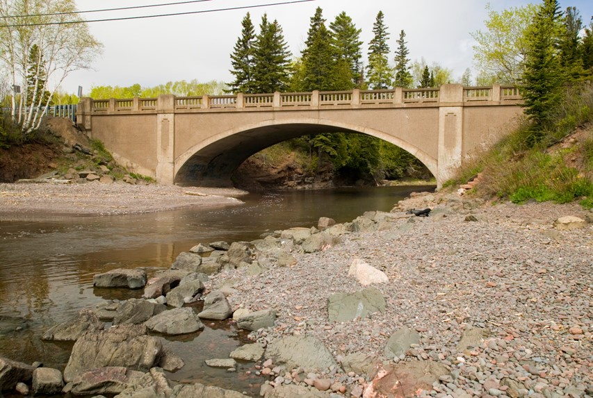
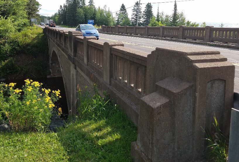
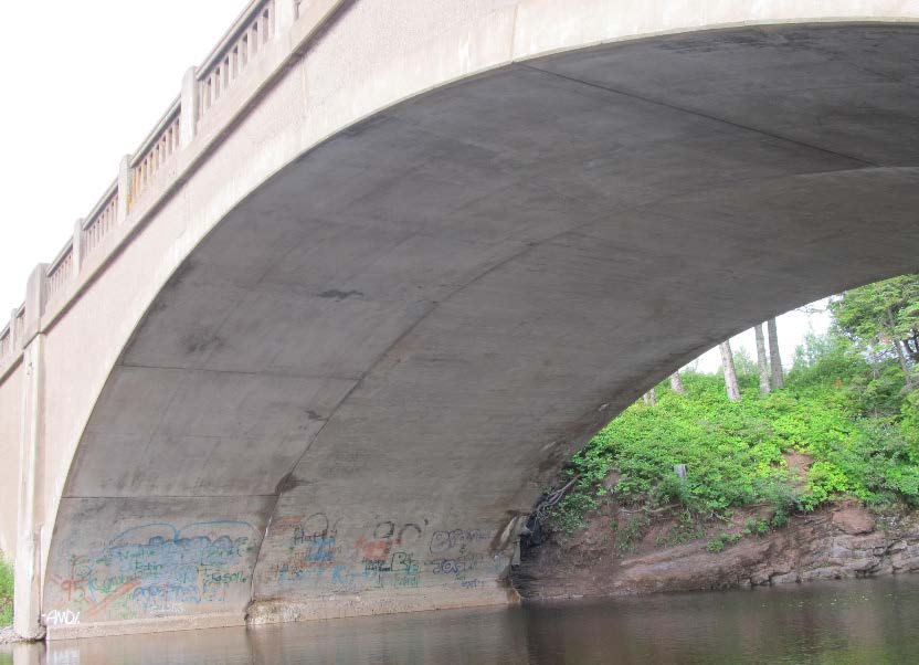
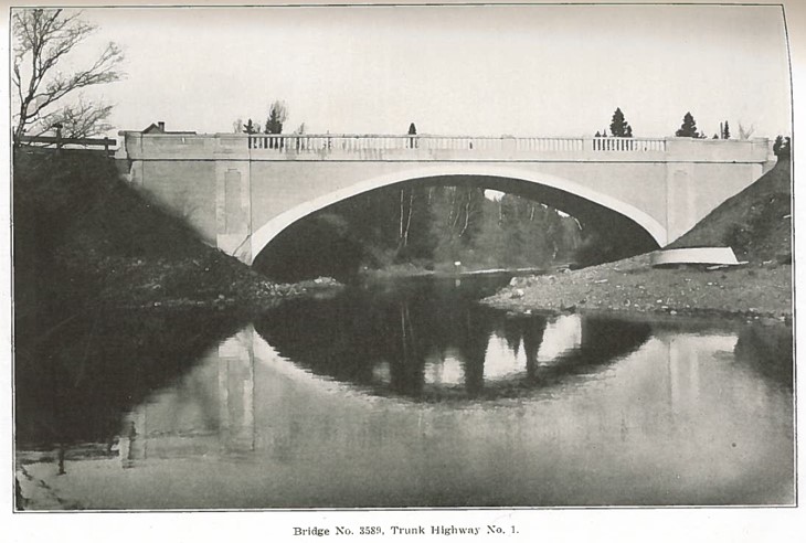
With its rock-rimmed river gorges, the area was one of the few regions in the state that favored concrete-arch bridges, which reduced substructure costs by springing directly from exposed bedrock. In 1924, the state highway department prepared a concrete-arch design, with a 70-foot span and a 19-foot roadway, to replace an older crossing of the Stewart River in a rural area just north of Two Harbors. On a bid of $9,285, Adams Construction Company of Minneapolis secured the contract for the project, and a photograph of the new crossing appeared in the state highway department's biennial report for 1923-24. The agency's pride in Bridge No. 3589 was understandable, as its sedate Classical Revival design was the most aesthetically accomplished statement yet produced by the state trunk highway program.
Bridge 3589 was listed in the National Register in 1998 under Criterion C for its architectural design, within the historic context of "Reinforced-Concrete Highway Bridges in Minnesota, 1900-1945."
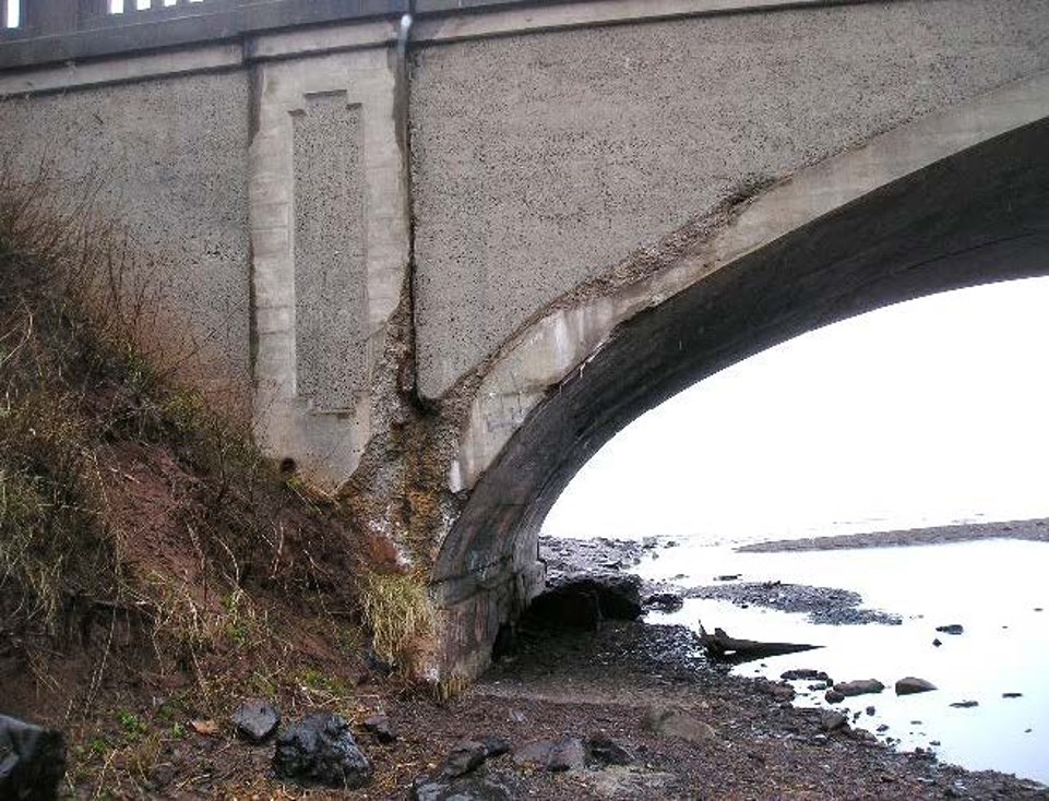
Character-defining features are prominent or distinctive aspects, qualities, or characteristics of a historic property that contribute significantly to its physical character. For Stewart River Bridge, the design and construction of adjacent reinforced-concrete arches are character-defining features. This superstructure includes the original 1924 west arch as designed for Trunk Highway No. 1 and the 1939 east arch that was added during the 1939 widening project. Together they represent the increasing traffic on this important highway along the North Shore of Lake Superior.
Secondly, the Classical Revival architectural detailing shows its character-defining features as well. The bridge is significant for being the most aesthetically accomplished bridge yet built on the recently inaugurated (1921) state trunk highway system when completed in 1924. The detailing, which survives on the original 1924 west elevation, was replicated on the new east elevation in 1939, and includes pilasters, recessed panels and concrete surface treatments. The 1939 project included new concrete railings and endposts.
Silver Creek Bridge history
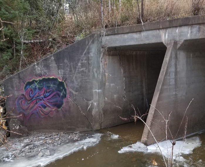
The Silver Creek Bridge consists of double barrel box culverts with a main span length of 12 feet and a total structure length of 26.5 feet. This structure was originally constructed in 1936 and remodeled in 1939. The existing box culverts convey Silver Creek under Highway 61 to Lake Superior.
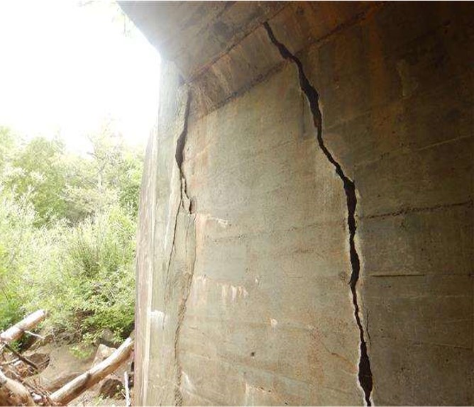
The bridge has a National Bridge Institute (NBI) culvert rating of 4 which corresponds to a descriptive condition as “poor.” MnDOT bridge inspection reports indicate the box culverts have various cracks, one of which is 1.5 inches wide, and is leaching heavily. The northwest wing of the culvert is heavily cracked, bowed and displaced, allowing water to flow behind the wall. Inspection history shows that the defects of the culvert have been worsening on an annual basis since 2014.