Bicycling in Minnesota | Routes and Maps | U.S. Bicycle Route 45 | Route maps
U.S. Bicycle Route 45 maps
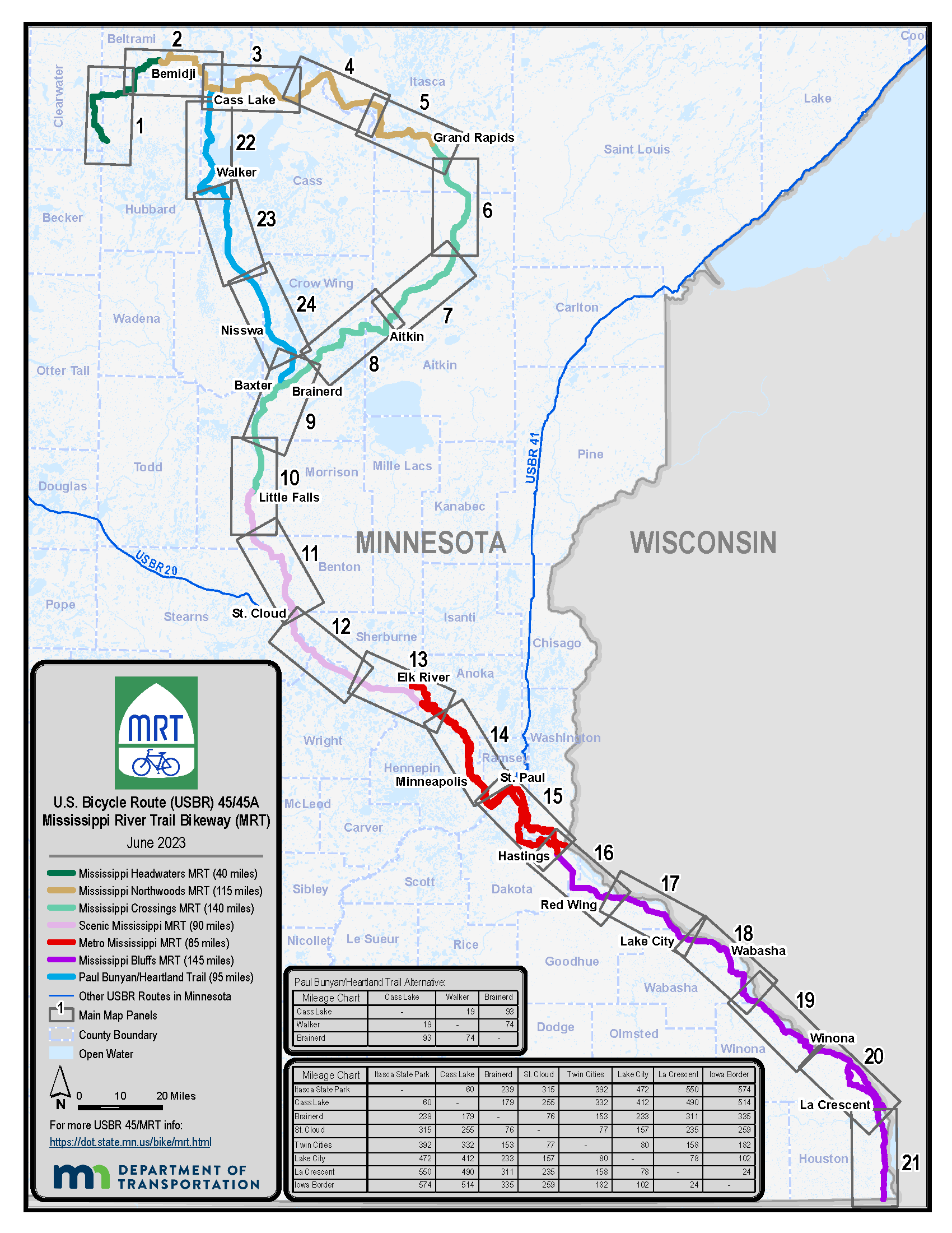
Maps and Route Guidance
View USBR 45/45A/MRT printable maps and turn-by-turn instructions (PDFs). Options are:
- A one-page overview map - not suitable for navigation (PDF)
- Panel maps (route maps that include map segments and inset maps with large-scale detail, simple turn-by-turn instructions, and elevation profiles; suitable for navigation).
- All Panel Maps - Printable on letter-size paper (30 pages at 8 ½ x 11”) [PDF]
- Panel maps may also be downloaded by segment if you wish to tackle just a part of the route:
- Detailed turn-by-turn instructions (suitable for navigation).
- Southbound turn-by-turn instructions (Itasca State Park to Iowa) [PDF]
- Northbound turn-by-turn instructions (Iowa to Itasca State Park) [PDF]
- Use these in combination with the one-page overview map to supplement the simple panel map turn-by-turn instructions and to supplement the digital maps.
- Digital maps
- View USBR 45/45A on a digital map or download to your mobile device (links to external Adventure Cycling site)
- Or, download a KMZ file to upload to Google Earth
Note
Service information on the maps, such as restrooms, campgrounds, bike shops, etc. may be limited to available state-managed data sets and have not been field verified. Riders are encouraged to use supplementary tools such as Google Maps or other sites listed above to identify additional services available.
Alternative Format
To request a MnDOT document in an alternative format contact MnDOT at 1-833-400-8432, relay assistance call 711, or email adarequest.dot@state.mn.us.