
Road diet case study
Highway 29 in Parkers Prairie
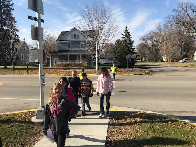
Parkers Prairie is a city of just under 1,000 residents in west-central Minnesota in Otter Tail County. The city’s economy includes agricultural, manufacturing, and service employers. Elementary, secondary, and high schools are located within the city limits and many children walk to school. Traffic volume on State Trunk Highway 29 through Parkers Prairie ranges from 3,500 to 5,000 vehicles per day. Traffic volume is higher in the summer.
Reconstruction of Highway 29/Otter Avenue in Parkers Prairie
 In 2014, the city began a visioning process for the reconstruction of State Trunk Highway 29 – called Otter Avenue within city limits – which runs north-south through Parkers Prairie. While MnDOT’s initial plans called for a mill and overlay, community planning work set the stage for a full reconstruction that was completed in 2016. Today, State Trunk Highway 29 in Parkers Prairie is safer, more beautiful, and has improved storm water management.
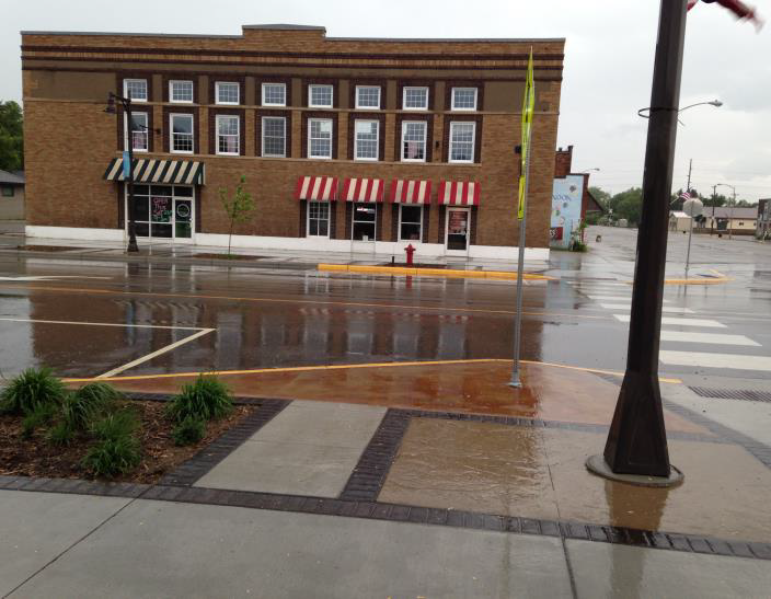
The new design includes narrower travel lanes, a new center turn lane, and pedestrian bump-outs at major intersections. Sidewalks were widened and curb ramps compliant with the American’s with Disabilities Act were installed.
 A landscape architect from MnDOT used the architecture of a brick building downtown for inspiration in the design of the sidewalks and planting areas. New energy-efficient and decorative lighting was also added.
Water, storm water, and sanitary sewer infrastructure were replaced in conjunction with the road project.
The city clerk, a master gardener, worked with MnDOT’s landscape architect on selection and design for the plantings, with the cost reimbursed through MnDOT’s Community Roadside Landscape Partnership Program.
The plantings were installed by youth crews from Conservation Corps of Minnesota and Iowa, with the funding from a grant through MPCA’s Partnership for Community Resilience.
The city, the school district, and MnDOT worked together to install a rapid flashing beacon in front of the high school.
Before Road Conversion (2015)
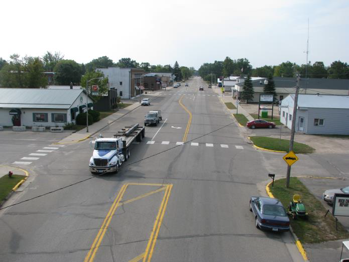
- Left turn lanes at some intersections: 12 feet wide
- Two travel lanes: each 12 feet wide
- Two shoulder area/parking lanes: each 18 feet
- Sidewalks: intermittent, most 5 feet wide
After Road Conversion (2016)
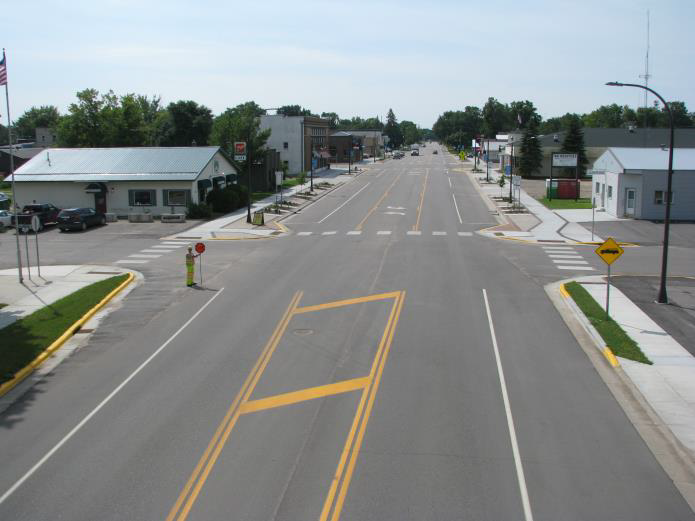
- Two-way left turn lane: 14 feet wide
- Two travel lanes: each 12-feet wide
- Two parking lanes: each 10-11 feet
- Sidewalks both sides: Typically 5 feet wide, but with sections as wide as 18-26 feet
Minimum roadway dimensions for State Trunk Highway 29, which is a minor arterial with slow speeds and low traffic volume, would have allowed a narrower roadway – travel lanes as narrow at 10 feet and a parking lane of 7-10 feet. Narrower lanes and narrower street width are known to be associated with fewer crashes. (See MnDOT Technical Memorandum No. 17-12-TS-05 and No. 18-09-TS-06. Technical Memos are an addendum to MnDOT’s Road Design Manual.)
Significant bicycle, pedestrian, and livability improvements on a MnDOT roadway are much more affordable to a local community as part of a planned roadway reconstruction. Options and funding are more limited for a mill and overlay.
Crash information
MnDOT data shows fewer crashes in the three years after the conversion was implemented.
Other improvements
The city received federal transportation funding to install a trail to Lake Adley Park along State Trunk Highway 29. Safe Routes to Schools funding will be used to install new sidewalks in 2019. Planning has begun for a redesign of Soo Street which is a corridor perpendicular to Highway 29 in Parkers Prairie.