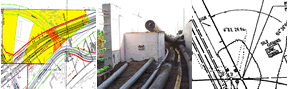
Right of Way mapping
Highway right of way maps
Access
There are three ways to access MnDOT right of way maps:
- Right of Way Mapping and Monitoring - Locate maps using a spatial interface
- eDOCS – Search for maps in MnDOT’s eDOCS Public Web
- Right of Way map assistance request form - Request assistance with maps or map applications
Maps
Historical railroad maps
U.S. Public Land Survey
Original plats, field notes, and other records (GLO records)
- View and download BLM records (BLM website)
- View and download MnGEO records (MnGEO website)
Original PLS special instructions (GLO instructions)
- LRRB research project - technical summary (LRRB website)
- LRRB research project - final report (LRRB website)
Original PLS contracts (GLO contracts)
- CTS GLO research project - final report (CTS website)
Reconciling PLS records in Minnesota
- CTS research project - final report (CTS website)
MnDOT PLS related records
Publications
- Cadastral standards (FGDC Cadastral Subcommittee website)
- Metadata standards (MnGEO website)
- Spatial accuracy standard (PDF - MetroGIS website)
- BLM manuals (BLM website)
- Cadastral Data and Right of Way Sharing study