E-ZPass Express Lanes
I-394 Wayzata to Minneapolis
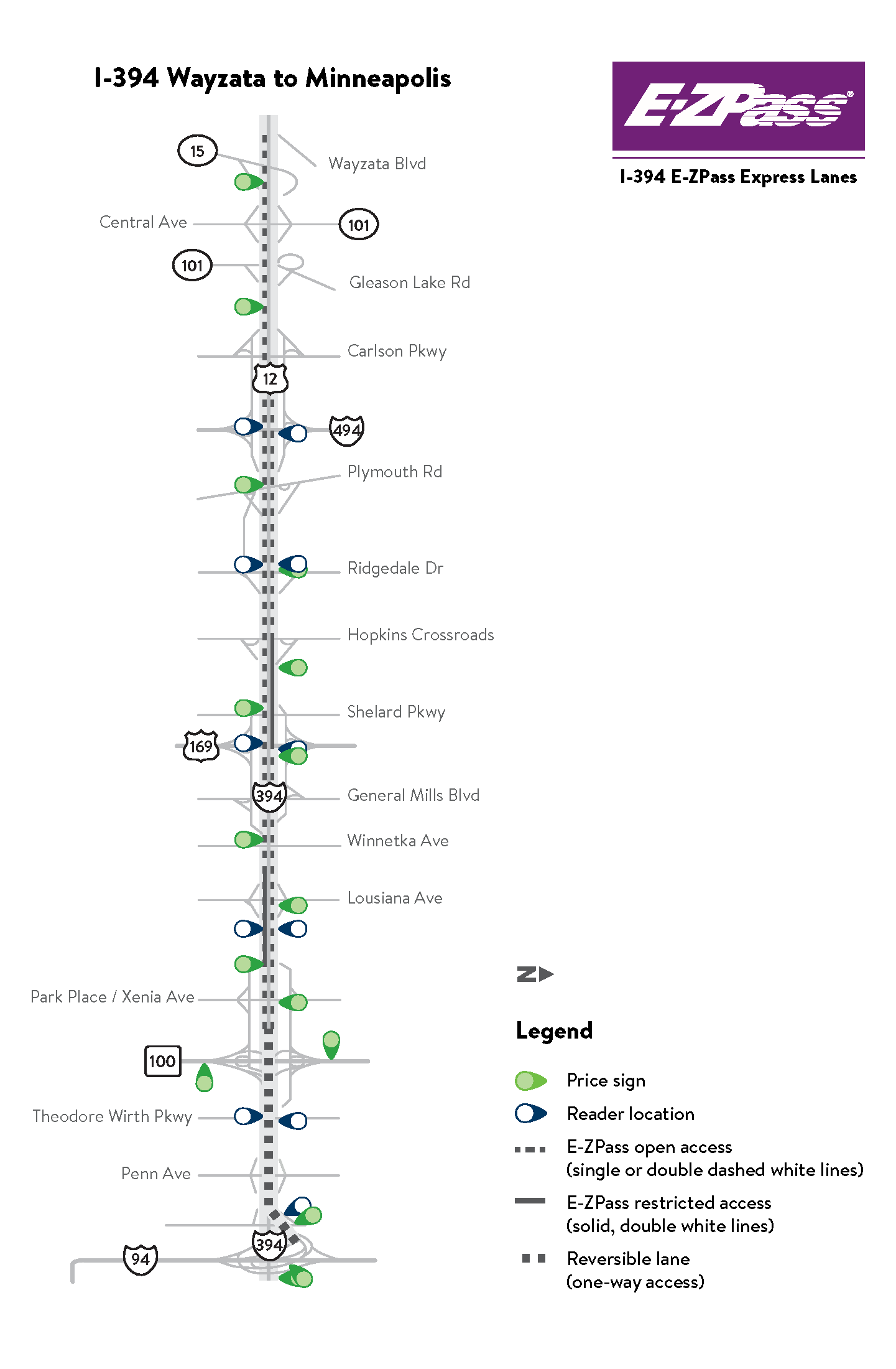
Facts
- Opened in May 2005
- The project was the first of its kind in Minnesota and was a new and significant change in highway traffic management
- Converted High Occupancy Vehicle (HOV) lanes to High Occupancy Toll (HOT) lanes. The goal was to maximize capacity on I-394 and to make better use of an existing HOV lane.
- 11 miles between Wayzata and Minneapolis
Hours of operation
Direction |
Location | Morning commute | Afternoon commute |
|---|---|---|---|
| Eastbound | Co Rd 101 to Hwy 100 | 6-10 a.m. | Open to all traffic |
Westbound |
Hwy 100 to I-494 | Open to all traffic | 3-7 p.m. |
Minnesota E-ZPass reversible lane hours*
Note: There is no E-ZPass option in either direction between Hwy 100 and I-94 February through November due to construction.
| Day | Location | Morning commute | Afternoon commute |
|---|---|---|---|
| Monday-Thursday | I-394 from Hwy 100 to I-94 | Eastbound 6 a.m. to 1 p.m. |
Westbound 2 p.m. to 5 a.m. |
| Friday | I-394 from Hwy 100 to I-94 | Eastbound 6-11:30 a.m. |
Westbound 12:30 p.m. to 10 a.m. |
| Saturday | I-394 from Hwy 100 to I-94 | Eastbound 11 a.m. to 6:30 p.m. |
Westbound 7:30 p.m. to 9 a.m. |
| Sunday | I-394 from Hwy 100 to I-94 | Eastbound 10 a.m. to 1:30 p.m. |
Westbound 2:30 p.m. to 5 a.m. |
*Friday through Sunday reversible lane hours may vary. All hours of operation are subject to change due to maintenance and other activities. The I-394 reversible lanes are tolled any time the lanes are open. The reversible lanes are closed to all traffic during the transition from one direction to the other.
I-35W Burnsville to Minneapolis
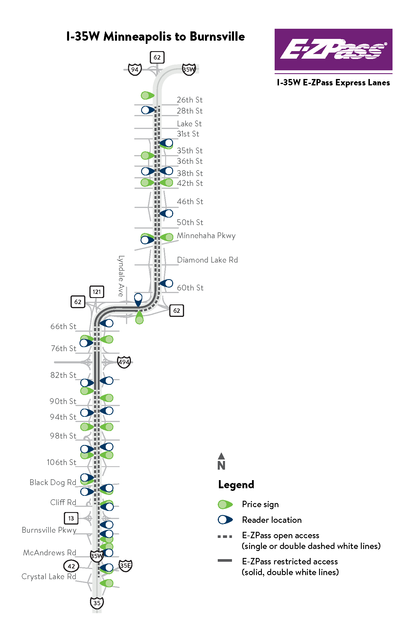
Facts
- Opened in three phases between 2009 and 2011
- In 2021, southbound lane extended between 46th St. and 26th St.
- 16 miles between Burnsville and Minneapolis
- In Minneapolis, E-ZPass hours are in affect during both morning and afternoon commutes for both directions; northbound from Hwy 62 to 26th St. and southbound 26th St. to I-494
Hours of operation
| Direction | Location | Morning commute | Afternoon commute |
|---|---|---|---|
| Northbound | Crystal Lake Rd to Hwy 62 | 6-10 a.m. | Open to all traffic |
| Northbound | Hwy 62 to 26th St. | 6-10 a.m. | 3-7 p.m. |
| Southbound | 26th St. to I-494 | 6-10 a.m. | 3-7 p.m. |
| Southbound | I-494 to Hwy 13 | Open to all traffic | 3-7 p.m. |
I-35E St. Paul to White Bear Lake
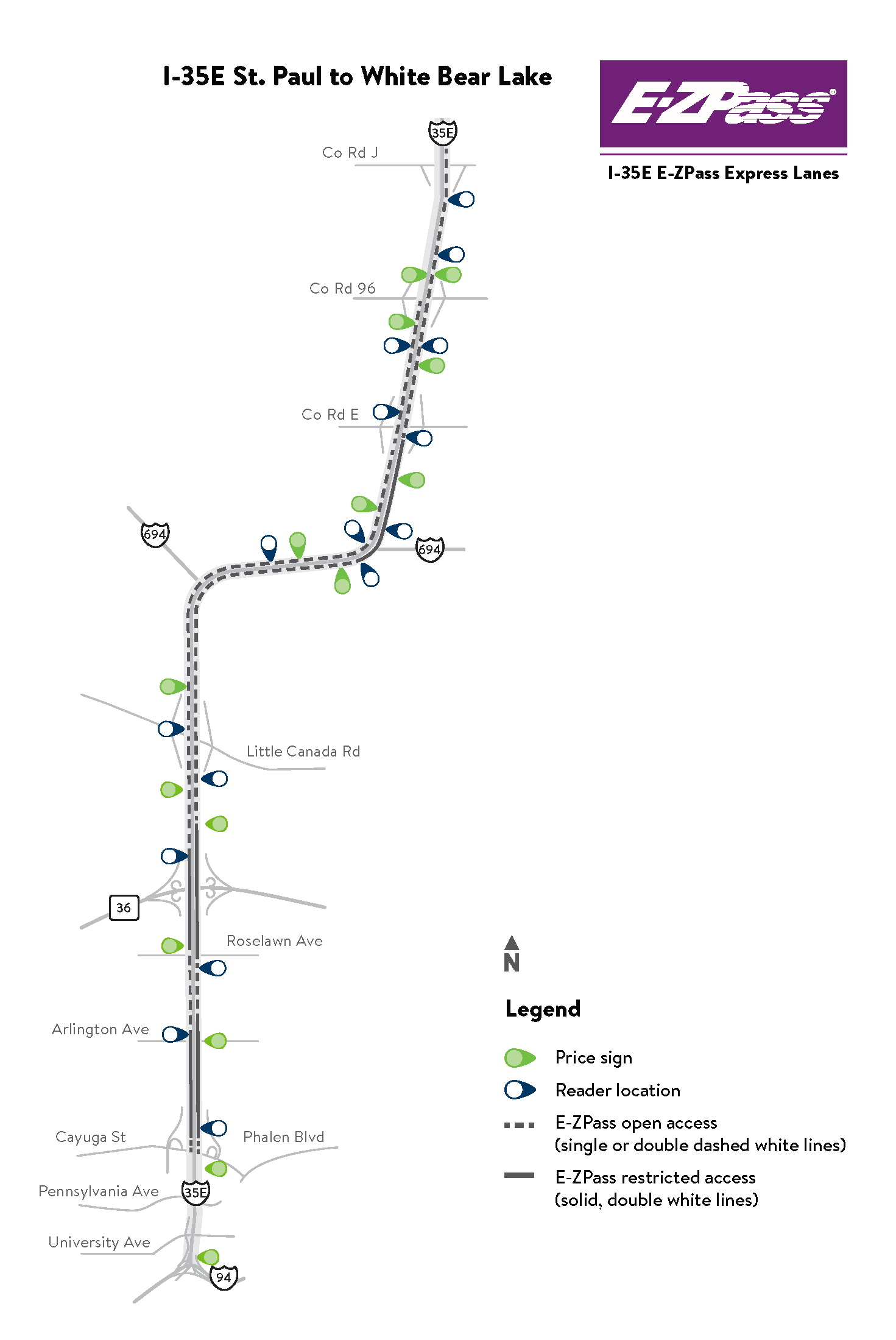
Facts
- Cayuga St. to Little Canada Rd. opened in December 2015
- First E-ZPass lane in the east Metro
- Northbound lane from Co. Rd. E to Co Rd J opened December 2016
- Southbound lane from Co. Rd. 96 to Little Canada Rd opened December 2016
- Northbound lane from Little Canada Rd. to Co. Rd. E opened in 2021
- 9 miles between St. Paul and White Bear Lake
Hours of operation
| Direction | Location | Morning commute | Afternoon commute |
|---|---|---|---|
| Northbound | Cayuga St. to Co. Rd. J | Open to all traffic | 3-7 p.m. |
| Southbound | Co Rd 96 to Cayuga St. | 6-10 a.m. | Open to all traffic |
I-35W Roseville to Blaine
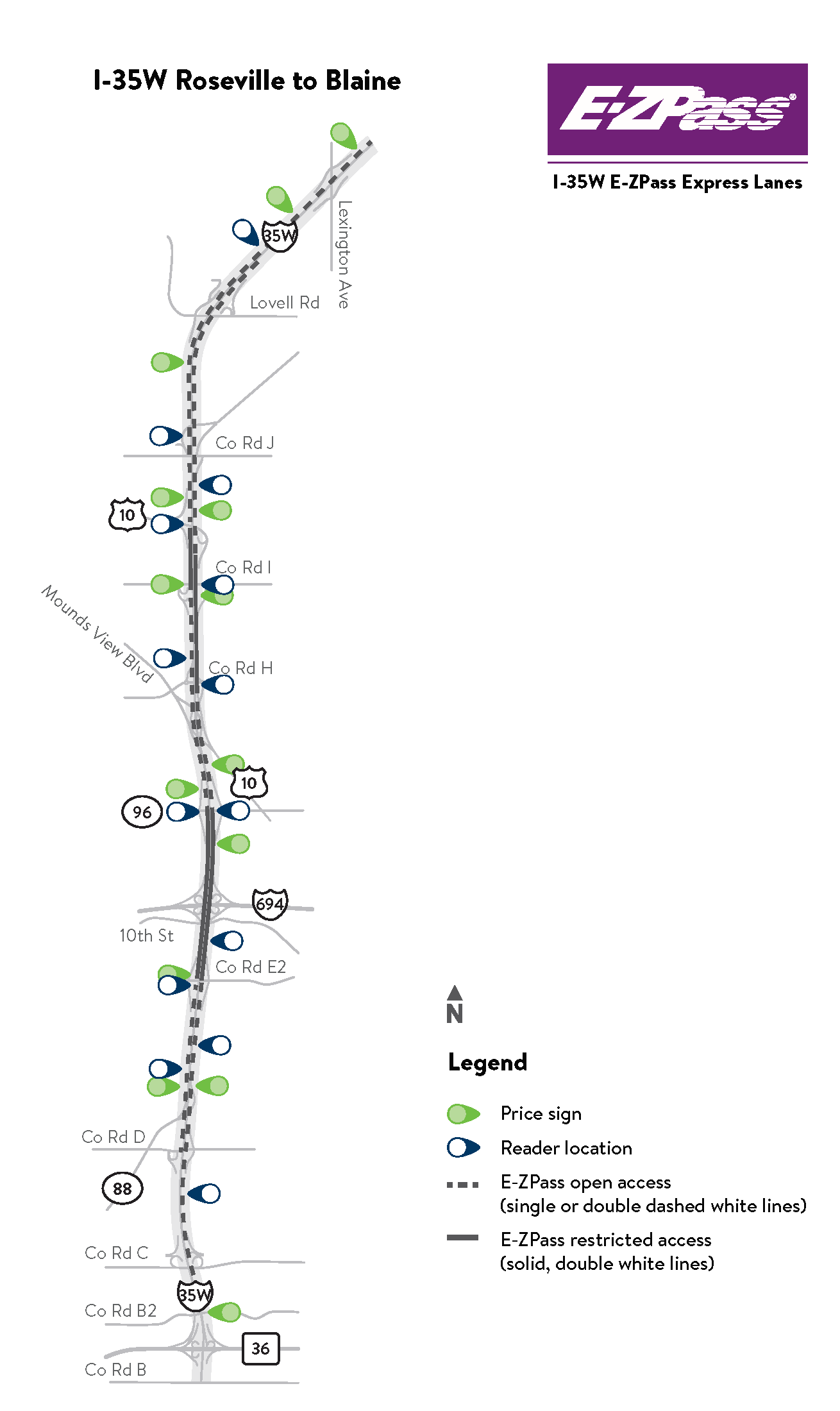
Facts
- Opened in August 2021
- 10 miles between Roseville and Blaine
Hours of operation
| Direction | Location | Morning commute | Afternoon commute |
|---|---|---|---|
| Northbound | Co. Rd. C to I-694 | Open to all traffic | 3-7 p.m. |
| Northbound | I-694 to 95th Ave. | Open to all traffic | 3-7 p.m. |
| Southbound | Lexington Ave. to I-694 | 6-10 a.m. | Open to all traffic |
| Southbound | I-694 to Co. Rd. D | 6-10 a.m. | Open to all traffic |