Complete Streets in Minnesota communities
Hwy 29/Otter Ave in Parkers Prairie
Background
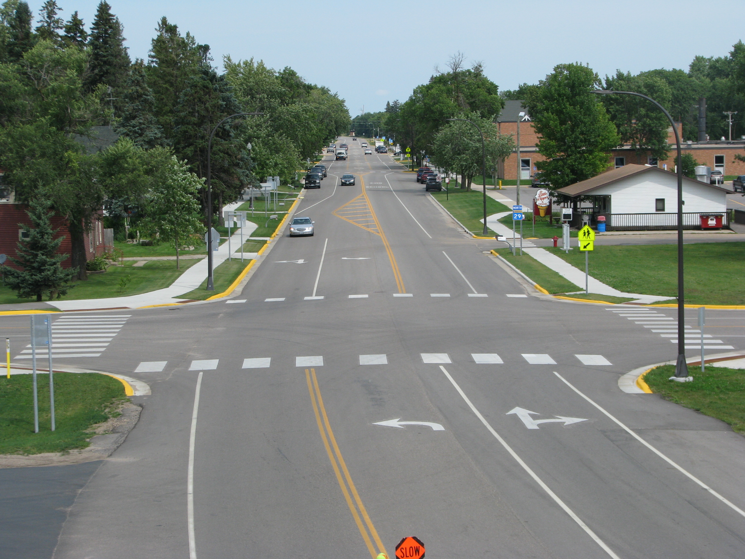
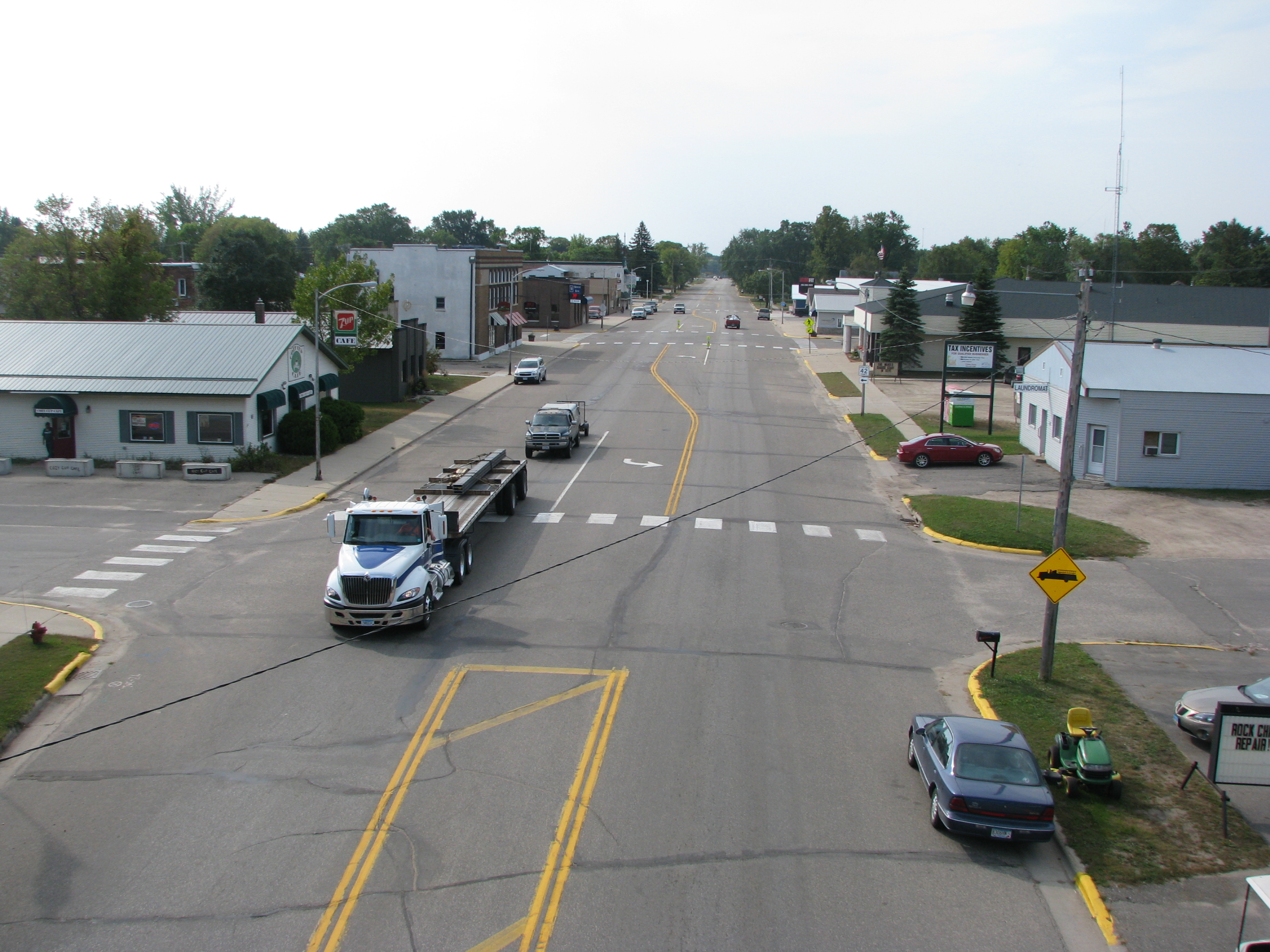
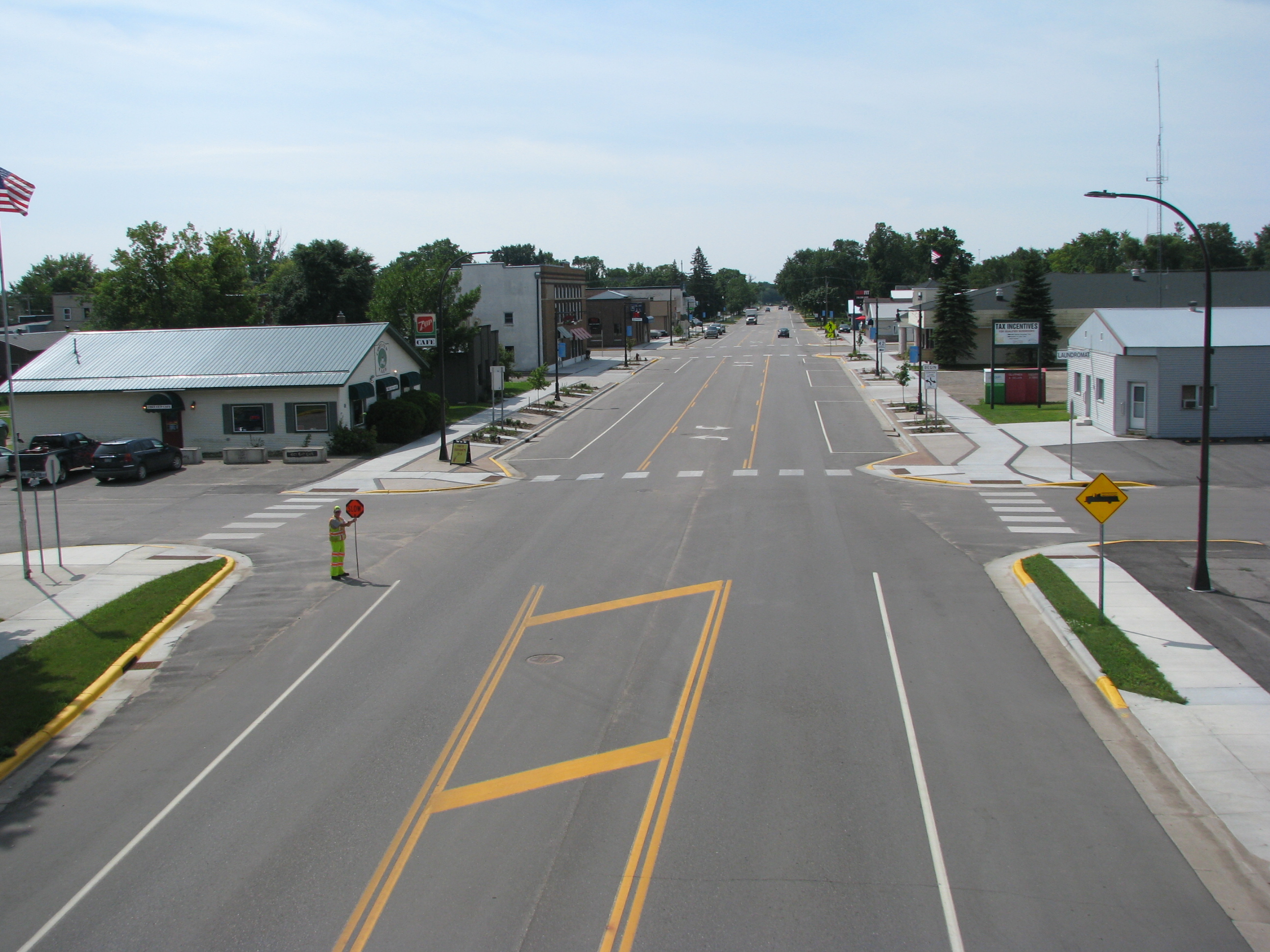
Highway 29, called Otter Avenue within city limits, runs north-south through downtown Parkers Prairie. While MnDOT’s initial plans called for a mill and overlay, community planning work set the stage for a full reconstruction that was completed in 2016. The goal of the Otter Avenue project was to connect desirable destinations within Parkers Prairie and integrate a safe, efficient, and enjoyable pedestrian and bicycle network with the community's roads and streets.
Additionally, the Otter Avenue section of Highway 29 is a frequently traveled route by children and families who walk to and from the community’s three schools. Ensuring safer roads around these schools was a high priority for the project.
The reconstruction project also provided a timely opportunity for the city to make water, storm water, and sanitary sewer system improvements.
Complete Streets elements
Lane adjustments
Narrower parking lanes help reduce the distance pedestrians have to walk across the street and allow additional space for biking and walking facilities. This was achieved while still allowing enough space for parking, freight mobility, and access to local goods and services.
Landscaping and lighting
New amenity zones that include pedestrian lighting, plantings, and benches serve as a buffer between pedestrian and vehicle traffic and provide an inviting street environment. Pedestrians and businesses thrive where sidewalks have been designed at an appropriate scale and street-level activity.
Curb extensions and improved crosswalks
Curb extensions—also called bulb outs or bump outs— extend a small section of sidewalk into the roadway at intersections or at midblock crossings. Curb extensions and high-visibility crosswalks increase road safety and pedestrian comfort by shortening the distance pedestrians have to cross and increasing visibility between drivers and people walking. By visually narrowing the roadway, curb extensions encourage drivers to slow down when approaching the intersection, which was especially important on this project to help children and families cross the street for school and access to businesses.
Rectangular Rapid Flashing Beacons
Rectangular Rapid Flashing Beacons (RRFBs) include flashing lights that can be activated manually by a pedestrian to increase driver awareness of the presence of pedestrians at crosswalks, uncontrolled intersections, or mid-block. This is especially important at night. RRFBs are a proven safety countermeasure by the Federal Highway Administration (FHWA), demonstrating a 47% reduction in vehicle-pedestrian crashes.
Before and after
Before
After
Complete Streets themes
Community
A key goal of the planning process was to make the corridor an enjoyable space to move through and be in. Special consideration was given to maintaining school vibrancy, improving public health, and increasing business activity. Aesthetic elements like pedestrian lighting, plantings, incorporation of a brick design in the sidewalks, and benches helped achieve this goal.
The city clerk, a master gardener, worked with MnDOT’s landscape architect on selection and design for the plantings, with the cost reimbursed through MnDOT’s Community Roadside Landscape Partnership Program. The plantings were installed by youth crews from Conservation Corps of Minnesota and Iowa, with the funding from a grant through MPCA’s Partnership for Community Resilience.
Safety
An RRFB was installed across from the high school, sidewalks were made ADA compliant, and school crossings were updated to support a nearby Safe Routes to School project.
Narrower lanes and narrower street width are associated with fewer crashes. MnDOT data shows fewer crashes in the three years after the conversion was implemented.
Freight
Highway 29 is often utilized by area farmers and freight drivers that may be navigating with wider loads. Concerns about turning radii and not impeding truck traffic access to the nearby grain elevator led to including a modified curb extension. Narrowing of lanes was implemented without impacting farming equipment, maintenance vehicle, and truck traffic access and mobility.
Collaboration
The city began a visioning process for reconstruction of Highway 29 in 2014 with support of Partnership 4 Health, which is the Statewide Health Improvement Partnership (SHIP) organization in the area. It is a collaboration of partners working to prevent chronic disease through sustainable changes in things like physical activity. High-level Complete Streets project concepts were created, which set the stage for continued community input and collaboration.
MnDOT worked with the Parker’s Prairie community to understand a diverse range of interests and build support. Staff had several meetings and discussions with the city council, farmers, businesses, public health partners, community developers, school district representatives, and other to fully understand needs and ensure the final project supported a safer and more beautiful downtown environment.