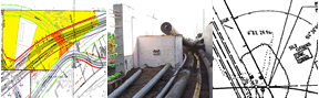
Historical railroad maps
The Office of Land Management has converted and indexed a sizeable collection of Minnesota’s railroad right of way maps. Increasing demand for these maps, difficulty in finding them, and their deteriorating physical condition prompted development of a digital spatial index. Geographic Information System (GIS) technology was incorporated to scan, convert, and geo-reference the paper maps into a digital format resulting in a GIS based index for easier searching.
The maps can be accessed using the MnDOT Right of Way Mapping & Monitoring (RWMM) website and can be downloaded at no charge.
Most of the maps available on this website were created under the conditions of the Valuation Act of 1914. The act had many requirements with maps comprising just one group of the valuation records. The maps were to be drawn according to detailed specifications. Three types of maps were created and maintained:
- Right of Way and Track Maps (example) (PDF) - access with RWMM
- Station Maps (example) (PDF) - access with RWMM
- Profile Maps (example) (PDF) - access by special arrangement
Alternative access to maps
The MnDOT eDOCS website provides an alternative source to view and download the Right of Way and Track Maps, and the Station Maps. The eDOCS site includes search tools enabling searches for maps by railroad name. Unique to this delivery site are maps from the 1936 Sectional County Map Series Collection (example) (PDF). The Sectional County Maps frequently reference railroads no longer in existence. Use the eDOCS Railroad Maps filter and click in the Document Type field to select Sectional County Maps. The Key Map of Sectional County Maps (PDF) is also available.
Railroad right of way plats
The railroad right of way plat is another type of map associated with railroad land acquisition. Several types and formats have been found.
- Single parcel railroad right of way plat maps (example) (PDF) – Copies of these maps once existed in the Minnesota State Land Office. Most maps represent a single parcel and are shown in proximity to a Public Land Survey (PLS) section. Drawings generally lack standardization. The range of their formats and quality is significant. Many indicate the railroad company name, show dimensions to PLS corners, include a certification, and often reference recording information. These maps can be accessed through the RWMM website in the Layer List as part of the ROW Layers. They are also available in original form at the Minnesota History Center.
- Composite railroad right of way plat maps (example) (PDF) – These typically show all the parcels for a given PLS section and include a table identifying: deed no., grantor, grantee, title, acres, date, when and where recorded, condition, etc. These copies were found in MnDOT records in April 2013. It is thought these records exist for much of the state, however their location is unknown. If you have any information regarding other copies of Railroad Right of Way Plats, please contact the MnDOT Office of Land Management.
- Statute based railroad right of way plat (example) (PDF) prepared using standards typical of a common subdivision plat.
Railroad right of way maps
MnDOT holds another large set of maps similar to the valuation maps. These maps are similar to the valuation maps except they do not include the individual parcel caption blocks. MnDOT received these maps in the early 1970’s directly from the railroad companies as part of a program to build a digital statewide transportation database. These maps are not in a digital format and have limited access.
Recent additions
In October 2019 the Hennepin County Surveyor’s Office provided MnDOT digital copies of over 400 railroad maps from their archives. The Office of Land Management is making plans to add these maps to the Right of Way Mapping & Monitoring (RWMM) application. Until this can be accomplished, see the index for a list of the maps received (Excel). The index includes the railroad name, PLSS reference, stationing, if the map appears in RWMM, and other references.
Statewide railroad maps
These maps were created by the Minnesota Railroad and Warehouse Commission and provide a comprehensive statewide reference for their time.
Other references
- Make Tracks to the Rail Maps (PDF) – 2002 presentation
- Finding Tracks, Maps, and Plats (PDF) – 2019 poster