Project complete
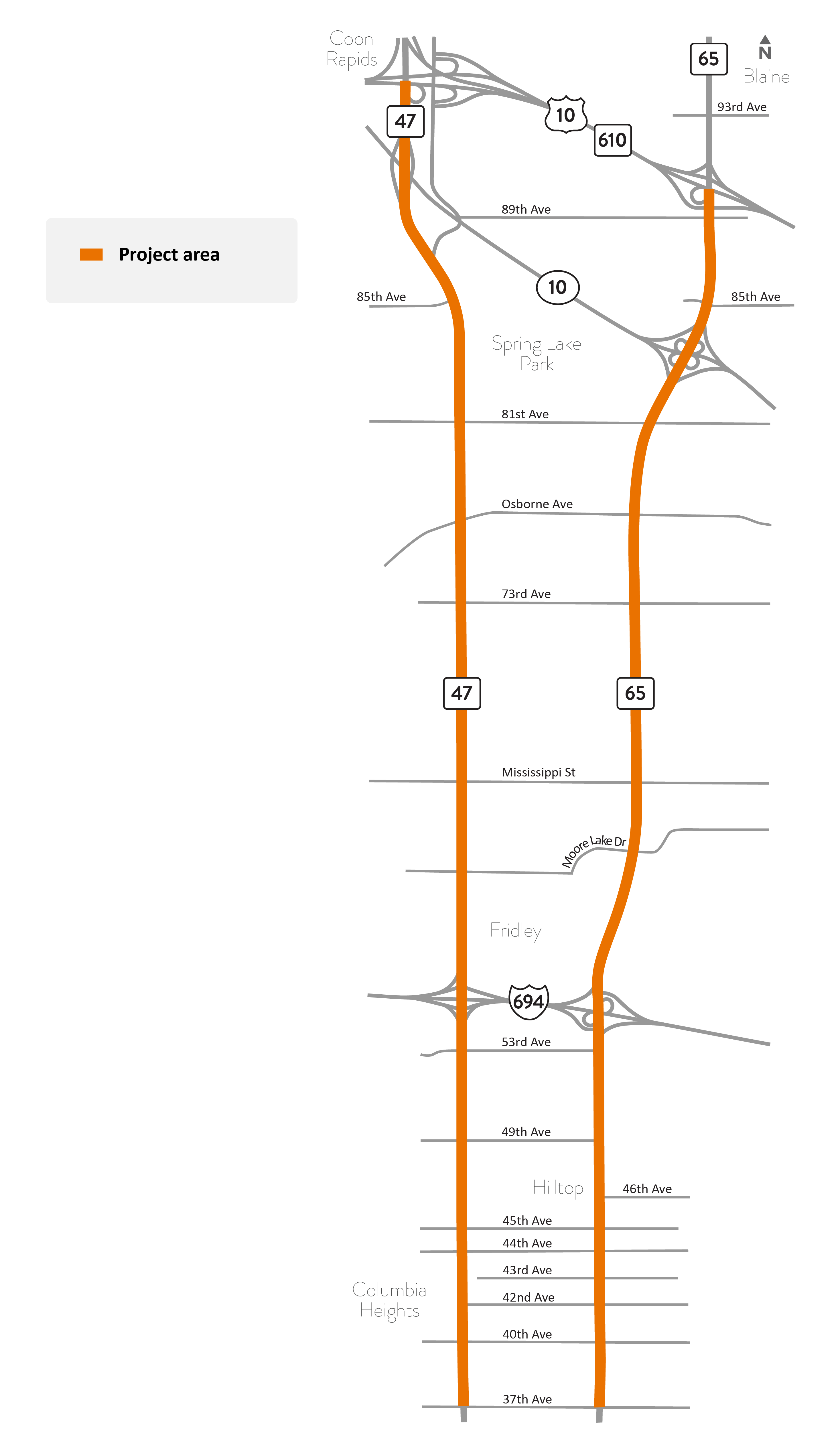
Hwy 47 and Hwy 65 project area map.
About this project
Crews installed temporary pedestrian/bicycle safety improvements at six intersections on Hwy 65 (Central Ave.) in Columbia Heights. The changes added painted curb and median extensions, along with flexible posts called delineators at Gould Ave., 40th Ave., 42nd Ave., 44th Ave., 45th Ave., and 50th Ave. These short-term, temporary improvements are a practical and low-cost way to improve the safety of all who use the street—including drivers, pedestrians and bicyclists.
Bump-outs or curb extensions shorten crossing distances and can improve visibility between drivers, pedestrians and bicyclists. They also calm traffic by making the crosswalk more noticeable to drivers; narrowing the roadway can help slow traffic speeds.
Extending the median in the middle of a wide roadway provides a safe area for pedestrians and bicyclists to stop while crossing the highway.
Summary of work
- Updated crosswalk pavement markings at the following locations:
- Hwy 47 at 44th Ave., 49th Ave., 53rd Ave., Mississippi Ave. and 85th Ave.
- Hwy 65 at 40th Ave., 49th Ave. and 50th Ave.
- Installed new crosswalk at the following locations:
- Hwy 47 at 44th Ave., 49th Ave. and 81st Ave.
- Signal poles new LED lighting or upgrades at the following locations:
- Hwy 47 at Osborne Ave., 81st Ave. and 85th Ave.
- Hwy 65 at 40th Ave., 44th Ave., 45th Ave., Moore Lake Dr., Osborne Ave., 85th Ave. and 89th Ave.
- New stop bars installed at the following locations:
- Hwy 47 at 49th Ave.
- Hwy 65 at 42nd Ave., 43rd Ave. and 46th Ave.
- New left turn flashing yellow arrow upgrades at the following locations:
- Hwy 47 at 73rd Ave. and Osborne Ave.
- Hwy 65 at 73rd Ave. and Osborne Ave.
- View location map of improvements (PNG)