Minnesota Department of Transportation

511 Travel Info

Hwy 55—Paynesville

North Fork Crow River, Stearns County

Current impacts

Hwy 55 detour

October 2026 - early July 2027
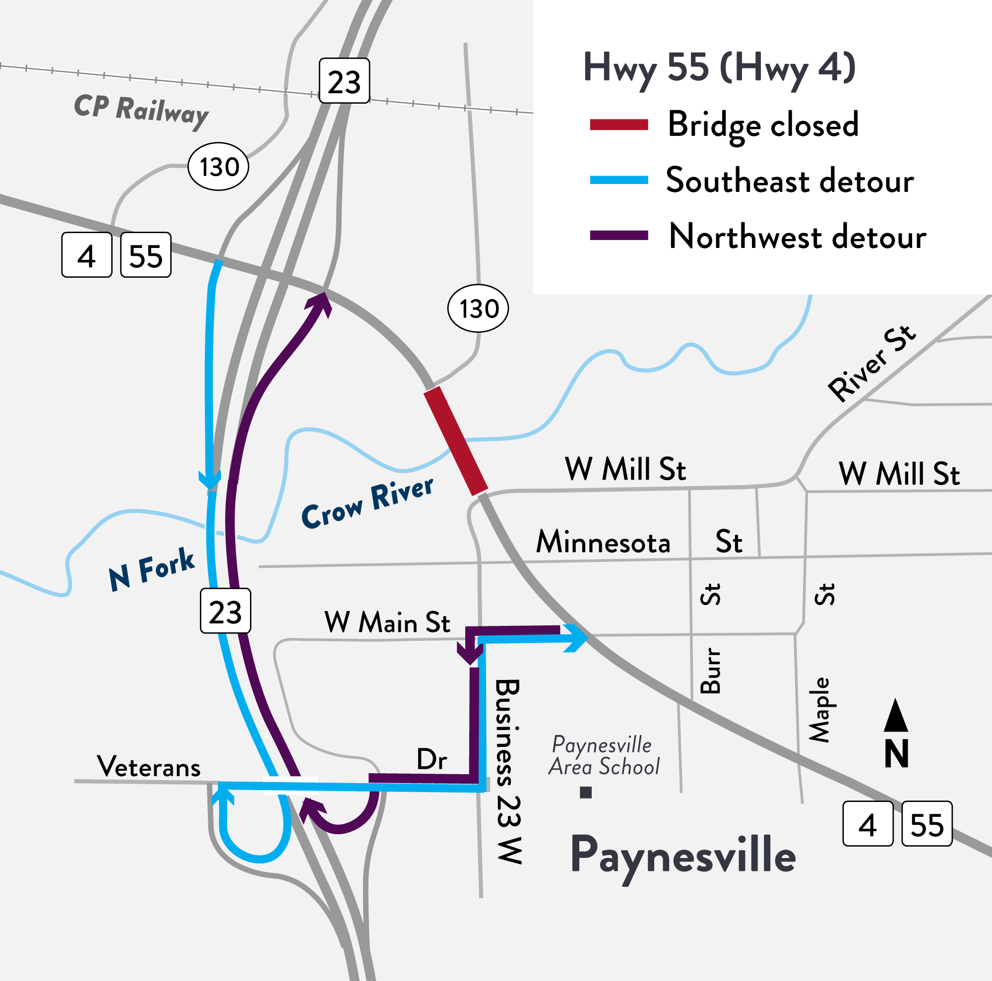
Hwy 55 detour map in Paynesville.
Select to enlarge Hwy 55 (Hwy 4) detour map (PNG).

Bridge closed between Business 23 W and east junction Co. Rd. 13

Motorists
Pedestrians
  • Seek alternate routes

Reconstruct bridge

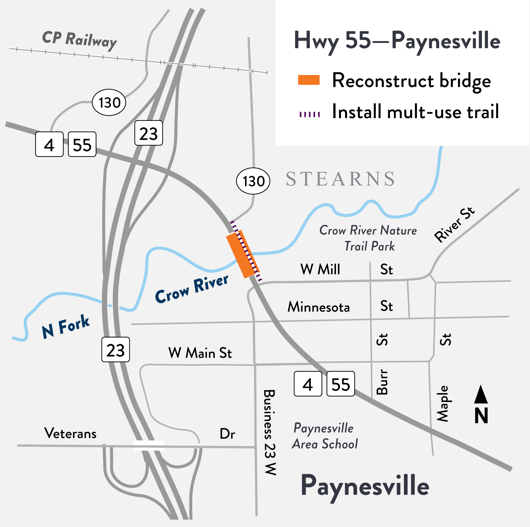
Project location map - Hwy 55 Paynesville
Select to enlarge Hwy 55 bridge project location map (PNG).

MnDOT will replace and improve the Hwy 55 (Hwy 4) bridge over the North Fork Crow River between southeast junction Stearns Co. Rd. 130 and Business 23 W (W Mill St.) in Paynesville. The project requires a detour over the 2026-2027 winter season.

Work highlights

    • Reconstruct a new wider bridge over the North Fork Crow River, includes concrete approach panels, stormwater catch basins and guardrail
    • Resurface road east and west of the bridge approaches and install fresh road marks
    • Install a new 10-foot, multi-use trail along the north side (westbound Hwy 55) of the bridge
    • Update and add lighting to bridge and trail