Corridor study
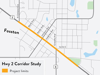
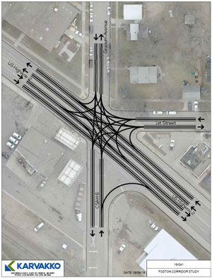
The City of Fosston conducted a corridor study to evaluate the transportation and pedestrian needs of Highway 2 in Fosston. The locally led study identified community concerns, and considered possible alternatives that could better suit business owners, motorists and pedestrians together.
Results of the study
The study found a community supported solution to reconstruct the highway from a four-lane to three-lane section, which will serve as a long-term implementation tool for both the City of Fosston and MnDOT.
- The highway was restriped in the summer of 2022
- See the full details of the study in the final report
Benefits
- Reduces overall traffic speeds through Fosston
- Creates a strong buffer between pedestrians and motorists
- Improves parking downtown
- Wider and safer sidewalks
- Provides left and right turn lanes which prevent rear end collisions and reduce traffic weaving
- Will create consistent traffic speeds with minimal lane changes
- Reduces blindspots for motorists and pedestrians
- Curb extensions will make pedestrians more visible and shortens crossing distances
- Does not require a center median at school crossing
- Increases opportunities for aesthetic enhancements
Priorities
Along with community input, the following priorities were developed by the community panel to guide the study:
- Reduce frequency of traffic speeding
- Improve pedestrian safety
- Reduce traffic confusion and potential crashes at intersections
- Provide wider and safer parking options along street
- Accommodate truck traffic to industrial park and grain elevator
- Make sidewalks more inviting for pedestrians
- Ensure low maintenance
- Improve aesthetics
Corridor study schedule
2019
- August: Corridor study kicks off
- Sept 4: Community Panel meeting
- Oct 7-18: Online survey
- Oct 16: Public meeting
- Nov 21: Community Panel meeting
- Dec 19: Meet with business owners
2020
- Jan 28: Community Panel meeting
- Feb 18: Public Open House
- Feb 24: Public meeting
- Mar: Study recommendations
2021
- Mar 25: Public meeting
- April 12: Panel meeting
- May 10: City Council meeting
2022
- Summer: Restriping - complete
Alternatives considered
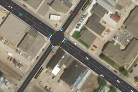
Three-lane option
This option had very few unresolved priorities.
- Curb extensions and landscape will require more maintenance
- Curb extensions will be more difficult for truck traffic to maneuver
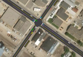
Four-lane option
This option resulted in a number of unresolved priorities.
- Little effect on traffic speeds
- Does not improve parking
- Requires refuge island at school crossing
- Minimal improvements to pedestrian safety
- Minimal reduction in crash risks:
- Does not eliminate blind spots
- Additional lane changes increase risk of collision
- No turn lanes
- Variable speeds
Hybrid option
This option was developed with the idea that the four-lane might be better suited for truck traffic west of Kaiser Aven and the three-lane would be better for the area east of Kaiser. Further analysis found that this was not the case, and it was scrapped as an option.
- Visit the About and FAQ pages to learn more about the alternatives under consideration
- Check out the final report
Community review panel
In order to work more closely with local leaders, residents and business owners, project staff worked directly with a community review panel throughout the study. This partnership allowed for a direct connection to the community through a transparent and collaborative process. The committee helped identify the current issues and create a local vision for the corridor. These neighborhood leaders ensured that community values were represented in the development and evaluation of project alternatives, while fostering conversations within the community.
This committee consisted of a diverse cross-section of community representatives that studied the project details in depth and helped define a vision for the corridor.
- Along with learning more about traffic safety/engineering concepts, they:
- Took an in-depth look at the current issue's
- Prioritized community needs and preferences
- Developed and researched possible solutions
- Cultivated and represented community members input
- Evaluated and prioritized preferred alternatives
Partnership
MnDOT and its partners have committed to work with the City of Fosston to ensure that the community’s concerns and aspirations are directly reflected in the alternatives developed as part of the Highway 2 Study and to provide feedback on how the community influenced recommendations and decisions.

