
Project details
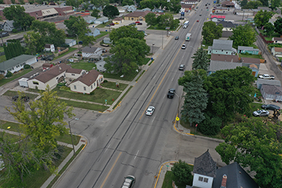
The Minnesota Department of Transportation will be reconstructing Highway 10 in Dilworth, from 34th Street to 14th Street, in 2031 and 2032. The road conditions in this area are expected to continue to deteriorate, increasing the resource needs from maintenance. In addition, the majority of sidewalk and pedestrian ramps in Dilworth are noncompliant and will be replaced as part of this project.
The Fargo-Moorhead Metropolitan Council of Governments (Metro COG), Minnesota Department of Transportation and the City of Dilworth completed a corridor study in 2023 to evaluate the current and future needs along the corridor. The study provides recommendations for possible lane reconfigurations and types of intersection control.
Key project elements
- Reconstruction of Highway 10 from 34th Street to SE 14th Street
- Traffic signal replacement at 34th Street
- Potential roundabouts at County Road 9, Main Street, 7th Street and 14th Street
- Utility replacements and adjustments
Project impacts
- Detours and lane closures
- Business impacts during construction may include temporary or modified pedestrian access and parking restrictions